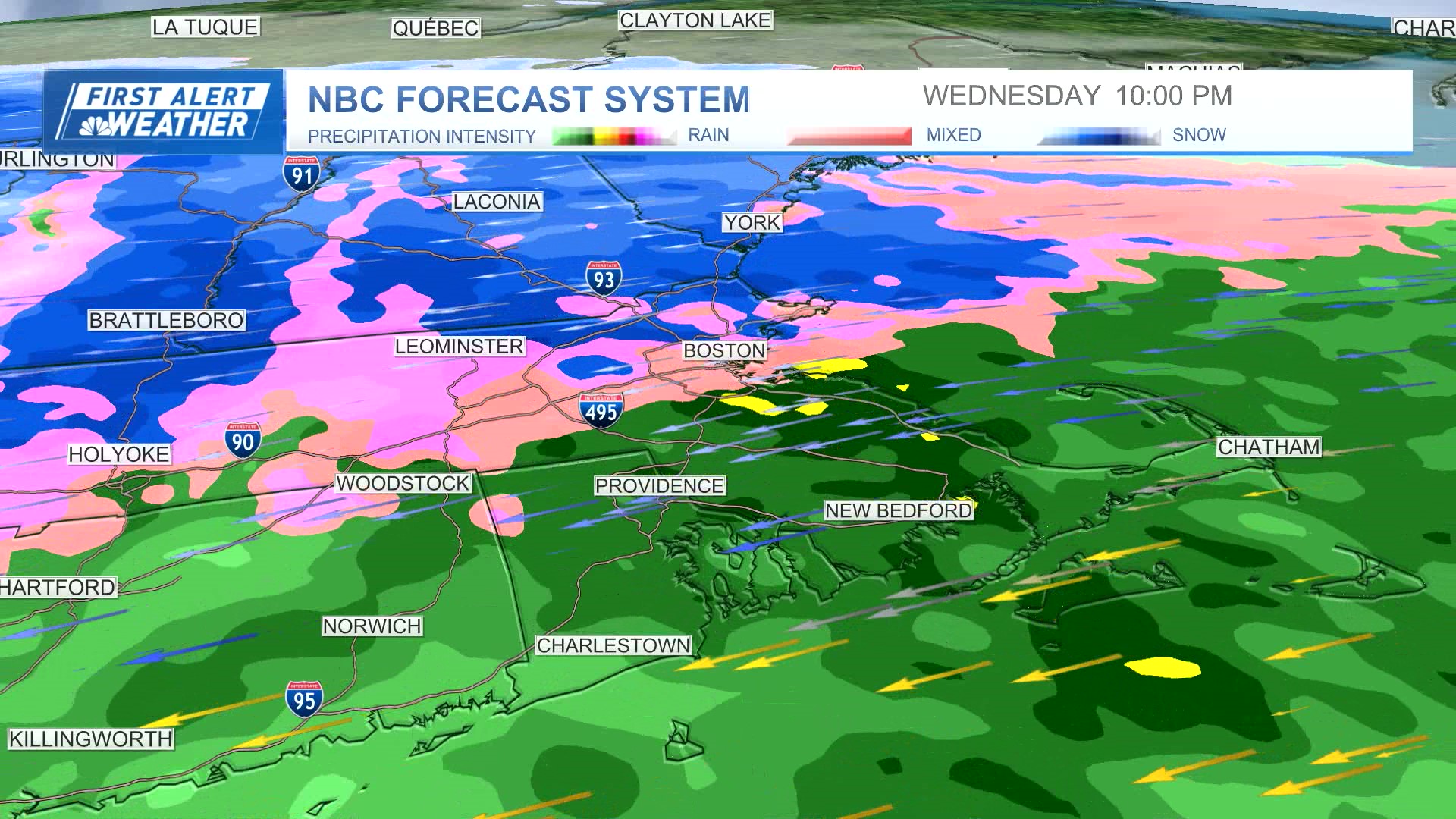
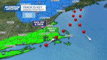
Our nor'easter will come together Wednesday night as it materializes off the New Jersey coast. Ironically, there is no bombogenesis or rapid deepening of the storm, later Wednesday night and Thursday.
Instead, it maintains its intensity as it moves across the Cape and into the Gulf of Maine, where it resides through Friday. This major (missing) element will be the deciding factor in us seeing mostly rain and wind and not a lot of snow.
Winter storm warnings in parts of NH
Get New England news, weather forecasts and entertainment stories to your inbox. Sign up for NECN newsletters.
There's still the upper-level energy that could sway some of the precipitation over to snow in the higher elevations of Worcester County and across southern New Hampshire. It's here we could see 1 to 3 inches of snow and/or 3 to 5 in the highest elevations. Our window is tight, too.
How much snow are we getting in Mass., NH?
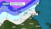
The switchover will be very late Wednesday night into early/mid-morning Thursday. After that, the temperatures will bounce back to the upper 30s, preventing any additional accumulation in all but the highest terrain of southern New England.
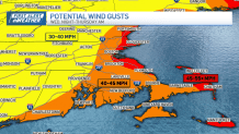
Power outages possible in Mass. due to strong winds
Our other issues will revolve around the increasing wind and rising tides into Thursday morning. Peak winds can be expected anywhere from late afternoon Wednesday through early morning Thursday. High wind warnings are already in effect for some areas.
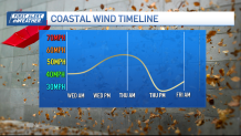
Some spots from the Outer Cape to Cape Ann and the Seacoast of New Hampshire will see gusts top 50 miles per hour at times.
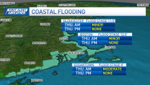
Coastal flooding possible from NH to Boston
High tides on Thursday morning from Hampton, New Hampshire to Gloucester, Boston and the Islands could reach minor to moderate flood stage. Coastal flood watches are in effect for some areas. This doesn't appear to be as bad as the floods of January and March thanks to the fact that we’re not at astronomically high tide for the month.
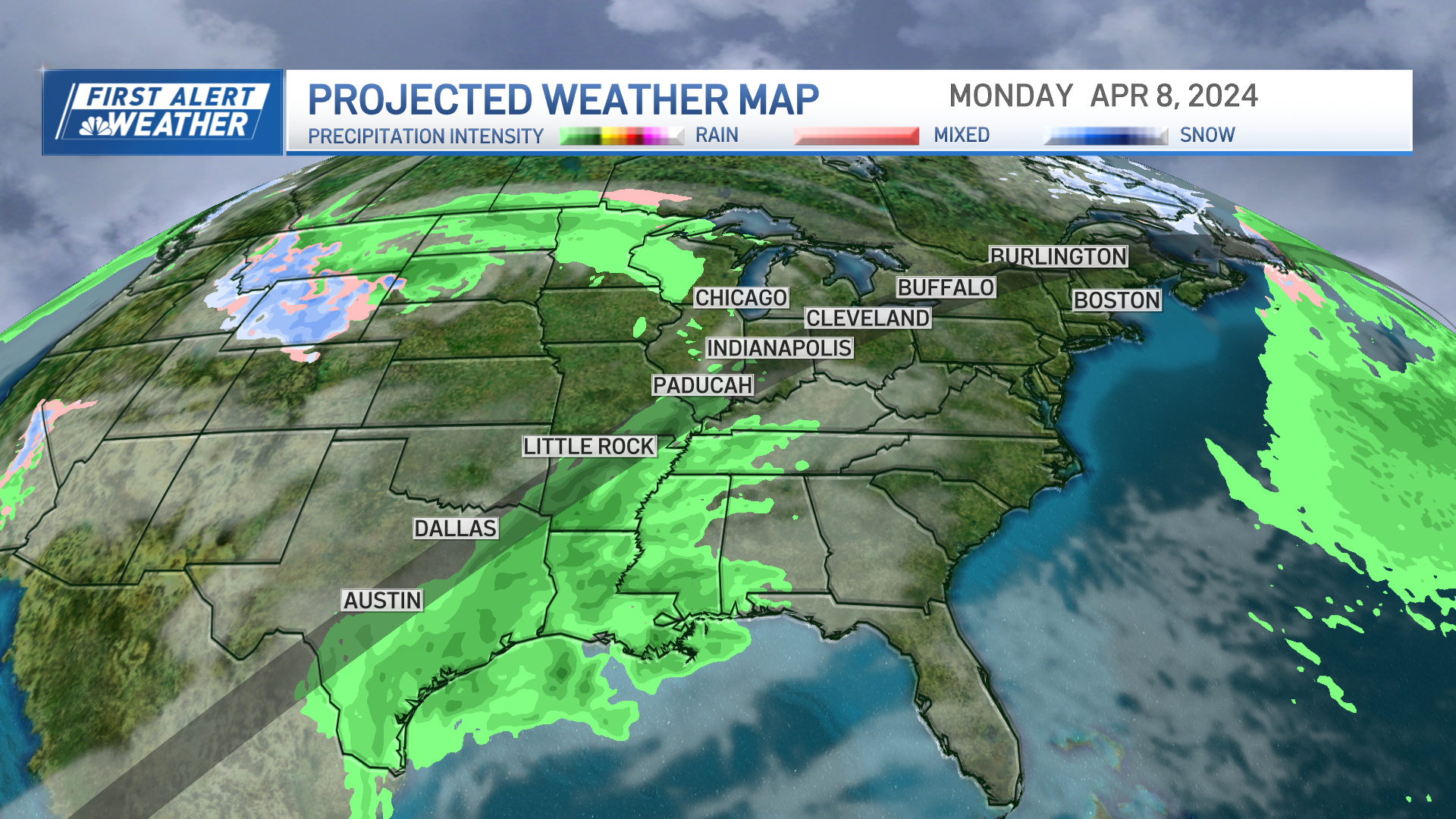
A remnant low pressure system will be all that remains of our nor'easter on Friday, Saturday and Sunday. As it slowly drifts away to the east, our weather will slowly improve. In essence, we'll see cool 40s and the threat for showers into the weekend. Saturday and Sunday will at least feature some sun.
Solar eclipse Monday kicks off warm weather week
Monday's eclipse still looks great, and it kicks off a wonderful week weather-wise. We’ll warm through the 60s and even challenge 70 by late week.
Plenty more updates through the storm. Stay with us on-air, on your favorite streaming platform, online, and on social media.