
Looks like another icy weekend is on our way for this week.
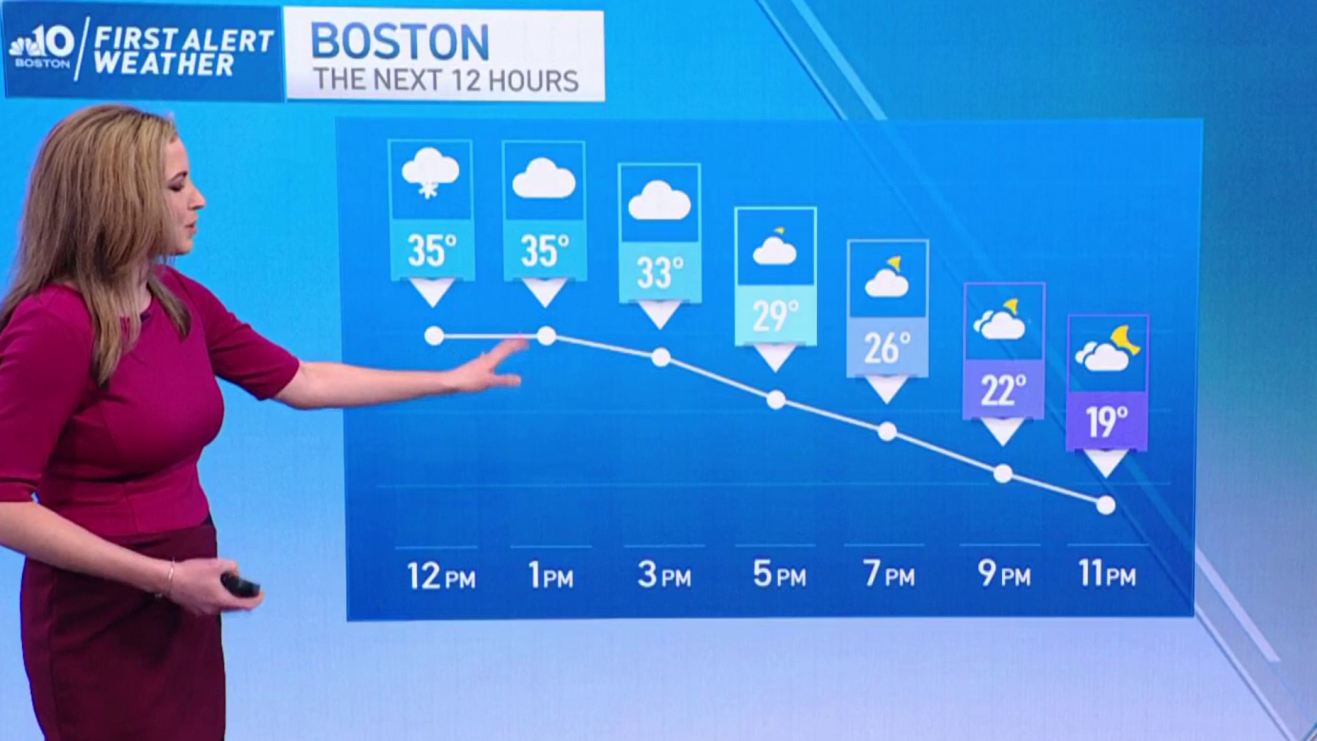
The ocean effect bands continue in the forecast through this afternoon. Another coating of 2 inches of snowfall is likely to be seen from coastal Plymouth and Barnstable counties until sunset.
As you drive down Route 3 from Boston to the Cape, it may be sunny one minute, the next minute you run into heavy snow. Low Visibility and fast accumulation is expected on roads with such cold temperatures.
This “snow machine” is similar to what happens across the Great Lakes. When we have such cold air aloft, moving over the warmer ocean water, this creates a lot of lift and instability. The unlimited moisture is carried onto land based on the wind direction and then is dumped over land in the form of snow.
Get New England news, weather forecasts and entertainment stories to your inbox. Sign up for NECN newsletters.
It’s a “wait-and-see where the snow bands set up” situation, and it’s based on the wind flow. Until Saturday night, our wind flows from the northeast, north. Then we flip from the west, southwest into Sunday when the snow finally ends.
More Weather Stories
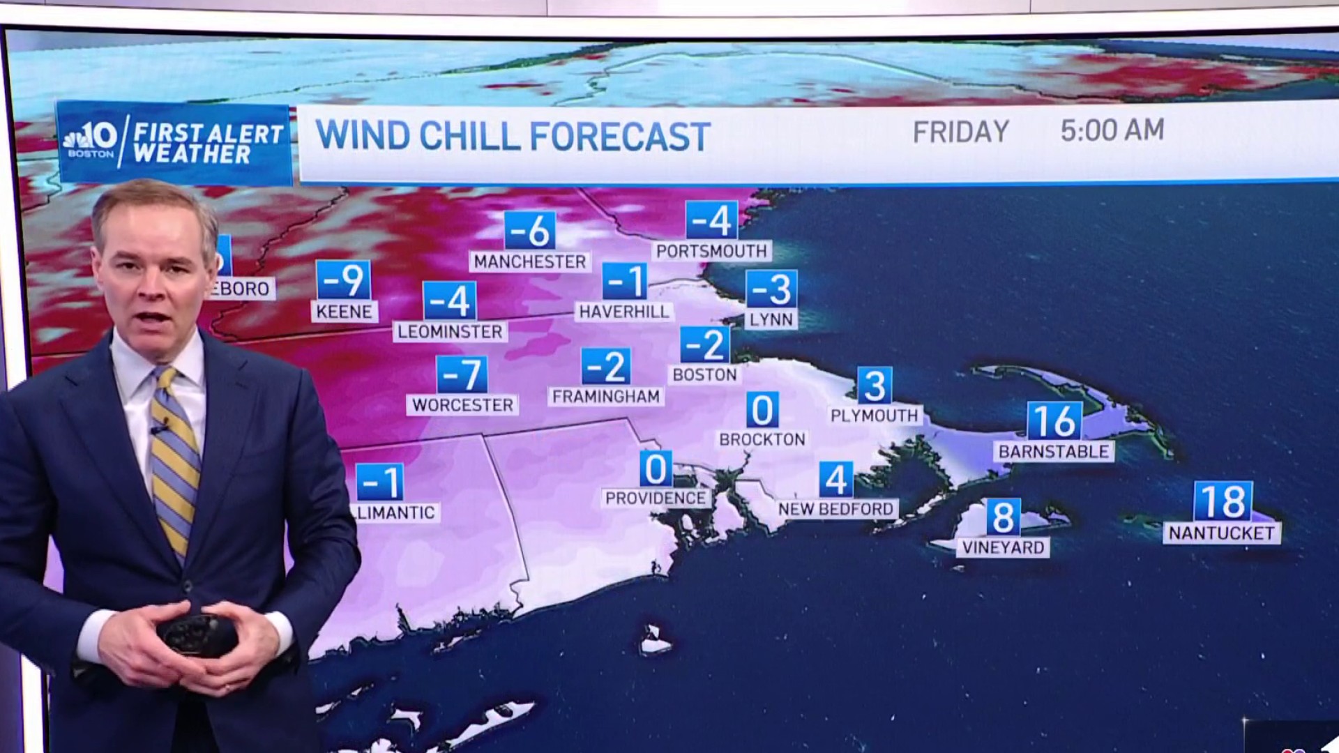
Meanwhile, it’s a quiet weekend across the northeast with cold air in place for today. Highs stay in the teens and 20s with minimal wind and plenty of sun. Bluebird skiing in the mountains and great travel weather to get there.
Sunday brings in a little warm up, highs in the 20s to 30s, morning clouds to afternoon sun. A couple flurries are possible in the mountains as a weak and dry cold front moves in.
Next week we stay quiet and cool off to the 20s on Monday. Then a Clipper system races towards us for Tuesday and Wednesday. Light snow is possible for most of us, with some rain then to snow around Boston.
Stay tuned as we update the snow forecast for next week.
