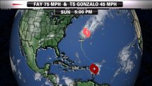
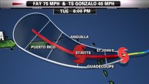
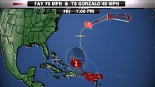
The 5th and 6th named storms of the 2014 Hurricane Season (June-November) formed in the last two days.

First came sub Tropical Storm Fay several hundred miles south of Bermuda Friday October 10th. Initially forecast to be a minor Tropical Storm a hundred miles east of Bermuda Sunday Morning October 12th. But Fay did not develop and track according to The National Hurricane Center Forecast. Instead of a weak storm safely east of Bermuda, Fay intensified to a Hurricane 15 miles east of Bermuda at sunrise Sunday October 12th. The result was sustained wind of 80 mph with gusts to 110 mph. for a few hours early Sunday. That is a fairly significant error from 48 hours out. There was not a hurricane warning in effect as the storm roared ashore.
Most of the damage was limited to scattered power outages and minor damage. What caught our attention on twitter was the voyage of the cruise ship Norwegian Dawn from Boston to Bermuda. Instead of arriving at The Royal Navy Dockyard in Bermuda Saturday Night, The captain was forced to circle back toward Boston due to Hurricane Fay. The National hurricane center was still classifying Fay as a Tropical Storm, but land based observations indicated hurricane force winds.
Here is the view of Norwegian Dawn's forward cam at sunrise Sunday.

The National Hurricane Center finally upgraded Fay to Hurricane status at 5pm Sunday, when the storm center was nearly 300 miles northeast of Bermuda and racing out to the open Atlantic.
By Sunset Sunday the wind and weather on Bermuda turned sunny and pleasant, allowing The Norwegian Dawn to make port at The royal Navy Dockyard. At press time we have no reports of problems from the voyage, but passengers were heard letting out cheers of joy upon arrival.


As demonstrated with the poor track and intensity forecast with fay, all residents and tourists in the northern Caribbean have to be prepared for Tropical trouble the next few days.
The 5 day forecast from NHC has Gonzalo as a Category 2 hurricane headed toward another possible impact for Bermuda late this week. I wonder how long Norwegian dawn is supposed to stay?

Here in New England we have a major warm up on the way. Fay will be joining forces with the same low that brought us the Saturday rain and chill, and by Wednesday we will have a massive storm south of Greenland. That mega North Atlantic Gale will have the power of a Hurricane, yet the size of a small continent. It will cause blocking in the jet storm, That blocking will result in slow moving high pressure to our east, inducing southerly flow and warm, to record warm air for Tuesday and Wednesday. During that time, a major severe Thunder Storm & Tornado maker will be edging eastward across the Mississippi Valley, arriving here on Thursday. we may end up with an inch or two of rain then. Our week overall is warm and windy, turning wet for the second half.

