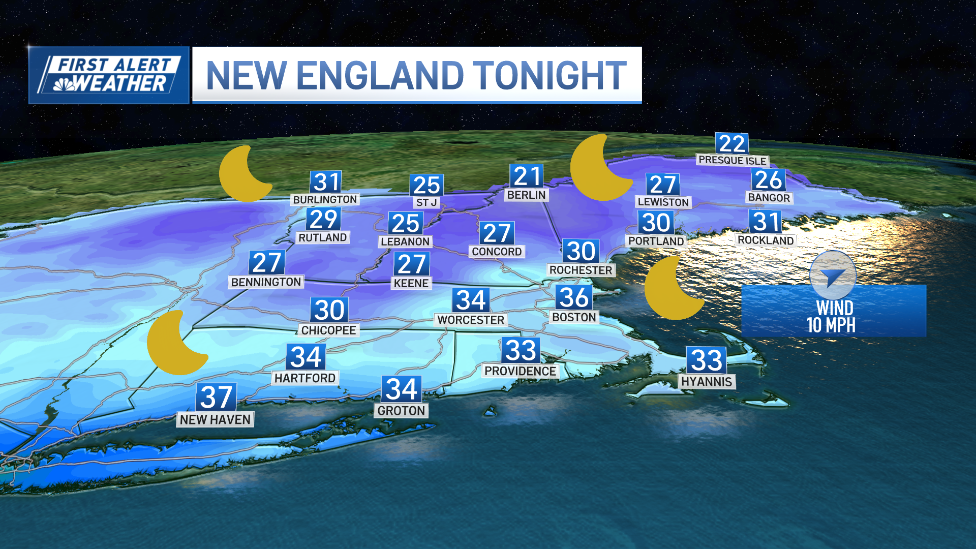
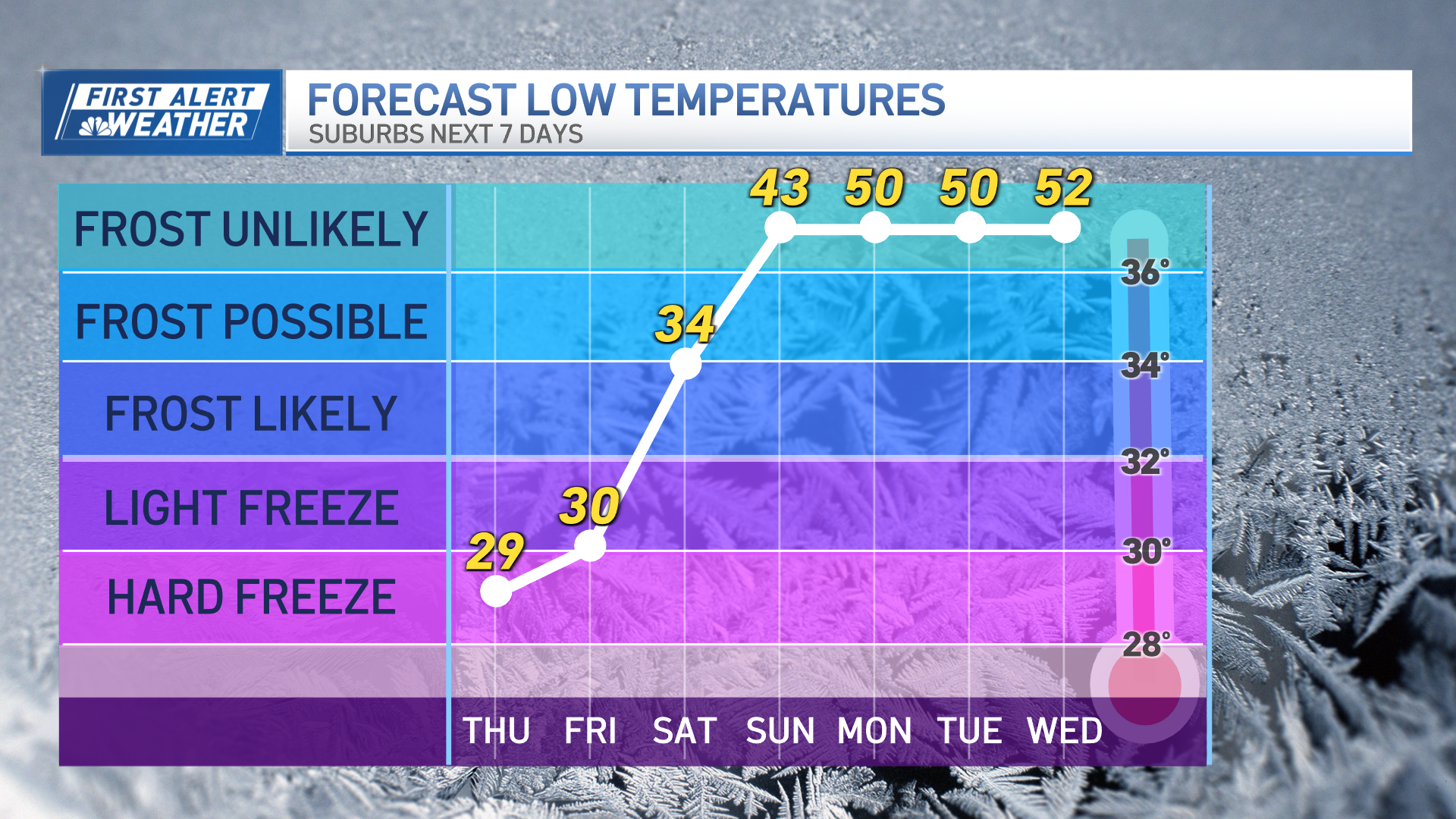
Before we talk about next week's weather, let's focus on the weekend first! High pressure just west of New England has been directing cooler air into the region with a lighter NW wind Friday, meaning plenty of low clouds with temperatures mostly in the 30s. Colder dry weather will continue to settle in over the region overnight with lows in the teens and 20s. Clouds will break but not totally clear. As the high slides over us this weekend, expect quiet weather with light winds. The only problem is light winds from the NE will direct more low clouds in off the water. Notice how southern New England will turn cloudy in the afternoon, with brighter skies North.
[[286388881, C]]
The clouds will thicken and continue to spread inland Saturday night into Sunday. Sunday will be mostly cloudy and cool 30s for most of the region. We are going to have to watch the coast of eastern Massachusetts for ocean effect snow showers developing late Saturday.
[[286388971, C]]
Thanks to a moist flow in off the water, snow showers will start to push inland Saturday night where temps will be near 32. There is the potential for a few slick spots into early Sunday. Expect light snow, flurries along the coast and inland areas Sunday morning.
[[286389051, C]]
A coastal front dividing the cool air inland from the milder marine air will set up along the coast and provide just enough lift at the surface to keep the light snow going into the midday on Sunday. Along the coast, snowflakes will change to light rain showers as warmer air will come in off the water with east winds Sunday. Accumulations of light snow in the order of a coating to 1 inch of snow inland, but there could be a few spots which pick up a bit more if any heavier bands develop.
[[286389131, C]]
Not a biggie this weekend, so there's plenty of quiet, cool weather to enjoy, which should be just fine for any last minute errands.
Looking ahead to next week, a more potent storm is gathering which deserves our attention. We are still several days away, and as we know the weather can change this far out. The good news is most of our models are in agreement with the overall set up, the bad news is there will likely be no white Christmas. This is a relief for those of us who have to travel. Here is how it looks right now.
An upper low will dig in over the Great Lakes Tuesday and Wednesday. This will cause the jet stream to dive far south to the Gulf of Mexico, where it will be able to tap into available moisture. This jet stream map below shows winds from the SSW up the east coast which will direct this moisture right up the east coast.
[[286389271, C]]
Looking at the temperatures in the atmosphere, you can see the mild air which will be transported from the tropics right into New England Wednesday, the day before Christmas. Don't be surprised to see temps in the 50s to near 60 on this day!
[[286389351, C]]
Showers will arrive in advance of this rain on Tuesday, with even a brief wintry mix at the start in the morning. But the main batch of rain will arrive Wednesday as we have been advertising. Plenty of instability, and strong winds will accompany this approaching rain. Rain will be heavy, which will make travel on the roads challenging, and there is the potential for winds gusting up to 50+ at the coast, plus astronomical high tides could mean some minor coastal flooding at high tide. What a mess.
[[286389521, C]]
Weather Stories
The cold front will slide off the coast Christmas morning with cooler air to follow with breezy west winds. The colder air will likely not arrive in time to interact with the available moisture for any change to snow. But upsloping mountain snow showers and flurries are a possibility.
[[286389581, C]]
After Christmas, we turn our attention to the New Year. Much of the month of December, the nation as a whole has taken a break from the Arctic air as it had retreated to the other side of the globe. Guess what? It's back! Expected a renewed arctic air mass to return to North America in particular the United States for the final week of December. Expect this Arctic air mass to be over the Northeast Dec. 29-31 and to bring in the New Year! Have a great weekend everyone. I will see you all again next week!
[[286389701, C]]


