This Inquiry arrived in the e mail bag today.
Tim... What happened with the snow squalls on Sat. morning? We ran into a near disaster at the Cape on route 6... total white out for miles...very dangerous.. and unexpected... just a nightmare... Thanks.. Ann M. Marblehead
That Saturday Snow was a spontaneous meso (small scale) low pressure cyclogenesis. This one is called a NorLun trough. A pair of meteorologists, Weir Lundsteadt & Steve Noguera coined the term to describe this type of event.The NorLun is a Rare Event and can form and dissipate very quickly. It is a Boundary where very cold north wind runs into, a little less cold west wind, initiating a narrow band of intense snowfall, that generally moves very slowly from north to south. Matt Noyes wrote a detailed description of Weir and Steve's discovery here.
Here is the view at the Shore in Scituate Massachusetts as the trough passed Saturday Morning.

Weather Stories


By 2 PM the Sun was back, and most of the snow melted.

Here is the View from Space, the 'Eye' is just southeast of Cape Cod.
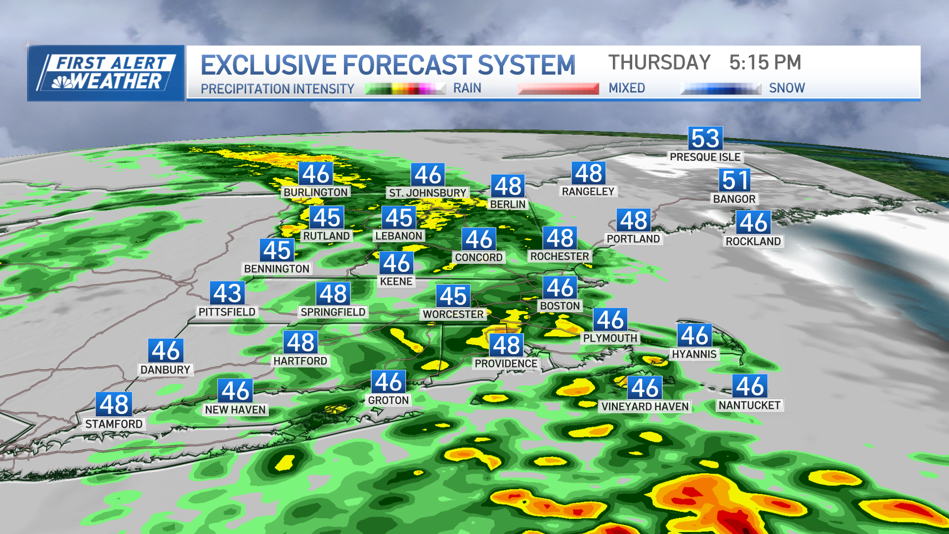
Our weather pattern is Fickle this winter, but there have been some repetitive patterns.Each Sunday seems to be cold, Monday Brings Warmer air, Then we get a wintry mix Thursday-Saturday, and repeat. That is roughly how this winter has been going.But the streak MAY end this week.Though it appears most of the week should be warm, this is the time of year for sneaky 'Backdoor' Fronts.
Backdoor fronts move opposite of most fronts, they originate in Quebec and travel north to south from Maine to Massachusetts, propelled by High pressure and heavy cold air.The heavy cold air undercuts the lighter warm air resulting in much cooler weather for Eastern New England.The storm that brought snow to New Mexico (again) last week, and flooding to Texas (good news, again) is tracking to the Great Lakes, but then will be deflected across Maine Tuesday Night. A minor blocking pattern near Labrador is doing the deflecting.
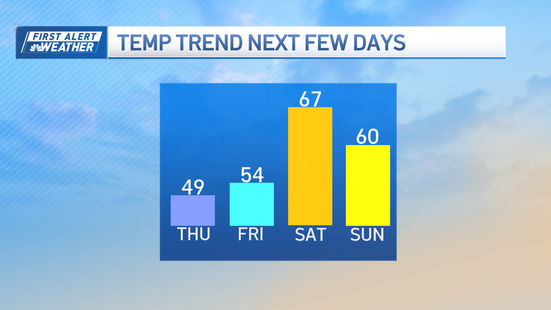
There is still a good amount of cold in Eastern Canada, and that cold may be deep enough for some 'surprise' snow in eastern New England Weds or Thurs, that would fit perfectly into the pattern all winter long.If this scenario pans out, we are then stuck with a subtle but significant front south of New England Friday and Saint Patrick's Day Saturday. Along this front more chilly and damp weather could spoil our little Spring Fling.We have many parade participants and spectators this weekend (South Boston & Scituate) watching forecasts hoping for the best. The best would be sunny and 60-70, which is possible. But the streaky pattern of winter says cold and dry. The two options are polar opposites from a Meteorological standpoint, so some sort of compromise is more likely.
My best guess is Sun & clouds, high in the 50s. But it could go either way.As per most periods this winter, confidence in the forecast is very low.Call it 'White Knuckle' forecasting.Sort of like Ann M experienced driving to Cape Cod in the NorLun trough on Cape Cod Saturday. I could not even forecast that event accurately with in 3 hours.Our weather is sneaky and spontaneous lately, don't put a lot of stock into 7 day forecasts.As Mark Twain said, "March Weather makes Apologists of Meteorologists."
On a side note, Ice out on Lake Winnipesaukee may happen soon.Look at this Monday March 12, 2012 image from Winnipesaukee.com.The ice is thinning rapidly. Last year ice out was April 19th.The earliest ice out on record is March 24, 2010. The latest is May 12 , 1888.What is your guess?

Copyright NECNMIGR - NECN


