Severe thunderstorms and tornadoes have been stealing the weather headlines through the nation's midsection in recent days and weeks (photo from south of Fort Worth, TX, courtesy of Twitter user @HavethenGive), and New England should get into at least a small piece of the action this week.
The forecast for deeper warmth to surge northward into the New England states on Tuesday, Wednesday and Thursday, implies a battle of departing cool air and incoming summer-preview warmth will ensue. These battles occasionally can produce thunderstorms, and conditions appear favorable for such a result this time around. Here in the NECN Weather Center, we believe nature's clue for our weather came in Pennsylvania on Monday, where the afternoon featured only a few thunderstorms - but intense ones that produced localized damaging wind, large hail and even some rotation. These storms expanded in coverage Monday evening and night across New York State, eventually weakening and bringing Monday night to Tuesday morning rain and thunder to some of New England.
All storms this season have been producing impressive amounts of cloud-to-ground lightning strikes, so we ask that you remember the rule "When Thunder Roars, Stay Indoors." This simple saying implies that if you can hear thunder, you're close enough to be in danger of being struck. While the safest place to be from lightning is in your car (because of the metal cage that will carry electricity around the outside of the vehicle), anywhere inside is safer than outside. Stay updated on the latest forecast by turning NECN on in the morning, midday and night to get our latest assessment. Of course, you can stay up-to-the-second with our NECN Weather mobile application for iPhone, iPad and Android, by searching NECN or NECN Wx in your app store - totally free, and a great radar.
Here's my take on our thunderstorm threat this week:
Tuesday: The warm front - leading edge to deep warmth - will be pushing slowly northeast across Southern and Western New England. South of the front, temperatures will soar well into the 70s and may approach 80 with a southwest wind. Northeast of the front, 50s and 60s with a northeast wind. This rapidly changing wind direction, and sharp temperature contrast, has me looking for any excuse for a thunderstorm to develop, as conditions would be favorable for any storm to intensify quickly. A weak upper level disturbance will move in from the west later Tuesday afternoon, and may trigger a few storms in Central/Western CT, Western MA and Southern VT - any of which could produce locally damaging wind, hail and perhaps some rotation that would need to be monitored for very low risk of tornadic development. A broader area of showers and thunderstorms may develop in the increasing warmth and humidity Tuesday night.
Wednesday: Most of New England, except Central and Eastern Maine, will soar into the 70s with an increasing south and southwest wind. This will "destabilize" the atmosphere, making it more favorable for thunderstorm development, and another upper level disturbance will combine with slowly cooling temperatures aloft - and a concurrent surge of warmth and moisture in the lower levels of the atmosphere - to favor more storm development Wednesday afternoon and evening.
Weather Stories
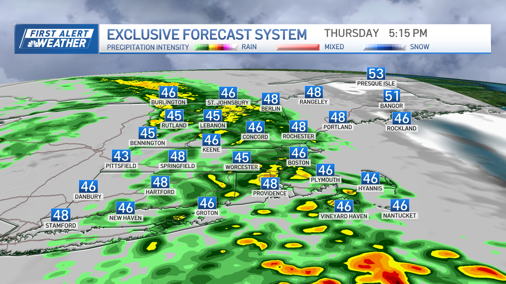
Thursday: The approach of a cold front Thursday will result in a pronounced increase in wind speed throughout the lower several thousand feet of the atmosphere throughout the day. The momentum of this wind, coupled with a sufficiently warm and humid airmass, will couple with shifting surface wind associated with the incoming cold front - and an energetic, upper level disturbance - to create one or more lines of potentially damaging thunderstorms Thursday afternoon, with straight-line downburst wind and large hail the most pronounced threats, along, of course, with frequent lightning.
Again - the best plan is to stay alert to the forecasts, check the radar, and be prepared to seek shelter should the situation warrant.
Some links to assist throughout severe weather season:
- Twitter Accounts: Matt Noyes, Danielle Niles, Nelly Carreno, Tim Kelley, Weather Team Account
- Facebook Pages: Matt Noyes, Danielle Niles, Nelly Carreno
- NECN Weather Page, with latest video forecast
- National Weather Service Storm Prediction Center
- National Weather Service Main Page (links to local offices)
See you on NECN...
Matt


