A major storm is bearing down on the region and will have widespread impacts across much of the region.
Friday is the day you may want to make some last minute preparations around the house before the storm commences. Around the home, make sure your generator is well ventilated, if you have one, gas up the cars, and grab any essential items at the stores because Saturday, travel won’t be recommended!
It is also a great idea to charge up any of your mobile devices in case of power outages, which will likely occur, especially along the coastline where we will see the strongest winds during the storm.
Get New England news, weather forecasts and entertainment stories to your inbox. Sign up for NECN newsletters.
Here's a closer look at some of the expected impacts from Saturday's big storm:
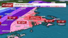
Snowfall totals in New England
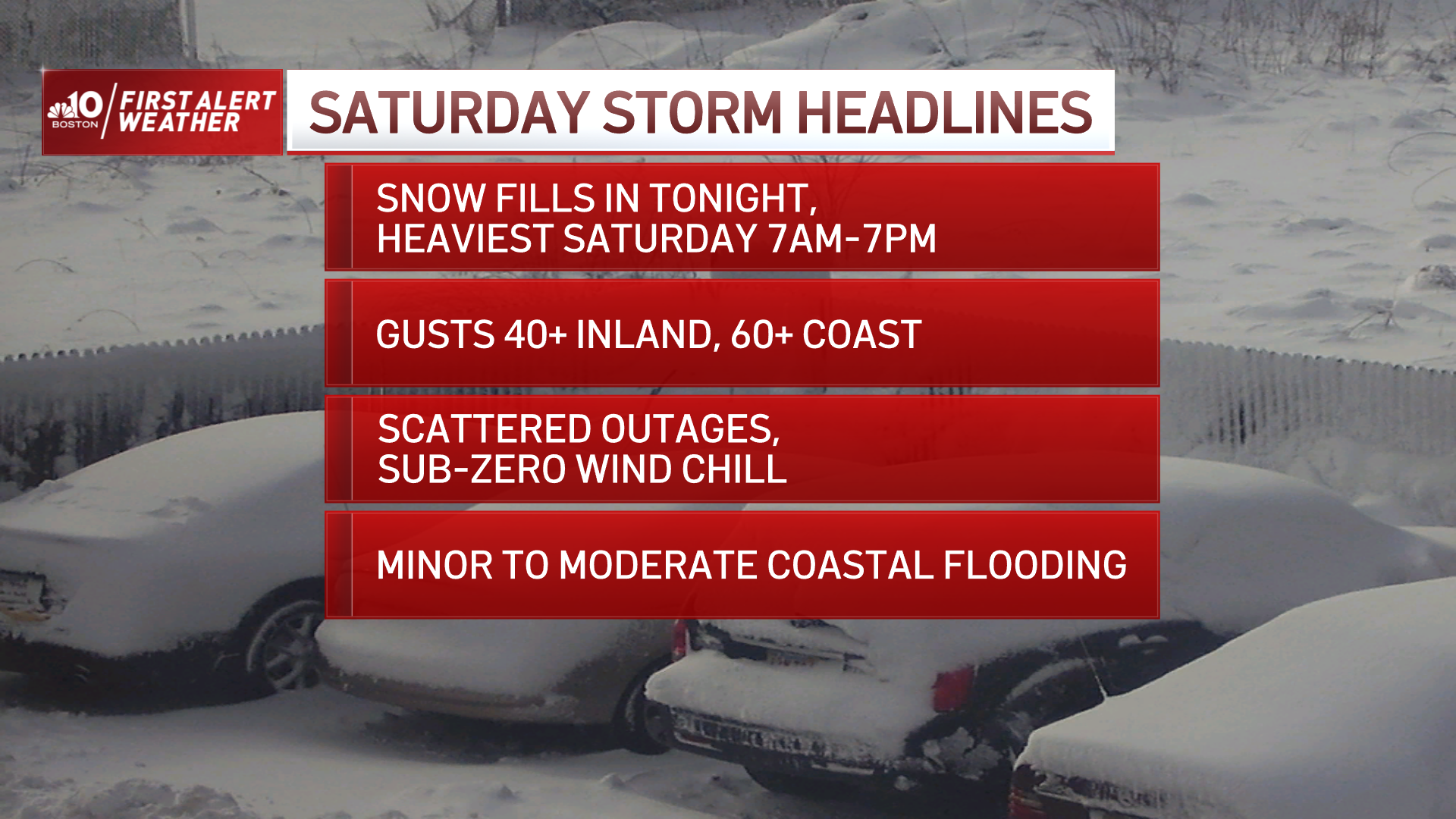
Snow develops late Friday night and becomes heaviest after 6 a.m. across southern New England. One to three inch snow rates are very possible, with thundersnow during the height of the storm, which we expect from the mid-morning through the late afternoon.
In general, this storm will drop around 2 feet of snow across much of the region, with 18 to 24 inches into central Massachusetts and a bit less in far southern Vermont, western Massachusetts and western Connecticut.
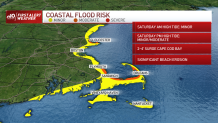
Coastal flooding
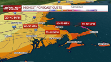
We will see a morning high tide, but should only see some minor issues due to the timing of the tide and storm’s location by then. By the afternoon, we will be experiencing whiteout conditions across much of the region, with heavy snow and gusty north/northeast winds, especially along the coast. Speaking of which, winds along the coast will gust up to or over 60 to 70 mph at times, perhaps higher across the Outer Cape. This will result in coastal beach erosion and flooding during the late evening high tide cycle.
Power outages
We are also expecting power outages, especially along the coast with these extreme winds.
Travel
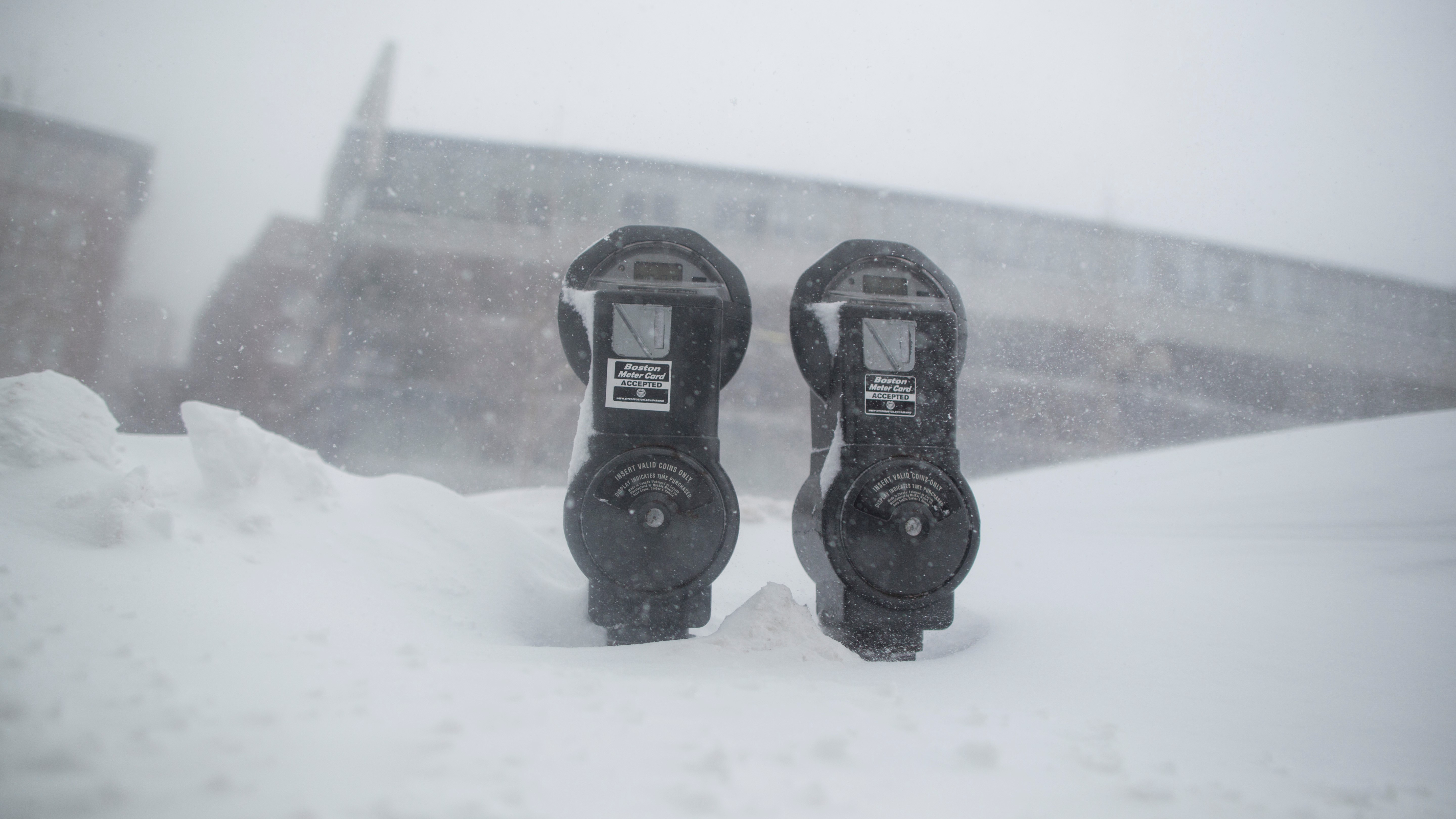
Roads will also become impassable for a while during the afternoon with heavy snow and gusty winds, and travel is most certainly not recommended.
Frigid temperatures
In the temperature department, we’re not expecting highs to rise above the low 20s south and teens north, which will create wind chill values below zero!
There are so many facets to this storm and the situation will continue to evolve as we get closer to the first snowflakes falling later Friday night. Your First Alert Team will be right with you through the entire storm.