Incase you haven’t heard yet, there’s a lot going on in the weather department this week. Let’s take it day by day and break down how it will be impactful to you.
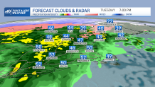
Tuesday, clouds are thickening up ahead of showers and steadier rain moving in. Have the umbrella with you, especially from late afternoon onward as the wet weather arrives west to east generally between 3 and 6 p.m.
A few slippery areas of travel will result from the White Mountains to the Crown of Maine, where a bit of mixing will occur. Otherwise, expect the rain to gradually taper off from midnight to 3 a.m. for most, with totals of ¼ to ¾ inches in many communities, with some locally higher amounts.
Get New England news, weather forecasts and entertainment stories to your inbox. Sign up for NECN newsletters.
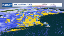
The wind will also kick up Tuesday night, gusting 40 to 50 mph and resulting in pockets of isolated outages. You’ll certainly hear it howling!
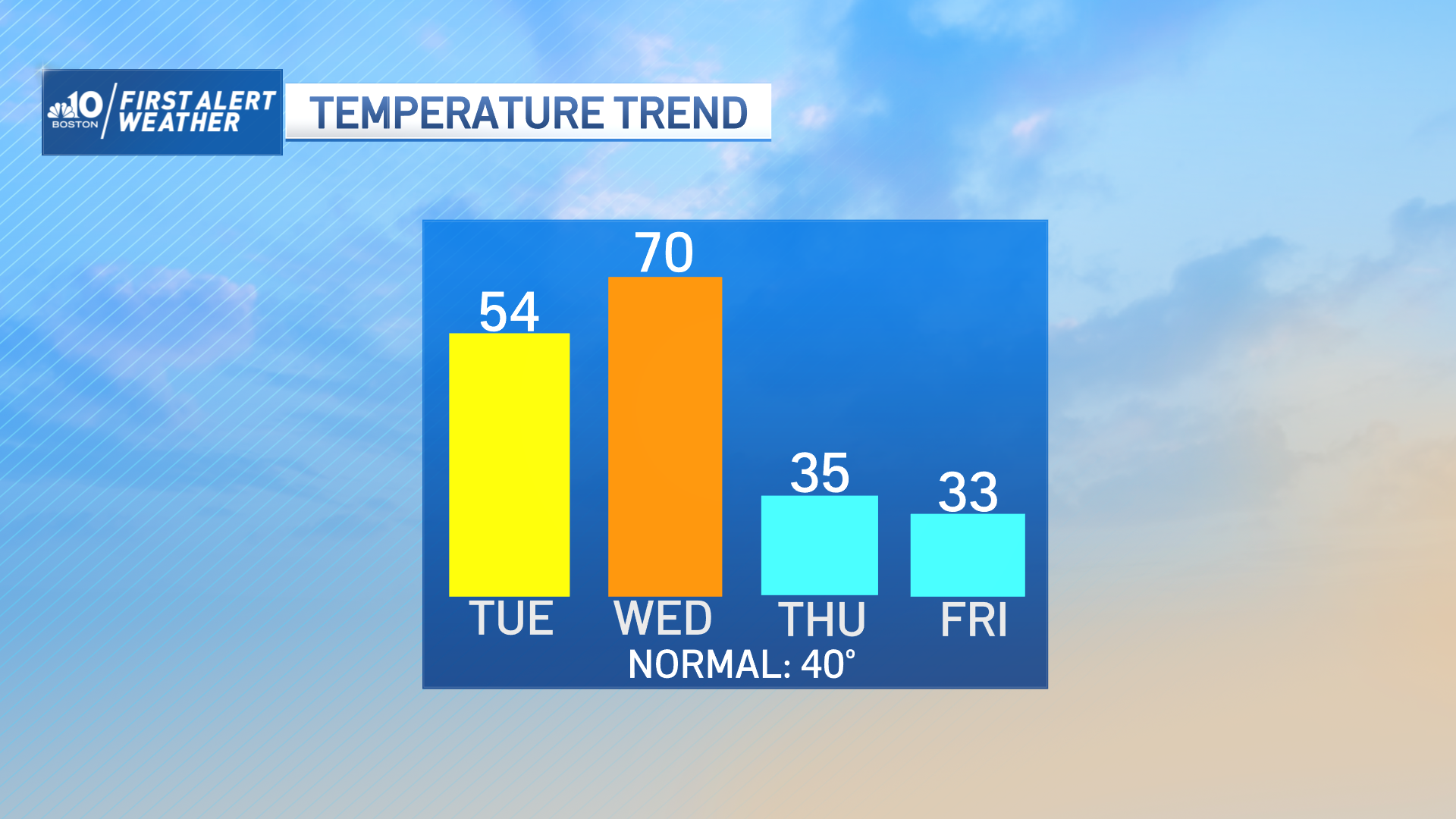
Wednesday, the wind stays active, generally 30 to 40 mph out of the southwest at first. That pumps in the warm air and allows our temperatures to climb into the 60s (central/south).
Northern New England will see its warmest temperatures in the morning as a cold front crosses there first, bringing sharply colder air and falling temperatures through the rest of the day. We’ll all be cold again on Thursday, and this cold air remains in place as our next storm arrives.
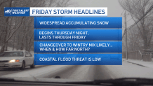
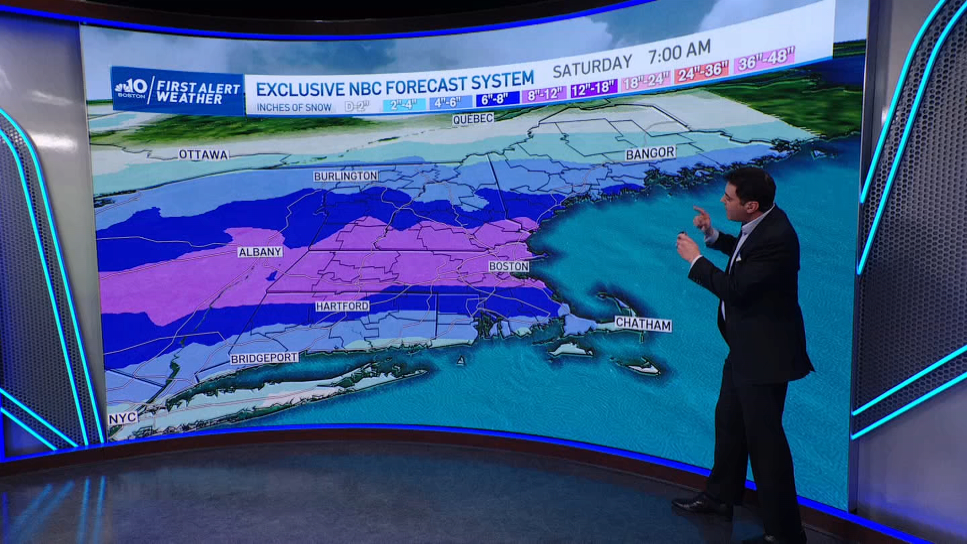
There has been little change to our thinking -- snow will develop overnight Thursday and continue much of the day Friday.
The biggest questions we still need to answer right now are how far north the mixing will occur and when exactly that transition takes place. This will have significant implications on how much snow your city or town receives.
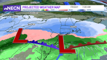
Travel Friday will be treacherous for much of the day, as the snow looks like it won’t taper off until the evening. Thankfully, residents along the shore can breathe a sigh of relief, as coastal flooding is a low concern with this system.
It’s out of here for the weekend, with chilly air sticking around in the 10-day forecast for much of next week, kicking off March on cool note. Stay tuned!