A tornado was confirmed to have touched down on Cape Cod during the intense storm activity caused by the remnants of Hurricane Ida as it moved through New England, federal weather experts announced Thursday.
Six tornado warnings had been issued for the Cape and Islands late Wednesday night into early Thursday morning amid strong winds and flooding rains. The last warning expired around 2:30 a.m.
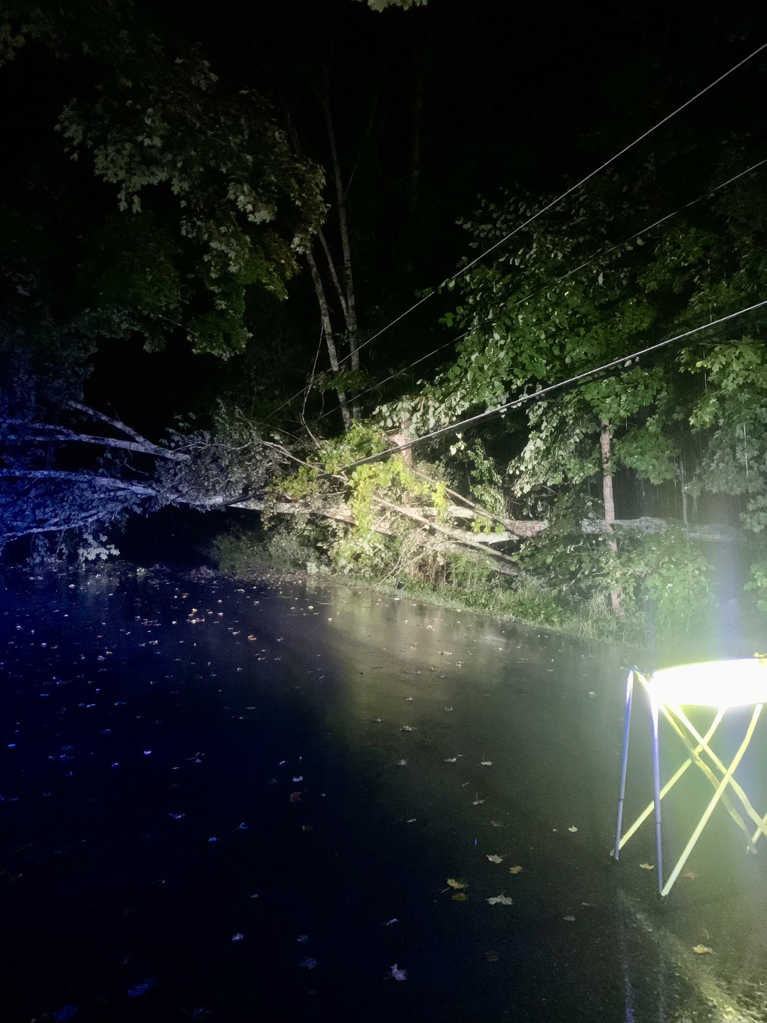
The National Weather Service had sent a team to Cape Cod on Thursday to determine whether a tornado touched down in Dennis, and they confirmed a small one had. The EF-0 tornado -- the lowest on the NWS' scale -- had maximum winds near 75 mph, causing damage near East Bay View Road and Wampanoag Trail.
Get New England news, weather forecasts and entertainment stories to your inbox. Sign up for NECN newsletters.
Over 30,000 people were without power across southern New England at the height of the storm, but that number has since dropped substantially.
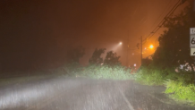
A tree was reported down across a road in Dennis, and two cars reportedly got stuck in flood waters in Bourne shortly before 2 a.m. One car was also seen being towed from a flooded roadway in Falmouth and another on Route 9 in Framingham early Thursday morning.
Three to four feet of flooding was reported on Storrow Drive with a car stuck. Two more cars were reportedly stuck in flood waters on the Route 24 north ramp on Interstate 495 in Fall River and several streets in Worcester have been closed due to flooding.
The state Department of Conservation and Recreation said flooding has been observed on Revere Beach Boulevard and Ocean Avenue in Revere, on the Lynnway in Lynn, on Furnace Brook Parkway and Quincy Shore Drive in Quincy, on the Neponset Valley Parkway, Storrow Drive, Bush Hill Road and the Arborway in Boston, on the Mystic Valley Parkway in Cambridge and on the Fellsway east in Melrose.
Several cars were seen driving through a flooded road in front Wareham Crossing Thursday morning. The Massachusetts Emergency Management Agency warns against driving and walking through flowing water, where most drownings occur during flash floods.
The MBTA said Orange Line service between Ruggles and Jackson was suspended around 6:30 a.m. due to water in the track area.
The Franklin and Providence/Stoughton commuter rail trains are also bypassing Back Bay, Ruggles and Hyde Park due to the track flooding.
Amtrak also canceled all service between Philadelphia and Boston with an initial departure before 9 a.m. due to the storm.
A tornado watch was issued for southeastern Massachusetts and all of Rhode Island through 7 a.m., but has since expired.
They were part of an extreme weather event caused by the remnants of what was Hurricane Ida inundating the Northeast Wednesday night.
Flash flood warnings were still covering most of Massachusetts, Rhode Island and Connecticut into Thursday morning. Some severe thunderstorm warnings were issued across the region as well, and there was a threat of further tornadoes into early Thursday morning.
A flash flood emergency was issued in Connecticut -- the first ever in the state -- with significant, life-threatening and unusual flash flooding expected. New York City also had its own first-ever flash flood emergency Wednesday, as historic amounts of rain fell, causing widespread flooding.
The National Weather Service recorded 3.15 inches of rain in New York’s Central Park in one hour, far surpassing the 1.94 inches that fell in one hour during Tropical Storm Henri on the night of Aug. 21, which was believed at the time to be the most ever recorded in the park.
New York’s FDR Drive, a major artery on the east side of Manhattan, was underwater by late evening and subway stations and tracks became so flooded that the Metropolitan Transportation Authority suspended all service. Videos posted online showed subway riders standing on seats in cars filled with water.
Other videos showed vehicles submerged up to their windows on major roadways in and around the city and garbage floating down a street in Queens.
Gov. Phil Murphy declared a state of emergency in all of New Jersey’s 21 counties, urging people to stay off the flooded roads.
The National Weather Service had predicted flooding from what remained of Hurricane Ida, saying steep terrain and even city streets were particularly vulnerable to a band of severe weather that extended from the Appalachians into Massachusetts.