
The Massachusetts Emergency Management Agency issued a statement Tuesday warning of possible local impacts this weekend as a result of Hurricane Dorian.
The Category 2 hurricane is currently located just to the east of Grand Bahama Island and 105 miles east of Florida. MEMA said current modeling suggests that over the next 48 to 72 hours, Dorian will begin to turn northward, passing just offshore of the Florida, Georgia and Carolina coasts, before turning to the northeast.
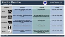
The storm is expected to weaken as it travels off the eastern seaboard, but if it continues its current track, MEMA said it will pass about 160 miles southeast of Nantucket early Saturday as a Category 1 hurricane, with sustained winds of 85 mph.
[NATL]In Photos: Hurricane Dorian Devastates Bahamas
Potential impacts:
A great deal of uncertainty remains regarding Dorian’s track as it approaches the New England region, according to MEMA, and the forecast may change significantly between now and this weekend. While an offshore track for Dorian is most likely, the agency said the average error over the past 5 years for forecasts at this time range is 140 miles.
If Dorian stays close to its forecast track, the following impacts are possible for the New England region:
U.S. & World


• Rip currents and rough surf along ocean-exposed south-facing beaches starting Wednesday and continuing through Saturday.
• Tropical storm conditions possible as early as Friday for the Cape and Islands, with high winds, heavy rain, and storm surge.
The magnitude of wind and rain impacts will be highly dependent on Dorian’s exact track as it approaches the New England region, MEMA said. If it tracks further to the south and east than forecast, impacts will be reduced.
State and local operations:
The State Emergency Operations Center is currently operating at Level 1 (Steady State Monitoring). MEMA is continuing to monitor the progress of Hurricane Dorian and will disseminate a Situational Awareness Statement with updated forecast information by noon on Wednesday.
How to stay informed:
For additional information and updated forecasts, see www.weather.gov/boston and www.weather.gov/albany. You can also download the NBC10 Boston app and the NECN app for the latest weather updates.
Utilize MEMA’s real-time power outage viewer to stay informed about current power outages in your community and region, and across the state, including information from utility companies about restoration times: http://mema.mapsonline.net/public.html
Additional online resources:
Massachusetts Emergency Management Agency at www.mass.gov/mema
MEMA's Facebook page: http://www.facebook.com/MassachusettsEMA
MEMA Twitter: @MassEMA
Federal Emergency Management Agency at www.fema.gov
National Weather Service Weather Prediction Center: www.wpc.ncep.noaa.gov/
National Weather Service Storm Prediction Center: www.spc.noaa.gov/
Northeast River Forecast Center: www.weather.gov/nerfc/
National Hurricane Center: www.nhc.noaa.gov
Mass211 at www.mass211.org
