Simply put, we just can't take any more! But, unfortunately, Mother Nature has other plans for us. A very active and cold pattern continues. Believe it or not, it will get worse before it gets better. We are living through historic times. People have been extremely inconvenienced by this heavy snow - from the subways to the buses, from schools to businesses.
A blizzard watch has been declared for parts of New England, including much of the Boston area.
Nightmare Commute
We hope and pray conditions do not get to the point where more buildings become compromised. It has been hard enough to get around, and now we will need to contend with even colder temperatures. The weather pattern is locked in and ready to roll. Let's get to the details!
Nightmare Commute
First, We have been watching ocean effect snow showers in Massachusetts, which have been most persistent from Boston, Hull, Quincy, Weymouth to Brockton. Accumulations of a coating to two inches is possible in this band of snow, which will gradually weaken and shift south as winds shift from NE to the north.
The next chance of snow we have been tracking for Thursday continues to look less and less impressive, thankfully. The low will be weak as it tracks south of New England Thursday. Light snow showers will begin in Vermont Thursday morning with accumulations of one to three inches. Light snow will develop for the rest of us in the afternoon, and become a bit heavier late in the day and evening just in time for the evening commute. Snow will be over by early Friday morning. Accumulations of one to three inches can be expected, with the possibility of three to four inches on the Cape and Islands.
The storm will then deepen far enough and wrap in gusty NNW winds on the backside, which will steer in very cold Arctic air in from Canada. Highs will be in the teens Friday with wind chills feeling below zero. Dangerous cold will remain in place through the weekend exposing all New Englanders to a harsh reminder of how cruel nature can be sometimes. Lows on Friday night will be below zero across the entire region. This will be the kind of cold that will be crucial to limit your exposure outside.

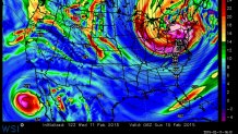
By Saturday, all eyes will be focused on our next storm. **THIS** is the storm to watch. Information will be changing as we get closer to this storm. Incredible amounts of energy will dive in from Canada and track through the Mid-Atlantic and then south of New England with a deepening low near Cape Cod by Saturday night.

Saturday will be another cold day with temperatures in the teens. Snow will spread into New England Saturday afternoon and become heavier by evening. This will impact Valentine's Day plans you may have. So gentlemen, please plan accordingly! The storm will be sitting off the east coast of New England Sunday morning and could very well be a **BEAST** of a storm. This will be a very cold and windy storm at dawn on Sunday with temperatures in the single digits and winds gusting to 40 or higher at the coast. Near blizzard conditions will be possible Sunday morning in blowing and drifting snow.
It is still early. There is plenty that could change between now and then. But the trend is for this storm to take a closer pass to New England, thus a better chance of a more significant storm. It is hard to say how much we could get out of this storm so early, but the way things have been going lately, you can assume with a storm of this magnitude, and track - well - it could very well be another very heavy snowfall with 18-1 snow ratios, which could mean fluffy snow that could add up quickly. This storm will also have the potential to bring heavy snowfall into northern New England this time! Either way, this will likely be a significant storm that will last through Sunday morning. [[291563581, R]] Bitter cold winds from the north will produce bitter wind chills below zero. Actual temperatures will be dropping below zero again Sunday night. As stated before, there will be a dangerously cold weekend to prepare for.

Our next storm will follow in the next Tuesday–Wednesday timeframe. Again, this is all long-range forecasting with details likely to change. Still, this next batch looks juicy. Unlike the Clippers diving in from Canada, this one will be coming with moisture from the Gulf of Mexico! This low will track from Texas into the Northeast. Snow will develop Tuesday and likely begin to see some mixing by Tuesday night. Where this low eventually tracks will be critical if we get snow or a mix with rain. This storm appears that it will track over New England and bring some warmer air in from the southern states, allowing for southern New England to turn to rain by Tuesday night into Wednesday morning before changing back to snow as the storm pulls away Wednesday afternoon.
This storm also will have the potential for areas of freezing rain inland, which could be another issue. It is important to note, while the talk of rain may sound good, it is not. That heavy rain could fall on our incredibly deep snow pack and add more weight to the snow. The potential for roof collapses will be tremendously high. It is imperative to clear rooftops that have heavy snow on them.

The heavy snow poses a real danger for many reasons. But with higher sun angles this time of year, and warmer temperatures elsewhere across the nation, we will have to watch for any quick warm ups or rainstorms. The snow contains four to eight inches of water and we will be adding to it in the coming days. This amount of water could be released in any rapid warm-up, which will be possible heading into March. The potential for dangerous spring flooding could be another chapter of this historic winter in New England.
Local
Let's hope for the best in this next round of winter weather and prepare for the worst! Use any free time around the house for cleaning up, clearing roofs and ice dams in the gutters. Unfortunately, it is going to be brutally cold this weekend. Bundle up!


