
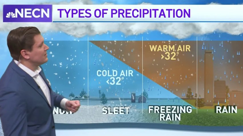
-
Forecast: Warmer temperatures and scattered showers to cover New England
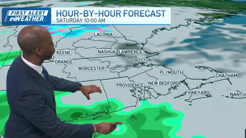
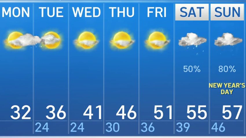
Thursday Evening: Breezy, few flurries and clouds. Temps around 30, wind chill around 20. Overnight Thursday: Quieter wind, partly cloudy. Lows in the 20s. Friday: Sunny. Highs in the 40s. Saturday: Cloudy with showers from late AM onward. Highs near 50.
-
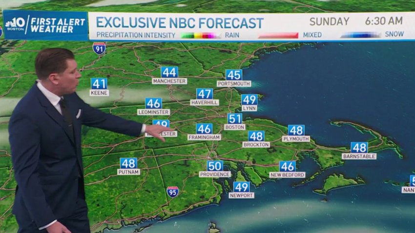
Mild Temperatures Saturday Evening Lead to Perfect Weather Sunday
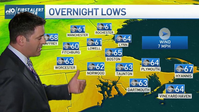
Cool and mild temperatures are expected throughout tonight (Saturday), with beautiful sunny weather all through the region on Sunday. Humidity and the chance of storms increases Monday and Tuesday, with high heat making its way mid-week.
-
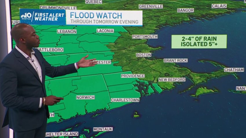
Potential Flooding Through Monday Evening
With 2-4 inches of rain expected to arrive through Monday evening, we’re seeing a risk of flooding. Much of the region will be hit with serious showers, which could lead to flooding on roadways. The showers subside for us to have a fairly dry day on Wednesday, only for another system to arrive Thursday and Friday.
-
Summer Solstice Coming Up, Temperatures Get Warmer
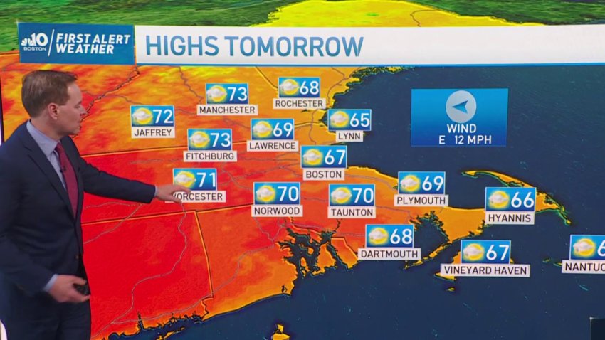
This week will have lots of sunshine, but with some humidity as well. The beginning of the week starts off milk with temperatures in the high 60s and low 70s, only to rise to the mid 80s for the weekend.
-
Could the Weather Be Any More Perfect?
A chilly start to Mother’s Day in the morning comes up to the high 60s with mostly clear skies. We’re anticipating a dry week that will drastically increase the risk of brush fires in the region. So if you’re grilling tomorrow or having a fire, use caution and see how high the risk is in your area.
-
Windchill and Low Temperatures Monday Morning
Dress warm Monday morning, as wind will make outside feel like it’s in the 10’s. Monday warms up as the day goes on, and rain is expected for Tuesday, Wednesday and Thursday. Friday clears up, followed by a sunny, milder weekend.
-
Mild and Partly Cloudy to Start the Week
Tonight (Sunday): Chilly with clear skies. Tomorrow: Milder temperatures with partly cloudy skies. Rain arrives in the middle of the week, with a mild and sunny weekend on its way soon.
-
Rain and Pockets of Snow Arriving on Tuesday
Tonight (Sunday): Mostly cool and clear. Tomorrow (Monday): Cloudy in High 40s and Low 50s. Snow expected in scattered spots of region, possibly even Boston.
-
Ice Storm Potential This Thursday After Mild Beginning to Week
Tonight: Cool and cloudy. Tomorrow (Monday): Cloudy and mild temperatures in 50s. Potential snowfall Tuesday evening, and high chance of icy conditions on Thursday.
-
Light Snow Could Lead to Slick Road Conditions Saturday Evening
Tonight, light snow continues on and off, with little or no accumulation. Temperatures tonight (Saturday) will reach lows of 30, which might cause wet roads to freeze. Tomorrow (Sunday), more light snow is expected east of I-495, with as much as 4″ of snow arriving along the shore.
-
Cold Air Sticks Around Today, Mild Pattern Arriving Through the Week
Don’t let today fool you, we have mild temperatures coming our way. We’re looking at temperatures increasing throughout the week into the high 50s, with rain expected on Saturday and Sunday.
-
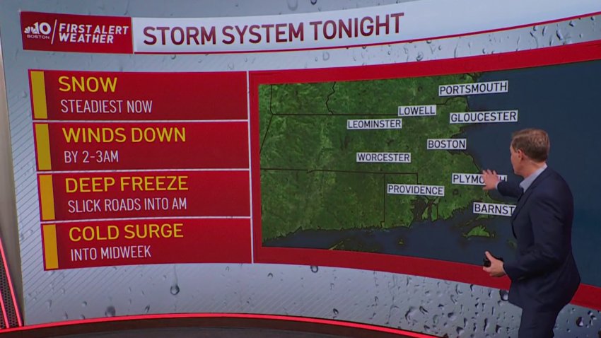
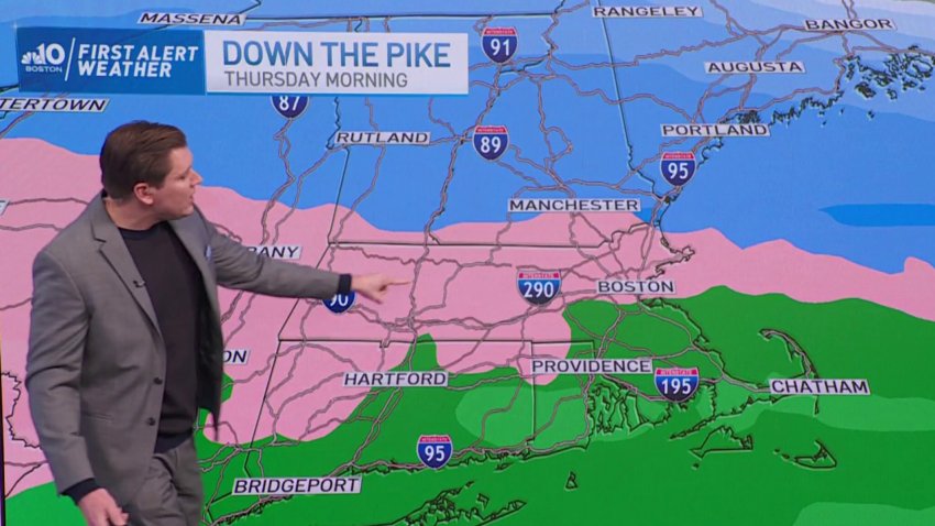
FIRST ALERT: Steady Snow Until 3AM, Slick Roads Into Monday Morning
Snow continues with a variable pace through 2-3am, then shrinks to the South Shore and finally out to the Cape by morning. Snow/rain showers will mix on the Cape until mid-morning Monday, with little to any accumulation there. Roads are slippery already, and will remain so as the temps fall to the low and mid-20s.
Trending
