
-
Flash flood warning for parts of Mass., Rhode Island
Showers have already started in southern New England, with localized heavy downpours south of the Mass Pike. The rain is expected to increase in coverage this afternoon, with the possibility of thunderstorms, although the main concern is heavy downpours & lightning. A flash flooding is in effect for parts of Massachusetts and Rhode Island, and the Sagamore Bridge to Cape…
-
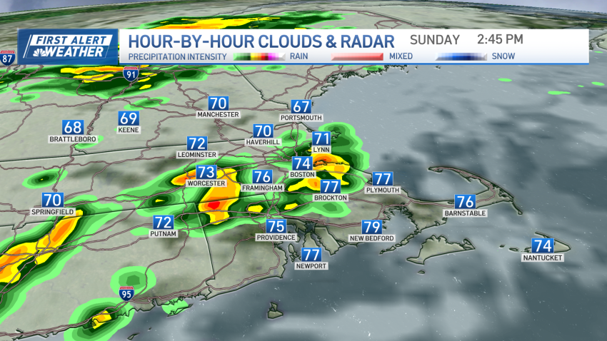
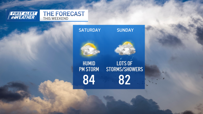
Humid, stormy weather continues on Sunday
Our stormy, and humid weather continues through the entire weekend on this Sunday. A stationary front is right across New England and will provide another day of showers, storms and maybe a strong storm with gusty wind, heavy rain and lightning. The showers will be around this morning, with another round in the afternoon to evening. More clouds are expected…
-
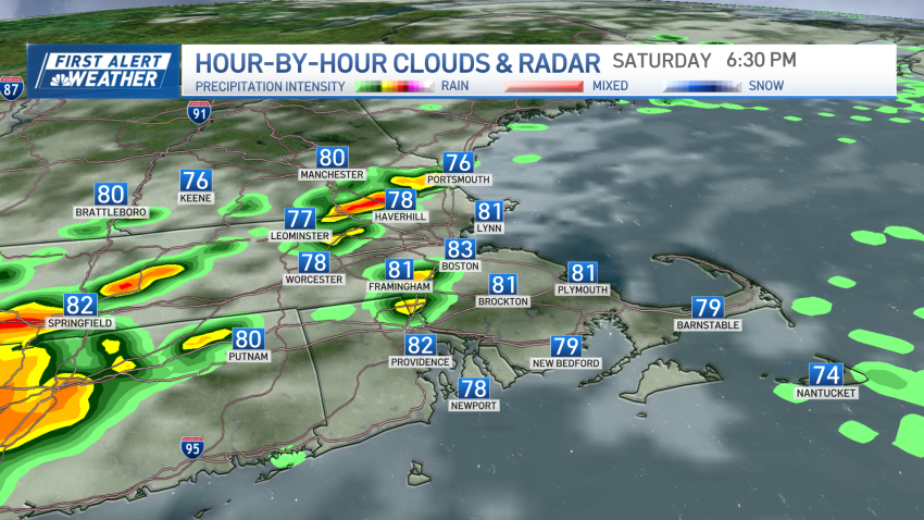
More showers and storms Saturday in New England
New England continues under cloudy skies, humidity, warmth as well as showers & storms this afternoon. The severe weather threat is lower compared to yesterday. Some showers and storms are forming in south central Connecticut, and moving into the northeast by the evening. Reaching inside I-495 in the middle of the day. Click here for the latest weather alerts. Highs…
-
High humidity with possible storms on Saturday in New England
After yesterday’s severe weather event, we’re all on pins and needles with the idea of more storms in the forecast. Today’s setup isn’t as robust as yesterday, but it’s possible that isolated severe storms pop up this afternoon. Humidity will remain high, so heavy rain will also be part of the equation (again). Placement and density is another consideration...
-
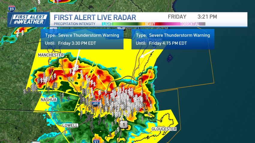
Storms cause problems across New England
There were severe storms across New England Friday afternoon, leaving tens of thousands of people were without power. Flash flood warnings and severe thunderstorm warnings were in effect in much of New England throughout the later part of Friday, but they have since expired. See all severe weather warnings in your area here, and explore interactive radar below. The weather…
-
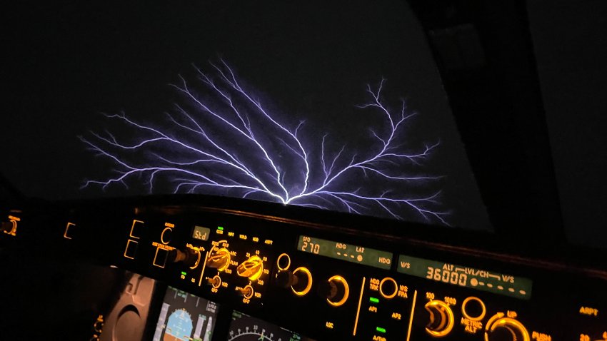
What is St. Elmo's Fire?
The glowing phenomenon is produced by an extreme buildup of electrical charge.
-
FIRST ALERT: Scattered severe thunderstorms pop up across New England
Severe thunderstorms popped up Sunday afternoon across New England, including in Maine — where flash flooding was possible — New Hampshire and southeastern Massachusetts. See all severe weather alerts in your area here. Isolated to scattered showers were marching across the region, but a slow-moving cold front was set to usher in drier air Sunday evening with decreasing cloud coverage…
-
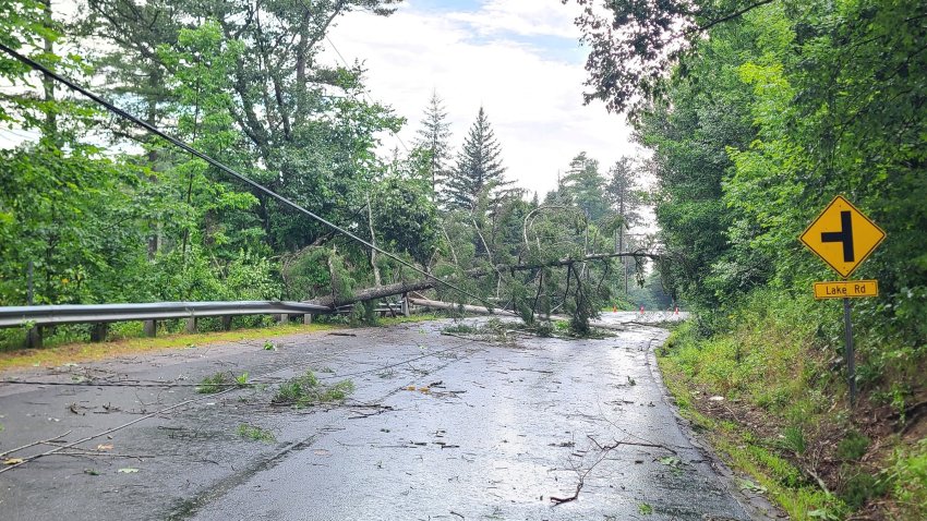
Damage follows possible tornado in NH, lightning strike in Boston
Trees and wires are down and roads closed in New Hampshire after an observed tornado and other severe storms Thursday, and a lightning strike caused damage in Boston’s South End. A weather observer reported the apparent tornado in the Keene, New Hampshire area. The National Weather Service has said they will conduct a storm survey in the Keene and...
-
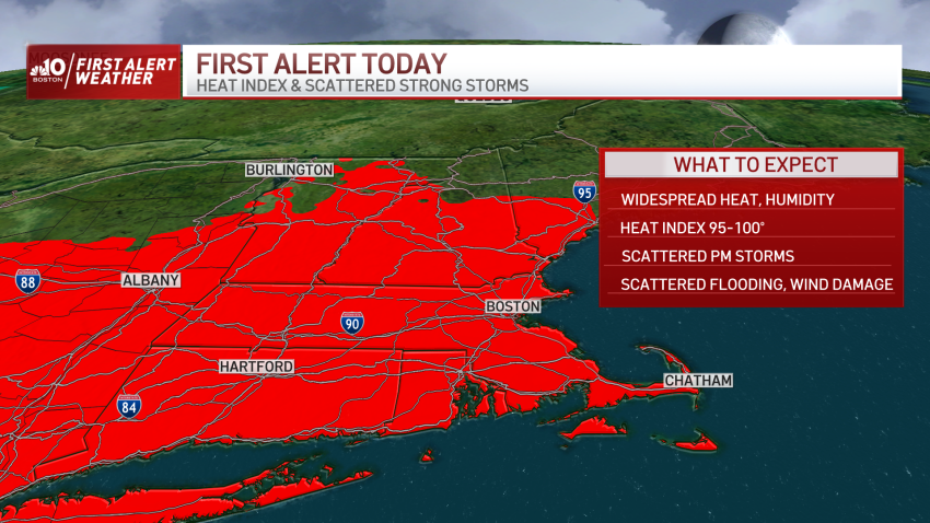
First Alert through Saturday for impactful heat and storms
Our First Alert on Thursday is two-pronged: impactful heat and impactful storms. The heat and humidity will be felt by nearly all central, southern and western New Englanders, while the storms will be strong for some, but not necessarily as widespread as the heat. See all severe weather alerts in your area here and track live weather radar below. A…
-
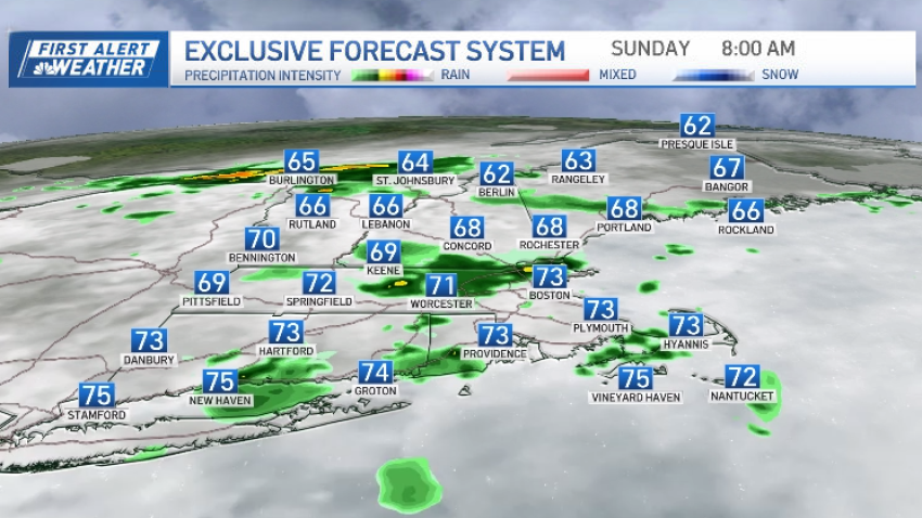
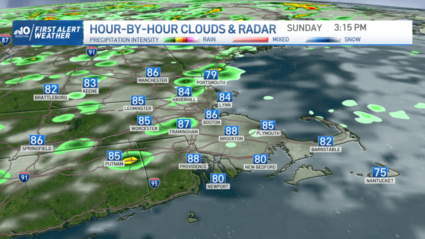
Heavy Rain Blankets New England Sunday: See Live Radar
Heavy rain will fill back in Sunday afternoon as another and larger wave of rain moves in. We remain soggy Sunday even with some breaks in the heavy rainfall. Areas of fog, drizzle and sprinkles will be intermittent across the Northeast as highs are stuck in the low 50s with an onshore wind. Then another push of heavy rain moves…
Trending
