
-
Beautiful Weather in the Next Several Days
Monday will reach a peak of 70 degrees in the region. The next chance of rain we’ll have will come Wednesday morning, but will dissipate before the afternoon. The rest of the week will be sunny and dry.
-
Week of Consistent Warm Temperatures, Risk of Brush Fires
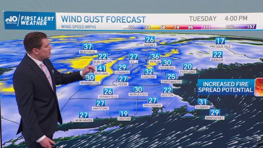
This upcoming week will be warm and dry, but because of less-than-average snowfall this year, we’re at risk for potential brush fires this coming week.
-
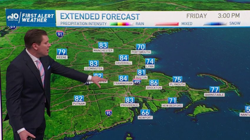
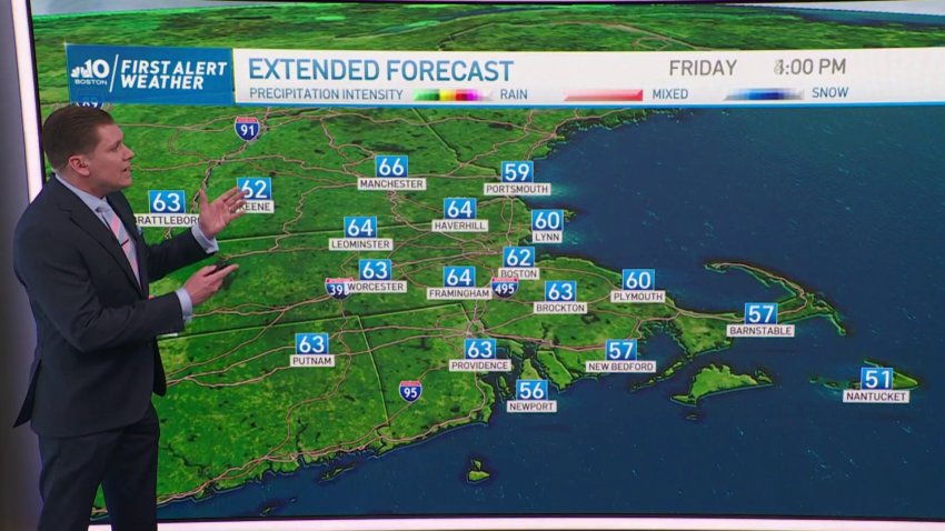
Warmer Temperatures Coming This Week
Tonight (Sunday): Low temperatures in the high 30s. Temperatures begin to rise into the 70s during the week, peaking in the 80s on Friday. The weekend cools down with partly cloudy skies, and the chance of rain on Sunday.
-
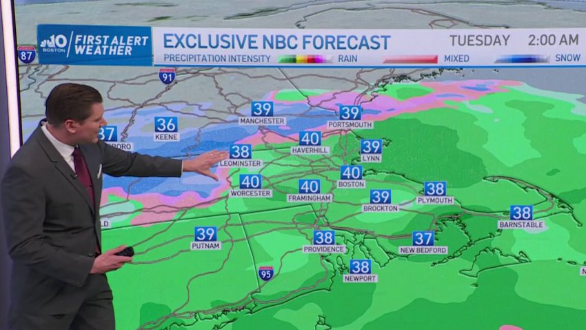
Rain and Pockets of Snow Arriving on Tuesday
Tonight (Sunday): Mostly cool and clear. Tomorrow (Monday): Cloudy in High 40s and Low 50s. Snow expected in scattered spots of region, possibly even Boston.
-
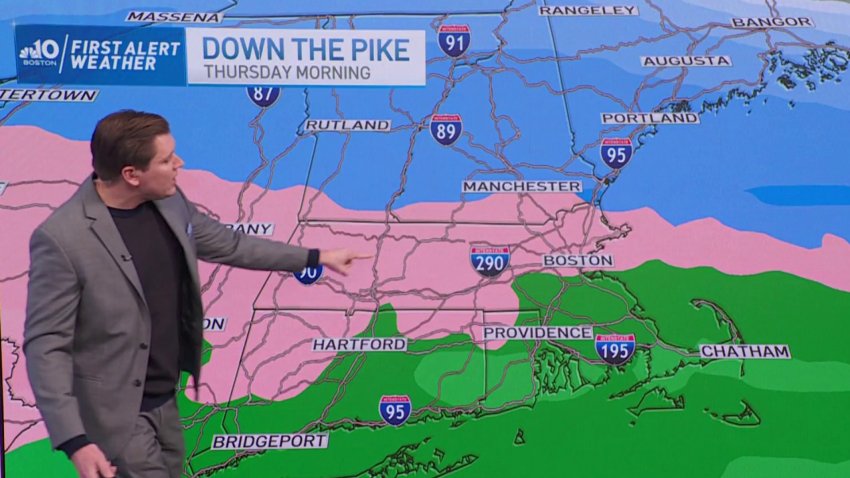
Ice Storm Potential This Thursday After Mild Beginning to Week
Tonight: Cool and cloudy. Tomorrow (Monday): Cloudy and mild temperatures in 50s. Potential snowfall Tuesday evening, and high chance of icy conditions on Thursday.
-
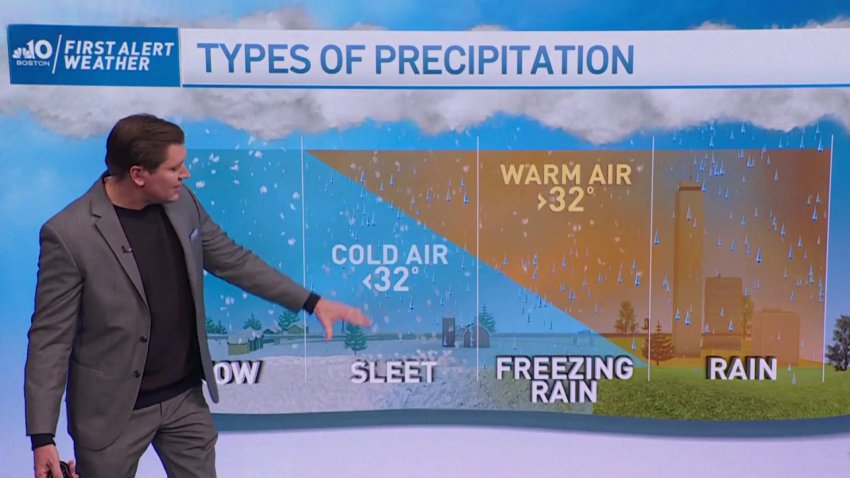
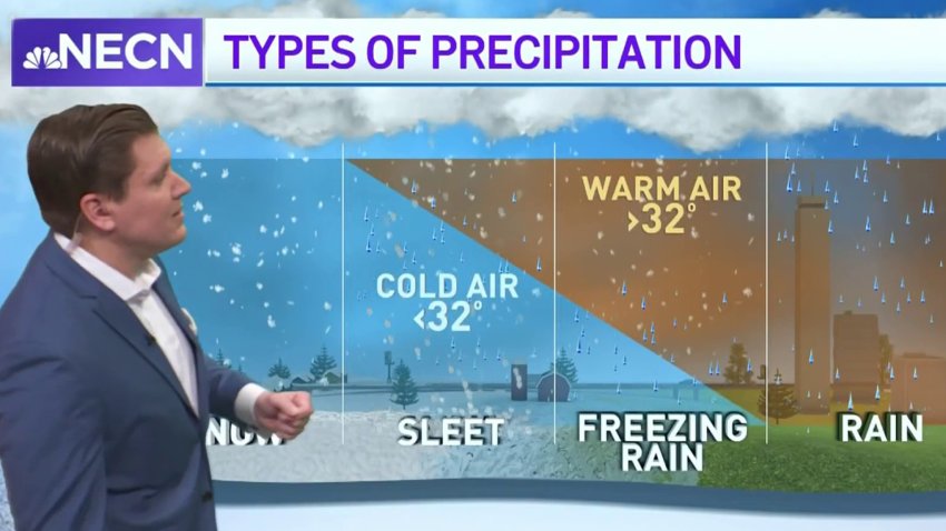
High Chance of Ice & Freezing Rain This Thursday
Tonight: Clouds and cool air. Tomorrow: Cloudy with milder temperatures. Temperatures drop Thursday leading to the likely chance of freezing rain and ice.
-
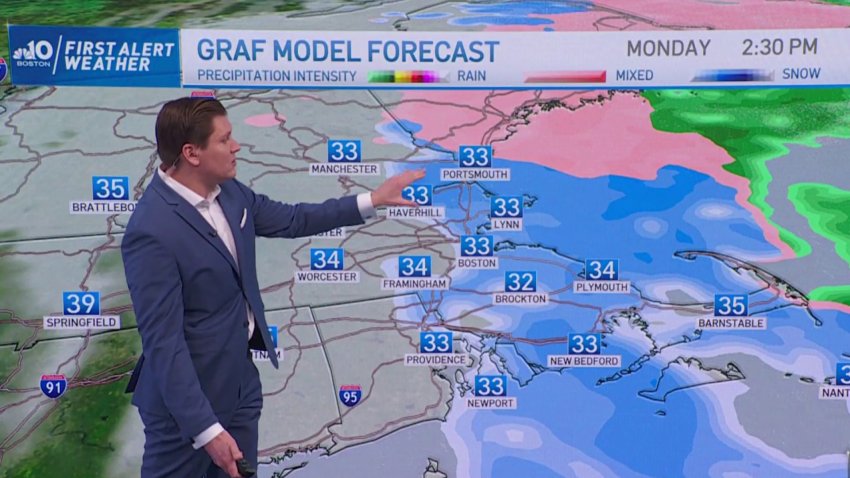
Freezing Temperatures Saturday Evening Could Cause Slick Road Conditions
Wet roads today (Saturday) could mean slick roads tonight. As temperatures drop across the region to 32 and below, wet roads have the chance of freezing. More snow will come its way Sunday morning, accumulating mostly on the coast of Massachusetts.
-
Light Snow Could Lead to Slick Road Conditions Saturday Evening
Tonight, light snow continues on and off, with little or no accumulation. Temperatures tonight (Saturday) will reach lows of 30, which might cause wet roads to freeze. Tomorrow (Sunday), more light snow is expected east of I-495, with as much as 4″ of snow arriving along the shore.
-
New Year's Day in the High 50s
Rain showers tonight (Saturday) will stop around 2 a.m., making way for mild temperatures and sunshine tomorrow.
-
Warmest New Year's Eve Since 1992
Record-setting New Year’s temperatures, and rain showers will continue through midnight tonight (Saturday), with showers ending at 2 a.m. tomorrow. New Year’s Day will be bright with temperatures in the low 50s. Colder weather expected this upcoming Thursday and Friday.
-
Mild Temperatures Tonight, Along With Rain
Tonight (Saturday): Showers and mild temperatures in the 50s. Showers and wind overnight. New Years Day will see continued mild temperatures, along with clouds and gusts of wind throughout the day.
-
Quiet Start to the Week, Rain and Milder Temperatures on Friday
We’re on a warm track this week. We start our week off with sunshine and some clouds, only for temperatures to increase on Thursday into the mid-40’s, and jump into the high 50’s on Friday with a sizeable rain storm.
-
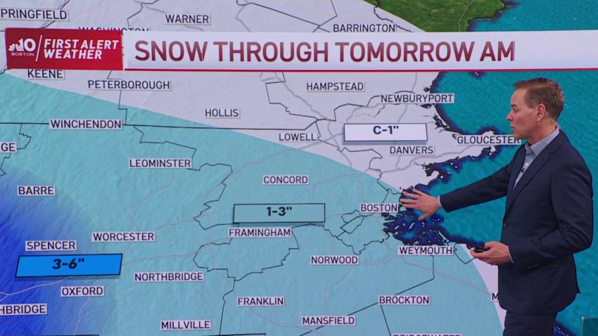
FIRST ALERT: Snow Through Tomorrow AM
This year’s first snowfall left much of the region covered with at least 1″ of snow, enough to keep roads slick. Take a look to see what to expect tomorrow morning on your way to work.
-
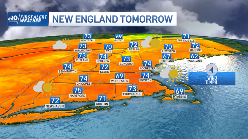
Get Outside! Here's Your Fabulous Weekend Forecast (With Some Wrinkles)
For a straight-forward forecast of mild air, there are some subtleties that will play into the finer details of the weekend forecast. But first, the straight-forward part: high temperatures will reach or exceed 70 degrees in a number of New England communities Friday through Monday. One of the subtleties to the forecast was evident early Friday morning: pockets of...
Trending
