A few snowflakes will fly Saturday night, but the worst of the storm is finally over with the exception of eastern Maine where we'll see snow shutting down after midnight tonight!
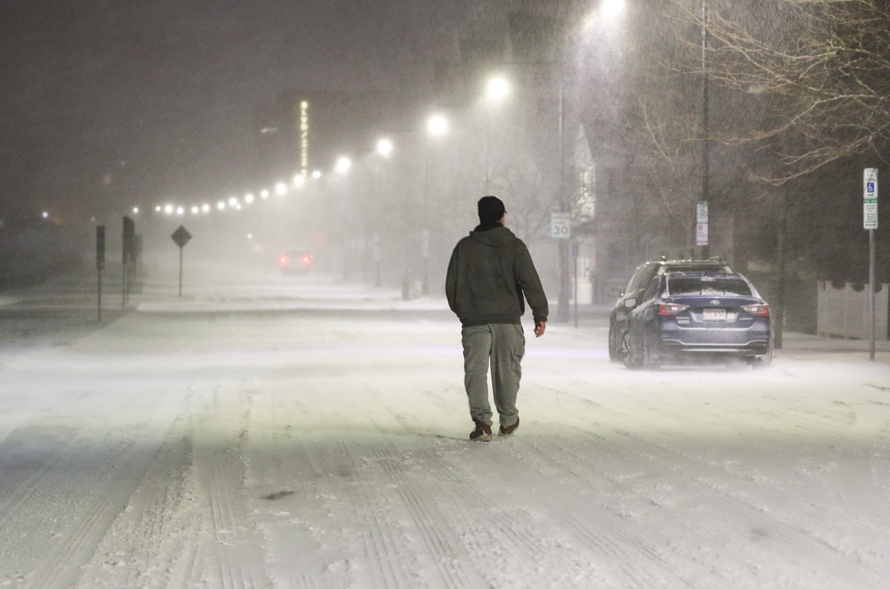
Saturday’s storm was certainly one for the books. We saw many reports of over 2 feet of snow across eastern Massachusetts and Rhode Island, with the highest totals just south of Boston and along the south shore.
Boston came in at 23.6 inches, putting it in a tie for the city's biggest one-day snowfall (Note: not storm total).
Get New England news, weather forecasts and entertainment stories to your inbox. Sign up for NECN newsletters.
National Weather Service Boston confirmed that blizzard conditions were met in several areas across southern New England, including Boston, Worcester, Hyannis and Martha's Vineyard in Massachusetts, and Providence, Newport, and Block Island in Rhode Island.
The National Weather Service considers a storm a blizzard if it has snowfall or blowing snow, as well as winds of at least 35 mph that reduce visibility to a quarter-mile or less for at least three hours. In many areas, Saturday's storm met those criteria.
The storm also caused many problems along the coast during both the morning and late evening high tide cycles with roads flooding and waves crashing over the sea walls.
The wind was also a huge factor, knocking out power for many residents, most of them living along the coast, especially across the Cape where power still hasn’t been restored. From Gloucester to the Cape, we saw peak wind gusts over 70 mph.
Overnight, we’ll still have to deal with the wind across much of the area, but thankfully it will wind down as the storm system continues to pull away from the region.
Though the strongest winds will be gone, the wind will be a factor overnight creating whiteout conditions as it blows the snow around and with temperatures overnight dropping into the single digits south to near 0, and below 0 north.
Wind chills will be dangerously cold as they remain well below 0 right through Sunday morning.


Sunday we’ll see winds continuing to diminish, but it will remain very cold as we continue to dig out from the blizzard. Highs reach the low 20s south, teens north, but the wind will still make it feel a lot colder, so please take it easy out there once again.

As we look further out on our Exclusive 10-Day Forecast, a warm-up is in the forecast toward the middle of the week with temperatures pushing 50 by Thursday with the chance for some rain showers, but it turns colder after that once again.