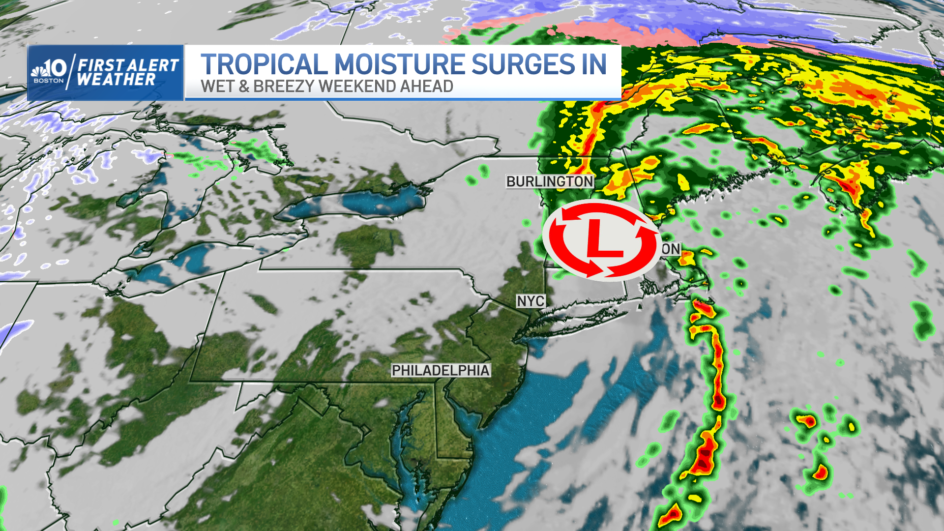
The clouds keep growing and showers enter Connecticut Friday afternoon, expanding over all of New England by the evening. Embedded thunderstorms and heavy downpours will tag along the bands of rain that will push into the northeast Friday night through Saturday morning. Wind will gust over 50 mph over the Cape and Islands.
Plymouth and Bristol counties, as well as half of Rhode Island will see wind gusting over 40 mph. Most of Massachusetts will also see wind gusting from 35-45 mph. While it will also be breezy across Vermont and New Hampshire, the wind will not be nearly as strong as the southeastern areas of the region.
We could see some affected tree limbs, branches, but nothing significant for now. Maybe a few outages possible across the areas with the strongest winds, but not a widespread risk.
Get New England news, weather forecasts and entertainment stories to your inbox. Sign up for NECN newsletters.
Rainfall amounts will range from half to an inch and a half. The highest amounts are concentrated among the west and northern areas due to higher rainfall rates Friday afternoon and evening, transitioning into Saturday morning.
While the heaviest rain may bring some ponding or standing water in areas, the risk of significant flooding is not expected. The tropical moisture will linger until late morning Saturday, but most of the rain will exit the area by midday Saturday. Some lingering showers may push into northern New England Saturday evening due to the passage of the frontal boundary leaving drier and colder air behind it by Sunday.
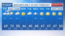
After temperatures in the 60s and low 70s Friday and Saturday, Sunday brings ample sun but a sharp drop in temperatures. Highs will remain in the mid-50s on Sunday with mid and upper 40s on Monday. And this is where the action begins. The winter vibes are back by midweek as we’ll see a cold front pushing through bringing in the chance for rain and even some snow Wednesday into Thursday.