
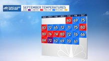
What a nice day! A fall weekend that brought a cold start, but conditions are improving through the afternoon with bright sunny skies and highs in the upper 60s.
Our temperatures increase a bit more Sunday as a warm front pushes in. We’ll begin to see increasing clouds tomorrow with a rise in dew points and the chance of showers late afternoon far west and becoming scattered over New England at night.
Those showers will linger through northern and western New England on Monday with some areas east getting a few of those showers, too.
Get New England news, weather forecasts and entertainment stories to your inbox. Sign up for NECN newsletters.
u003cemu003eSign up for our u003c/emu003eu003ca rel=u0022noreferrer noopeneru0022 href=u0022https://www.nbcboston.com/newslettersu0022 target=u0022_blanku0022u003eBreaking newsletteru003cemu003e u003c/emu003eu003c/au003eu003cemu003eto get the most urgent news stories in your inbox.u003c/emu003e
Rain chances will be present through Wednesday, although not all of New England will receive the same amount of rain.
Much of New England will see sunny skies Tuesday, but more instability north and spreading showers are expected on Wednesday.
Weather Stories


Right after that low pressure system leaves, a high pressure coming off from Canada will dip into New England bringing a cold air mass for Thursday-Friday.
Temperatures will remain with highs in the 50s and lows in the 30s-40s.
Meanwhile, new tropical storm Ian out in the Caribbean is forecasted to enter the Gulf of Mexico, after affecting Jamaica, Cuba and southeast Mexico. It may potentially make landfall in southeastern US.
The remnants of this new cyclone may travel as far north as New England and could enhance the chance for rain on the second half of next weekend. NBC10 & NECN’s First Alert Team will keep following its path.
