A huge dome of cool and dry air continues to exert influence over the Northeast, including New England, and is expected to extend our stretch of dry weather for several more days, with only a few exceptions.
Clear skies overnight Wednesday night into the predawn Thursday afforded a great opportunity for residents of dark spots in northern New England to enjoy a Northern Lights, or Aurora Borealis, display and this was captured by some of our viewers, and the awesome Star Cam from Twin Pine Cabins near Mount Katahdin, Maine, at neoc.com.
Daylight hours Thursday find no exceptions whatsoever to the dry conditions, though a disturbance aloft will deliver variable clouds that will tend to increase and thicken during the afternoon into the night. For most New Englanders, the clouds won’t drop any raindrops but will serve to block the view of the Taurid Meteor Shower, peaking Thursday night with 5-10 meteors per hour.
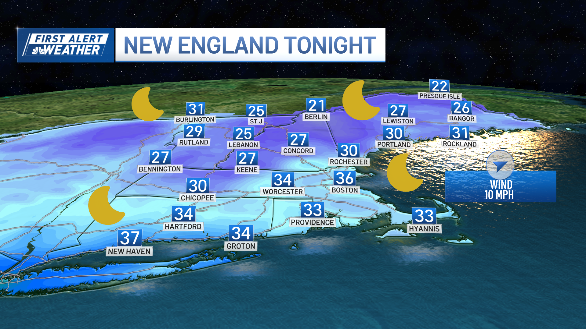
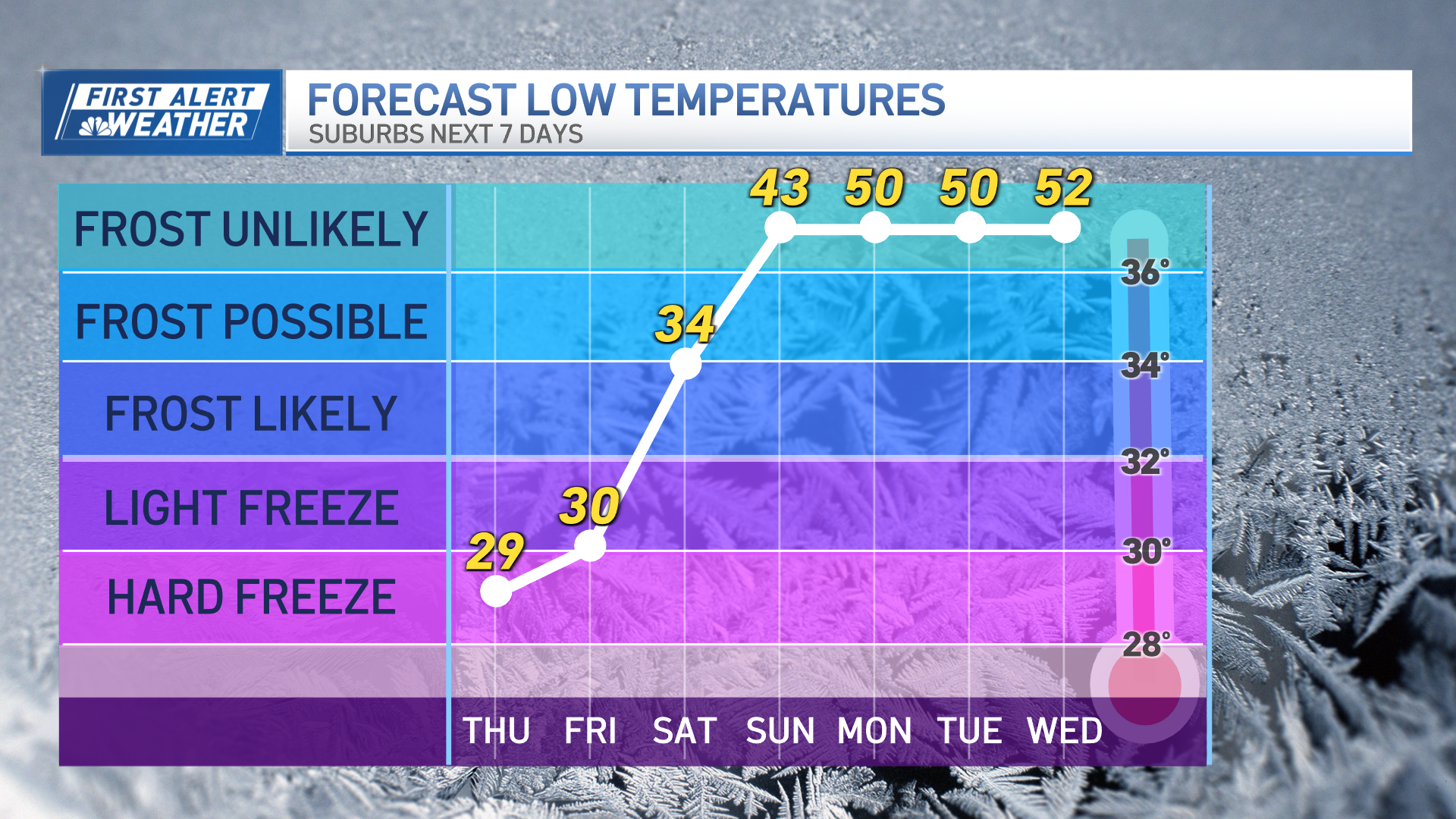
It’s possible that by predawn Friday, enough clearing will move into interior New England to allow for some meteors to be seen and for temperatures to drop back to frosty lows in the 20s and 30s, but from Cape Ann to Boston to southeastern Mass., a northerly wind overnight Thursday night through Friday morning will instead set up a feed of clouds, sprinkles and light showers off the Atlantic.
Get New England news, weather forecasts and entertainment stories to your inbox. Sign up for NECN newsletters.
Termed “ocean-effect” showers, these showers are caused by the contrast of cold air flowing over relatively warm ocean waters, with the ocean warmth and moisture condensing into clouds that grow heavy enough to drop some showers where the wind blows them.
Although Friday likely dawns with these ocean-effect showers from parts of the South Shore to Cape Cod, by Friday afternoon it's likely the drier air in place over the rest of New England combined with a shifting wind to blow from the northwest and reduce wind flow across the water will cause the showers to depart and clouds to break apart. Nonetheless, cool air continues its grip with high temperatures Friday struggling to get to 50 degrees for one and all and widespread frost at night.
The weekend brings relatively steady day-to-day temperatures with frost by night and 50s by day, though a developing large and strong storm over the Gulf Stream, south of New England, will spread increasing clouds into our sky Sunday.
Weather Stories
As long as the late weekend storm misses as expected, our dry spell continues through much of next week with temperatures slowly moderating by a couple of degrees each day until we recover to near 60 degrees for daytime highs toward the end of the exclusive First Alert 10-day forecast, though that relaxation of the cool and dry air also means increasing moisture, and therefore an increasing chance of showers, at the end of next week into next weekend – so while this weekend will be cool, make the most of it, just in case next weekend is wetter!


