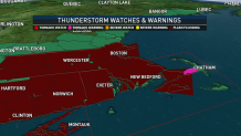
Multiple tornado warnings were issued for the Cape and Islands early Thursday morning as the storm system once known as Hurricane Ida made its way through New England.
A tornado watch was issued for southeastern Massachusetts and all of Rhode Island through 7 a.m. Tornado watches indicate the possibility tornadoes could form, and are a degree less urgent than tornado warnings.
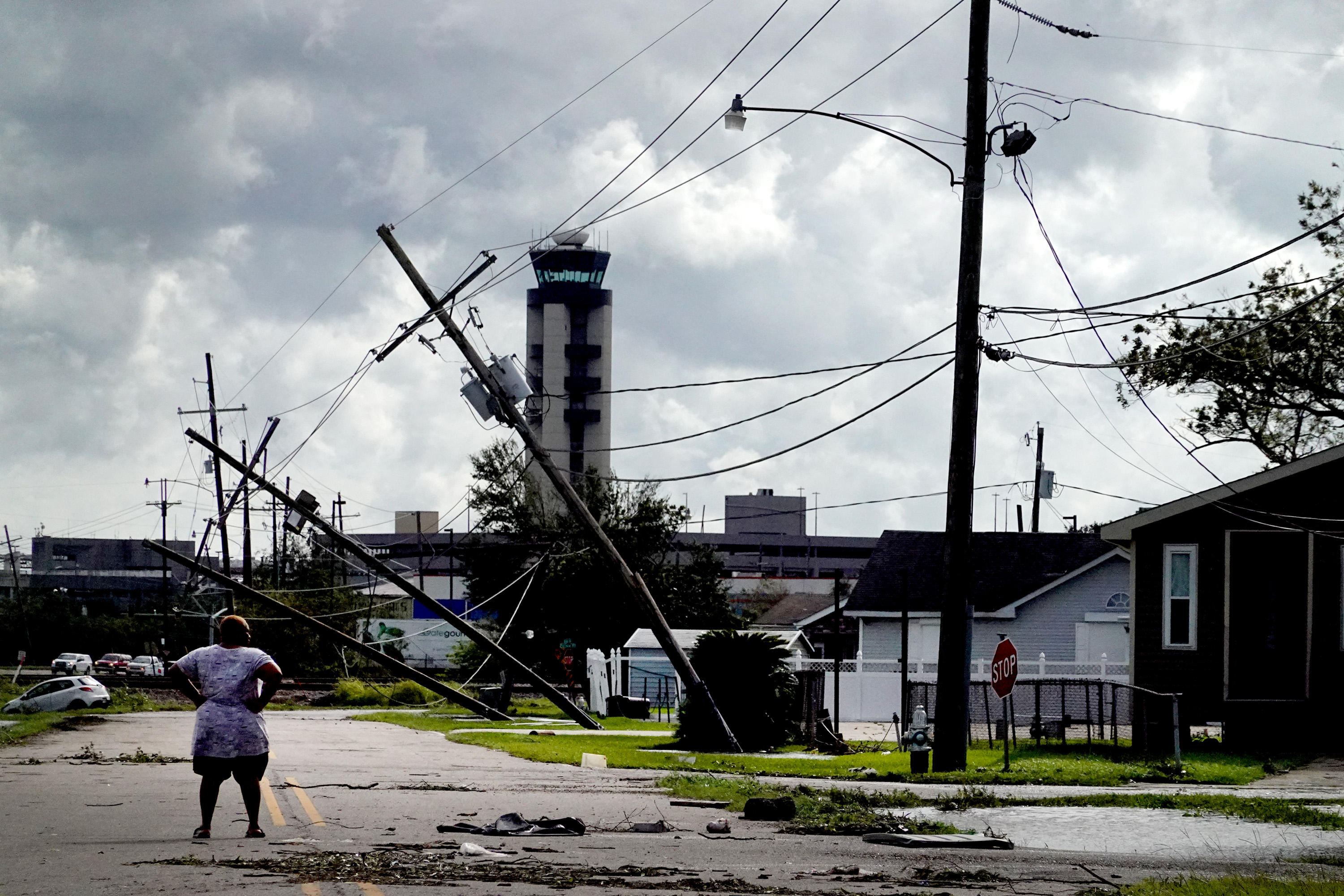
They're part of an extreme weather event caused by the remnants of what was Hurricane Ida inundating the Northeast Wednesday night. Flash flood warnings expanded across southern New England, including the Boston, Worcester, New Haven and Providence areas.
Get New England news, weather forecasts and entertainment stories to your inbox. Sign up for NECN newsletters.
Flash flood warnings are covering most of Massachusetts, Rhode Island and Connecticut into Thursday morning. Some severe thunderstorm warnings were issued across the region as well, and there was a threat of further tornadoes into early Thursday morning.
See all severe weather alerts in your area here.
A flash flood emergency was issued in Connecticut -- the first ever in the state -- with significant, life-threatening and unusual flash flooding expected. New York City also had its own first-ever flash flood emergency Wednesday, as historic amounts of rain fell, causing widespread flooding.
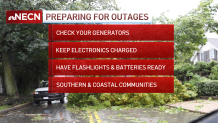
The severe weather, which prompted an NBC10 Boston First Alert, comes as heavy rain takes over in New England Wednesday night from the remnants of what was Hurricane Ida.
The torrential rainfall will lead to widespread flooding and flash flooding across central and southern New England through Thursday morning.
Here's what to know:
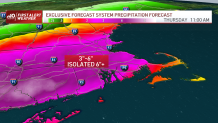
Rain: Tropical downpours continue across the northeast through Thursday morning. The rain will be so quick, and there will be so much of it in a short period of time, that flash flooding is likely across New England. Basements, low-lying streets, urban and small-stream flooding all will be possible.
Stay tuned for flash flood warnings being issued and remember, if you come across a flooded road, don’t drive through it. It doesn’t take much water to carry a car or person away in a deceivingly swift current (if it’s near a stream or river).
The rain will amount to 3-6 inches, with isolated areas getting 6 inches or more, through Thursday morning.
Severe Storms: Heavy rain is one threat, and the next is for embedded thunderstorms. These will run along a warm front that looks to settle across the south coast (or near there) Thursday morning. This is where there is a potential for rotating storms and brief spin-up tornadoes, especially between 2-6 a.m. across Cape Cod.
Our First Alert weather team will be on standby for any of those warnings, too.
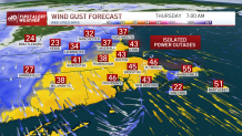
Wind: Gusts will be between 35 and 50 mph, with higher winds near the coast Wednesday night into Thursday morning.
With the ground being so saturated, it won’t take much for trees to fall or for power to go out.
Extended Forecast: Much better weather is forecast for Labor Day weekend. Overall it will be sunny, dry and in the 70s.
Sunday night brings a few storms across the mountains. Monday we see more scattered showers or storms for all.
More highs in the 70s and periodic storm chances remain in the 10-day forecast.