Quiet weather has returned as our pattern seems to be dry during the work-week and a storm during the weekends. We do have a storm in the forecast for the weekend, but all possibilities are on the table — one being a total miss.
The pattern is a split-flow pattern. Colder air stays north, while storm systems pass far to our south. But if those flows merge then we can get a disturbance to move through the northeast.
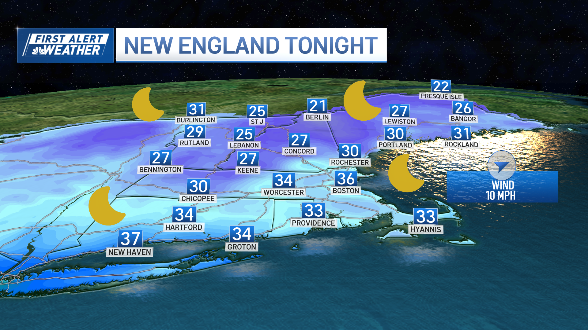
This evening, a shortwave continues to head offshore so this means that our clouds dissipate and the sprinkles or showers spitting from the clouds will also go away. Overnight lows dip into the 20s to low 30s so watch for black ice again through Tuesday morning.
Tuesday and Wednesday we will have more sunshine as highs will be in the mid to upper 30s, but seasonable. There could be some ocean-effect snow showers across Cape Cod for Tuesday night into Wednesday morning with the north/northwest wind bringing a cooler airmass over the milder ocean water.
Highs on Thursday will also be in the mid-30s with more sun than clouds.
There is a storm system that will move through the Gulf states for the middle and end of the week, but this storm will stay south of New England until another southern system affects us possibly this weekend.
Weather Stories
Meanwhile, we will see highs back in the low to mid-40s on Friday and dry weather.
As another southern storm tracks farther east, the forecast models have many different outcomes for us by Saturday into Sunday. The "near-miss" solution is on the table still, as well as a coastal low that could bring some snow Saturday for southeastern New England.
The third possibility is farther north with more rain. Stay tuned as we continue to update you!


