
First Alert weather continues into Friday as the threat of severe thunderstorms arrives into New England Thursday night. Preparation is key and we must be aware of the potentially strong storms that will come in Friday.
A cold front will be pushing over western New England overnight with an easterly and slow movement to the east. But with its slow movement, it will interact with daytime heating, increasing the atmospheric instability and allowing for some of these storms to produce the risk of severe weather.
These storms will be capable of generating damaging wind gusts and possible spinning in the atmosphere that could give way to tornado formation (though we're hoping this is not the case). Again, preparation is key, and being weather aware can allow us to be on the lookout for any possible strong cells.
Get New England news, weather forecasts and entertainment stories to your inbox. Sign up for NECN newsletters.
Heavy downpours, lightning and small hail will also be possible. As far as the total rainfall amounts, we’re looking at localized amounts that could add up to 2 inches in western Massachusetts, Connecticut and Vermont. But most of the east, with the exception of northern New Hampshire, could see totals of less than half an inch to 3/4 of an inch.
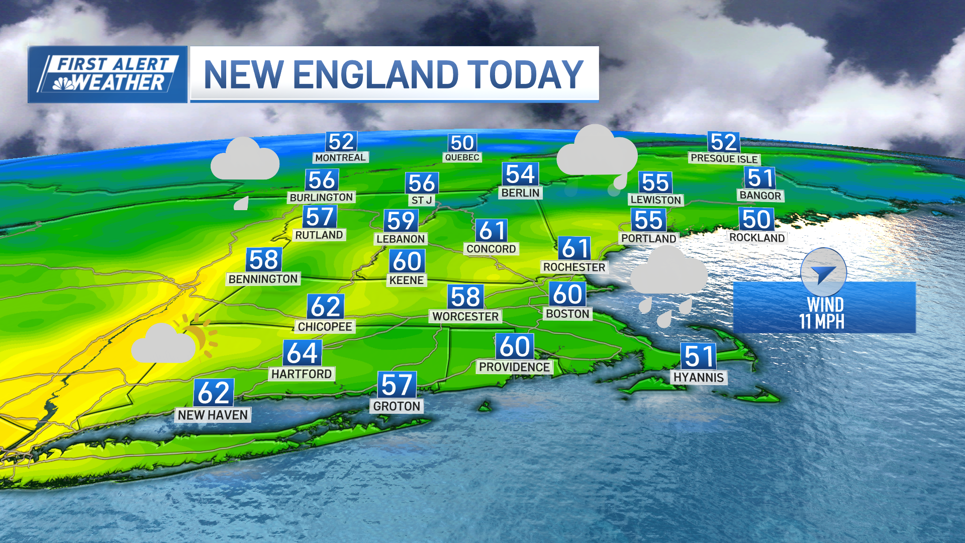
Timing is hard to precise, but our models have been congruent on the storms heading into eastern New England by lunch time. So, by 4 p.m., most of the west will be under mostly sunny skies while the east will be tracking showers and heavy downpours.
The energy in the atmosphere will diminish after that, thanks to the earlier sunset and the loss of the daytime heating, and most of the storms will begin to weaken slowly.
Weather Stories
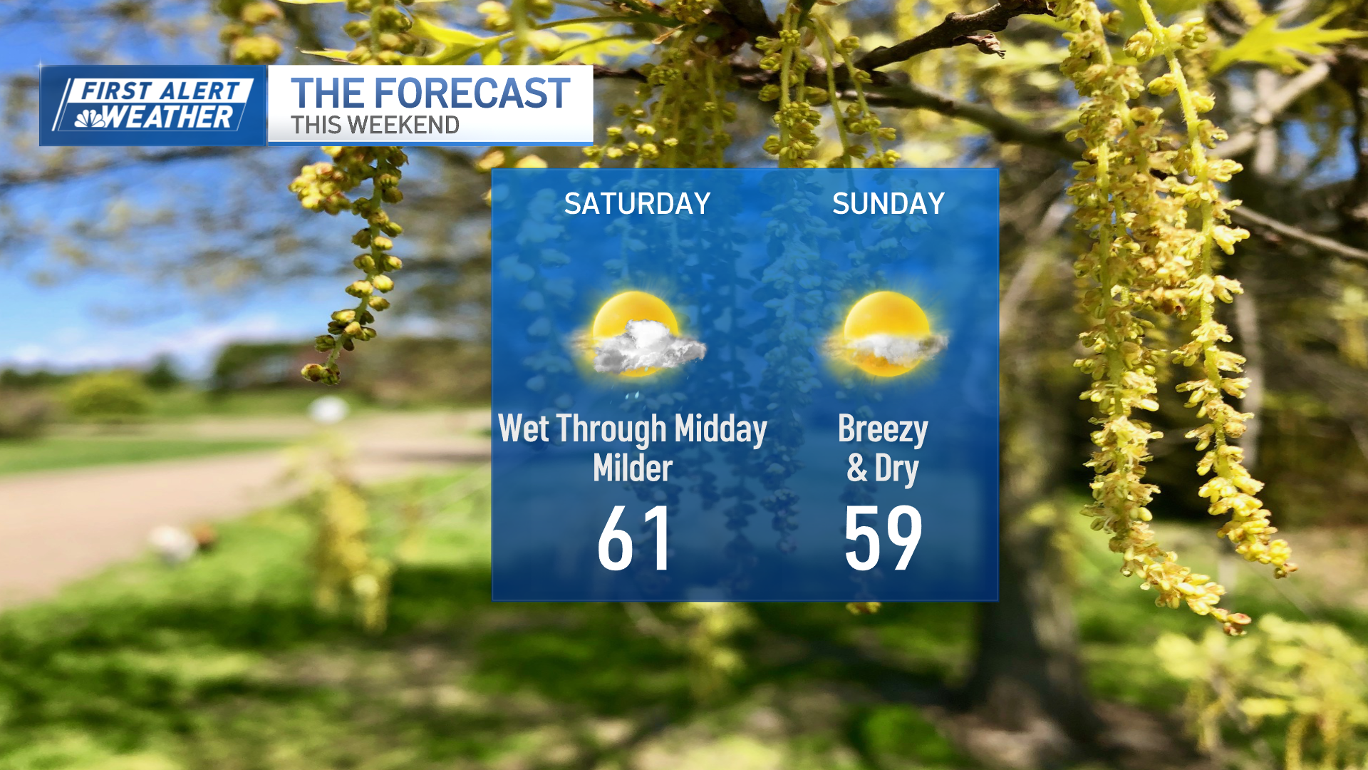
While the forecast shows some lingering showers on eastern New England for Saturday morning, a break from the rain is possible in the afternoon, with rain chances returning for the evening.
Sunday is looking overall great, and mostly dry, but a few pop-up showers could be possible as a shortwave moves through Vermont and New Hampshire.
Our highs will continue to climb up to the 70s for the next couple of days but a fall feeling will finally arrive by mid-week as a cold front pushes in, allowing for temperatures to drop into the 60s.
