
A major storm of wind, snow and rain has just blasted the Pacific Northwest, knocking out power to half a million in western Washington alone.
That's prompting high wind warnings for damaging wind gusts throughout the Rockies and midwest on today. This major storm, chock full of atmospheric energy and carrying Pacific moisture, will cross the country in the coming days and comprises our forecast unsettled weather to start the weekend.
We have time and distance between now and then, though a steady feed of atmospheric disturbances aloft will ensure sunshine will be at a premium after Wednesday, when a fair sky and light wind will make high temperatures around 40 degrees feel rather nice for this time of the year throughout New England.
Although clouds start drifting in noticeably later Wednesday, they won’t really take over the sky until late Wednesday night, keeping the sky gray through the first half of the weekend.
As the air starts changing aloft – milder air begins an arrival ahead of the strong storm slowly moving east into the Great Lakes – the collision of outgoing cool and dry air with incoming warmth and moisture aloft will mean not only clouds Thursday, but also occasional light showers of snow and rain.
For some spots – particularly in northern Massachusetts and southern Vermont and New Hampshire – a dusting of snow is possible on the grass at times during the day. Although the next surge of moist air will touch off rain and snow, that surge won’t arrive until late Friday night and Saturday, meaning most of Thursday night and Friday brings lots of clouds but little more than an occasional flurry or sprinkle.
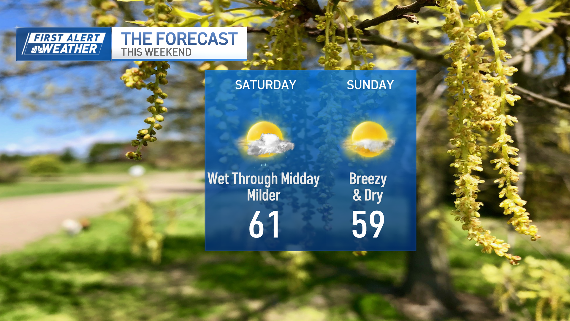
While high temperatures still reach 40 degrees both Thursday and Friday afternoons, the lack of sun surely will mean a cooler feeling than midweek. As precipitation arrives late Friday night and Saturday, the east and south wind ahead of the approaching storm will have eroded the cold air enough for rain to fall in southern New England.
Weather Stories

From the Berkshires to the Monadnock Region and Lakes Region of New Hampshire, enough cold air may linger Saturday morning for a start as snow before changing to rain, while much of Northern New England is expected to see a burst of one to three inches of snow before areas outside of the mountains turn to a mix and rain.
In the mountains of New Hampshire to Maine, holding onto cold air the longest of anyone in New England, snow of three to six inches is possible Saturday, while around three-quarters of an inch of rain is expected in Southern New England. Sunday is sure to be the better of the weekend days: brighter and drier, though a busy breeze and cool air will return a bit of January chill with high temperatures near 40 degrees but a wind chill closer to 30 degrees.
Next week, we reset to a cool and dry pattern for at least the start of the week, with a storm chance showing up in the second half of the week in our exclusive First Alert 10-day forecast.
