Afternoon temperatures spring into the 50s this week. Monday morning, a passing shower and even some flurries are possible before 10 a.m., with clearing skies through the morning. By the afternoon, a few clouds stick around with highs in the low 50s.
Tuesday will be the best afternoon to get outside, with 55 degree temps and mostly sunny skies. Tuesday evening more clouds build in ahead of dreary Wednesday.
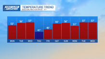
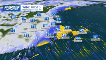
While Wednesday will be the warmest day of the week, it will not be the most enjoyable to be outside. Wednesday will be wet and windy, with scattered showers beginning in the morning and the wind cranking up. Wind gusts will be as high as 55 mph along the coast and 40 mph for interior New England.
Get New England news, weather forecasts and entertainment stories to your inbox. Sign up for NECN newsletters.
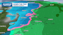
After on-and-off showers throughout the day, a cold front will guide the last batch of rain overhead Wednesday into Thursday. Rain totals will be near and below 1 inch. Higher elevations could see some snow or a rain/snow mix before sunrise Thursday.
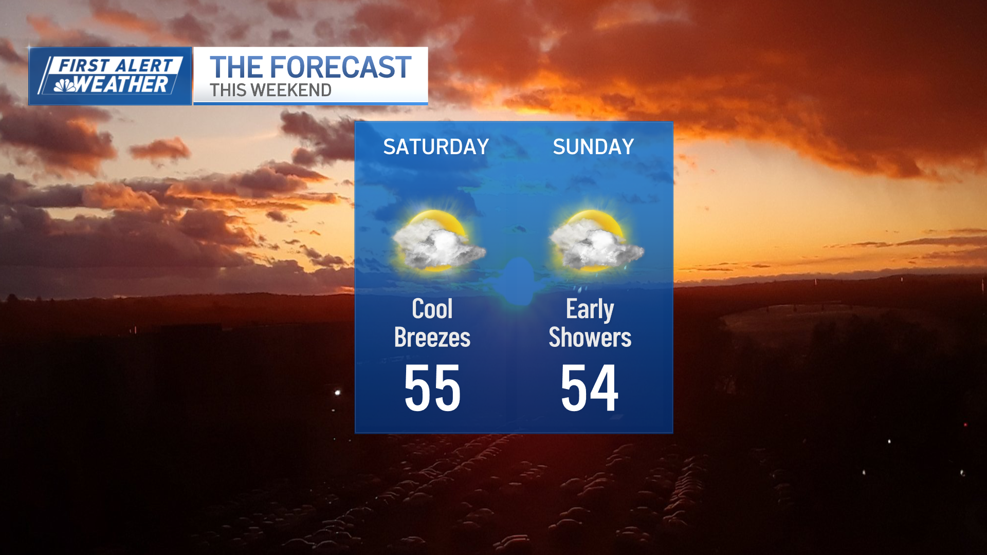
Thursday remains windy with drying skies. Temperatures will drop throughout the day Thursday, and by Friday morning it will be brisk. The cold air won't linger long, and by Saturday we're back to the mid-50s.