


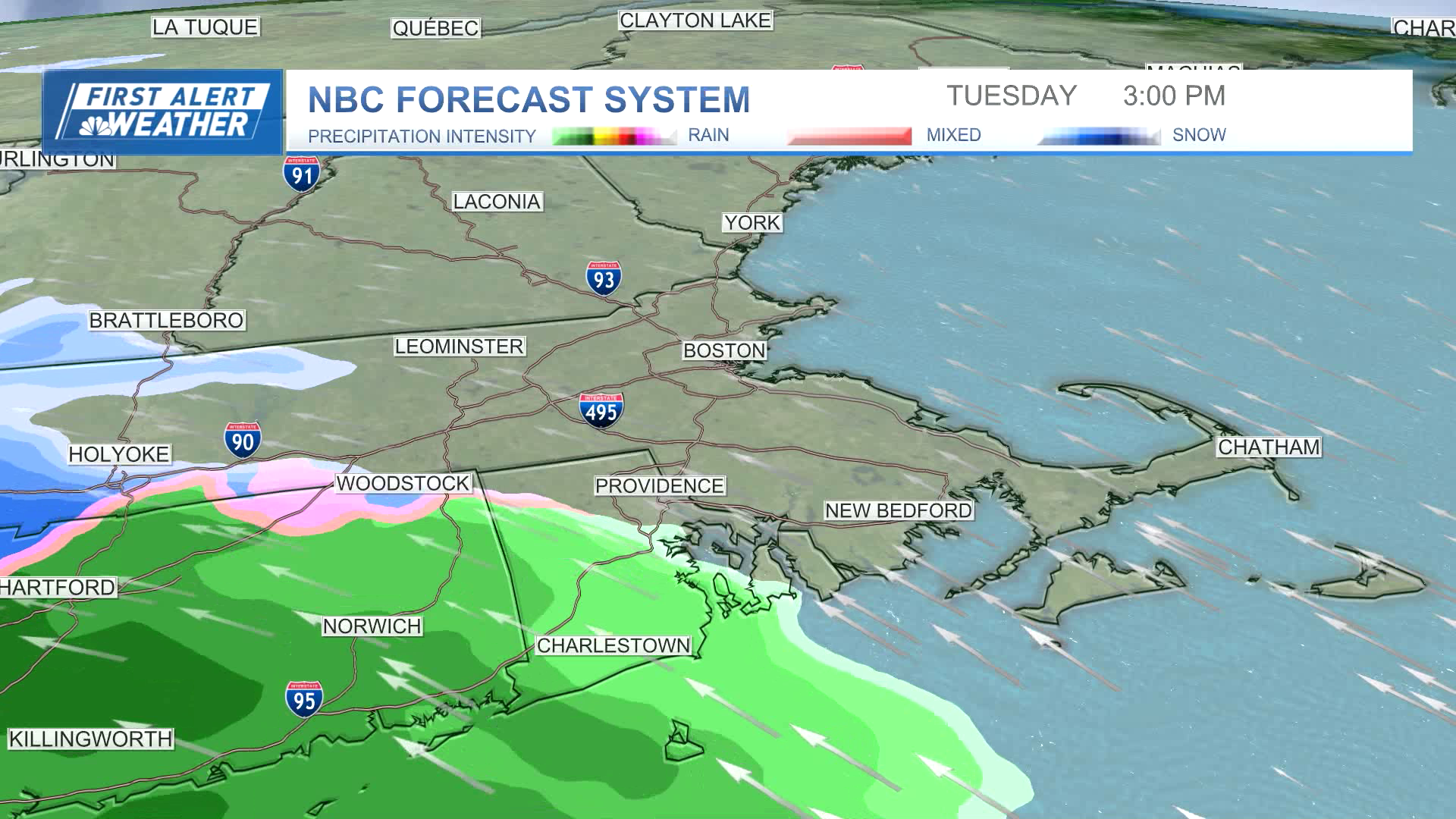
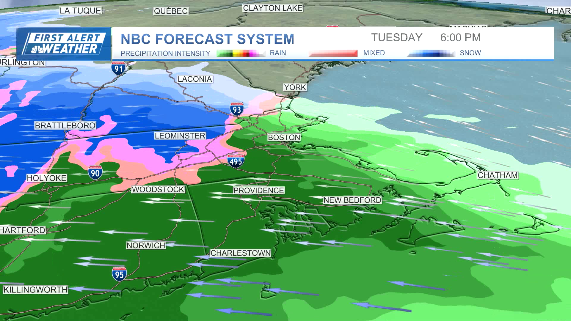
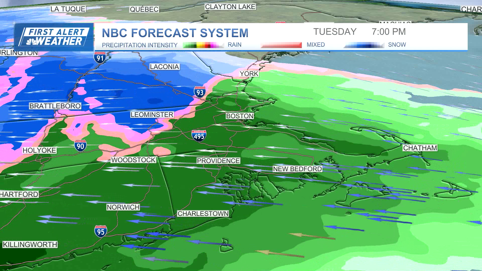
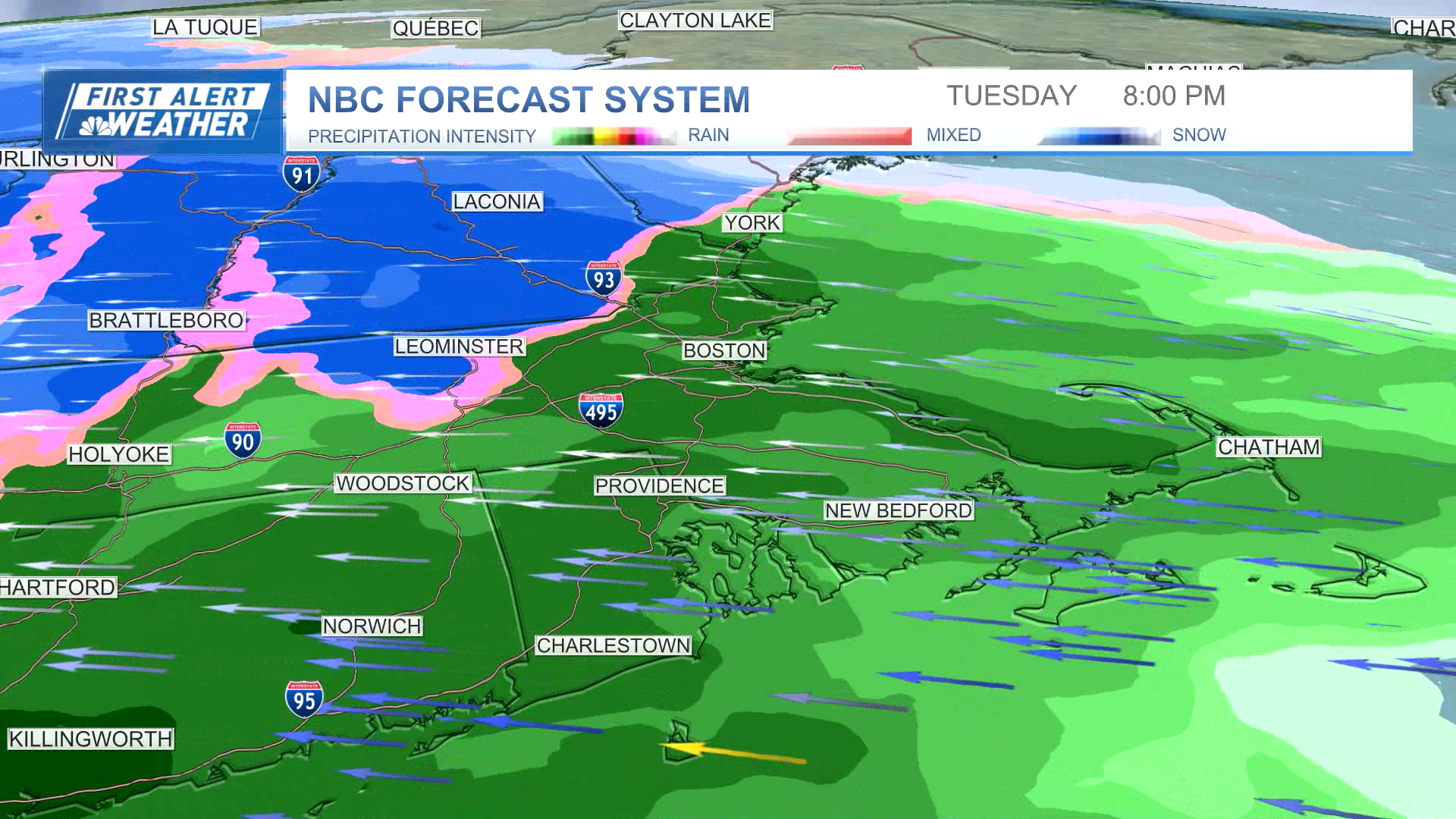
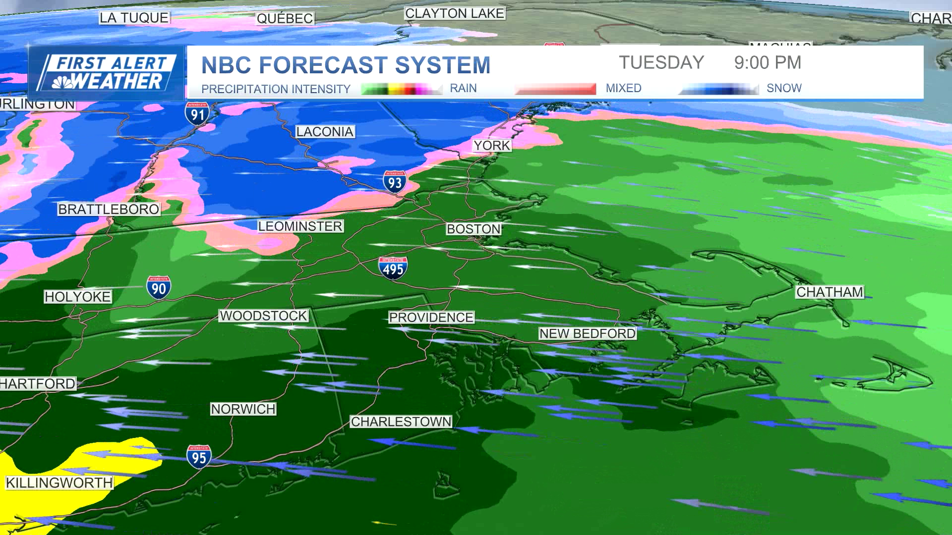
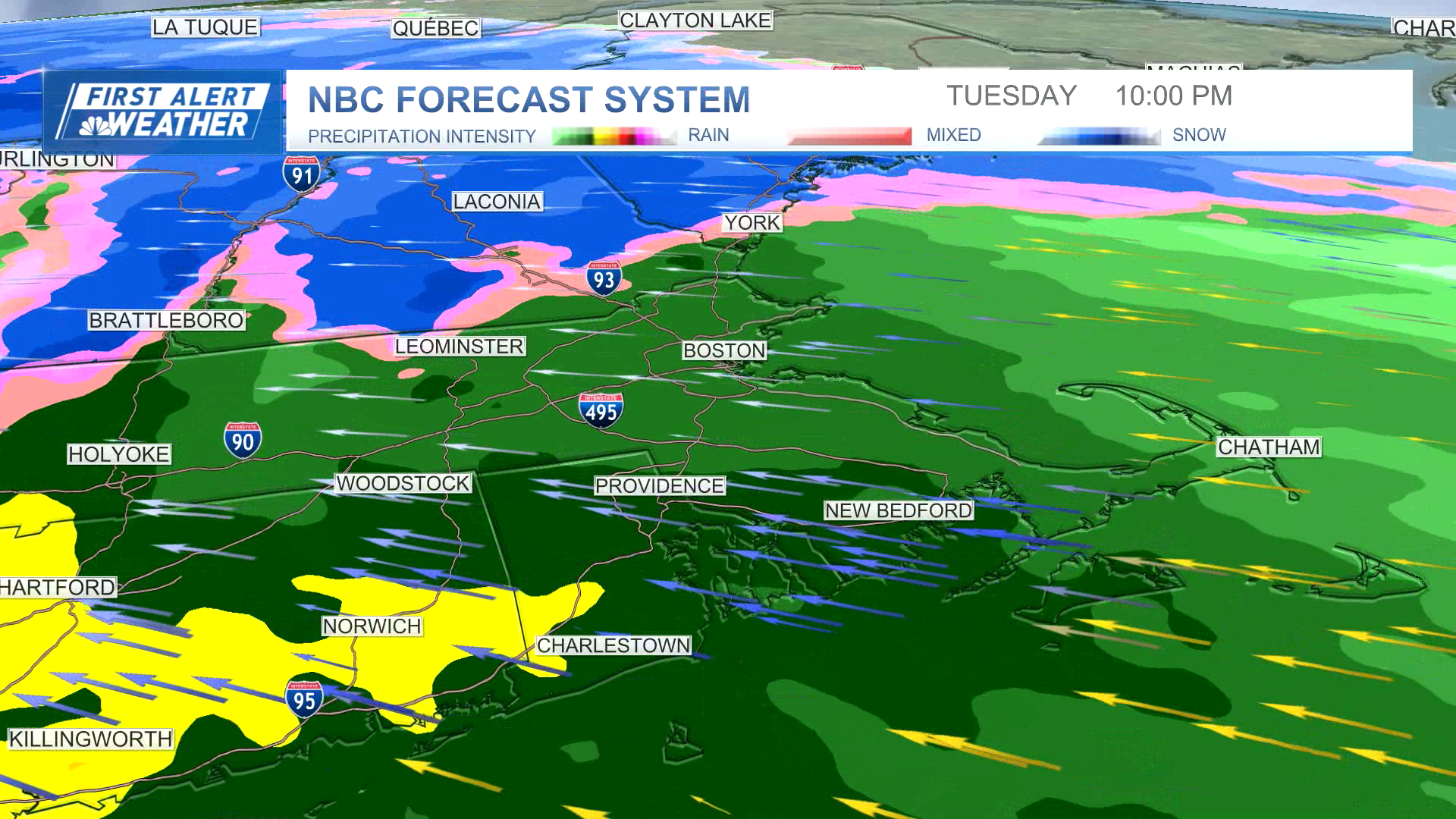
Tuesday: Cloudy and cool. Late day rain and inland snow changing to rain. Highs 35-40.
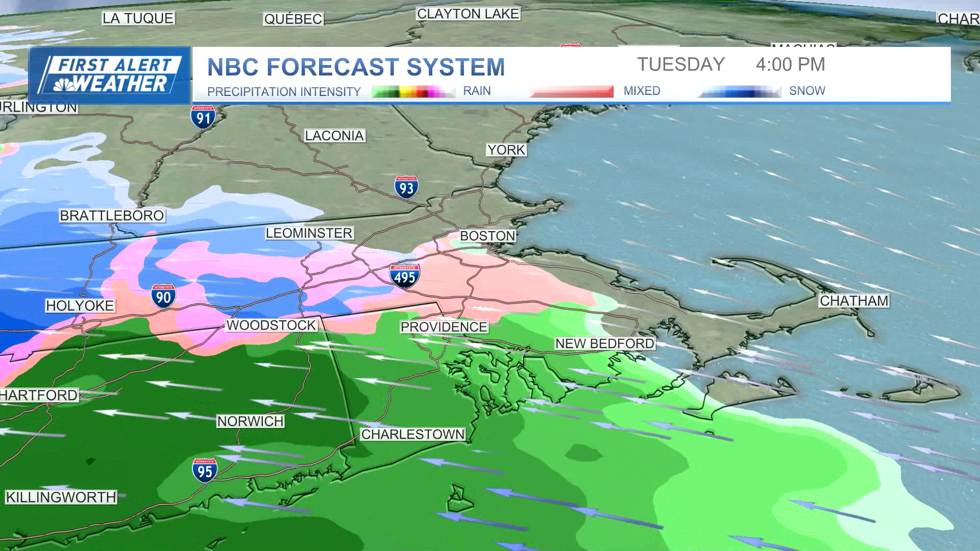
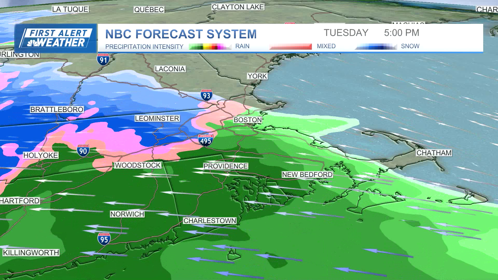
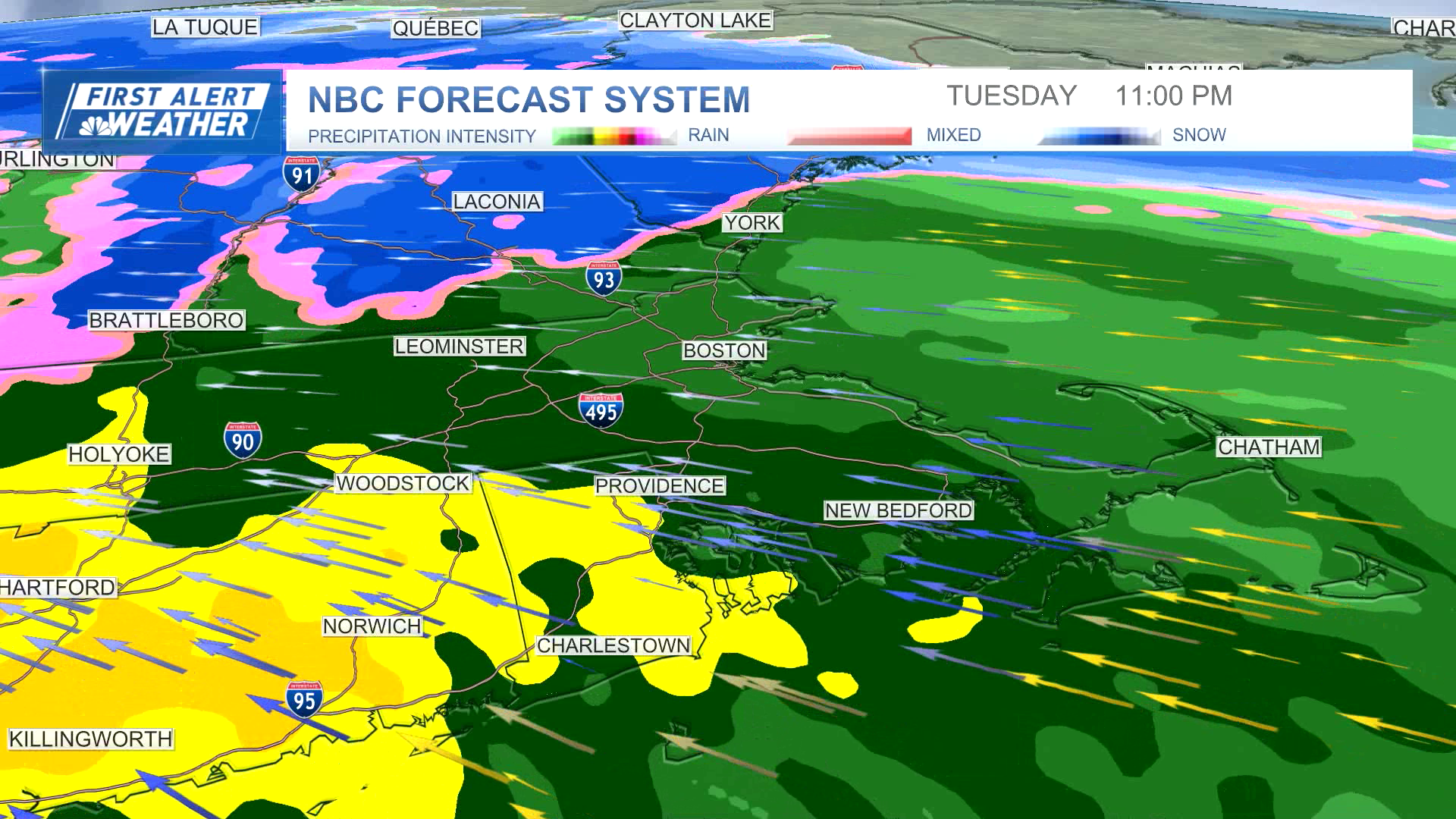
Overnight Tuesday night: Downpours and strong wind gusts resulting in localized flooding and scattered power outages. Temperatures rise to 50.
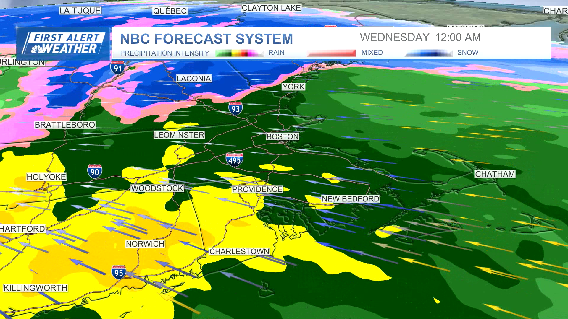
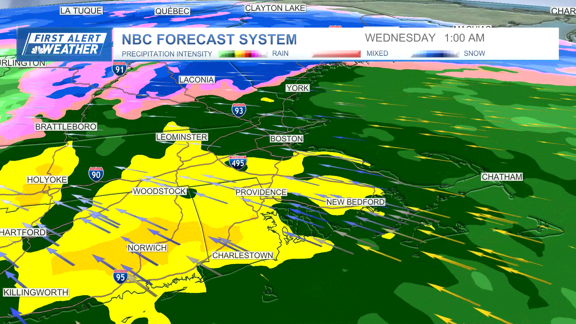
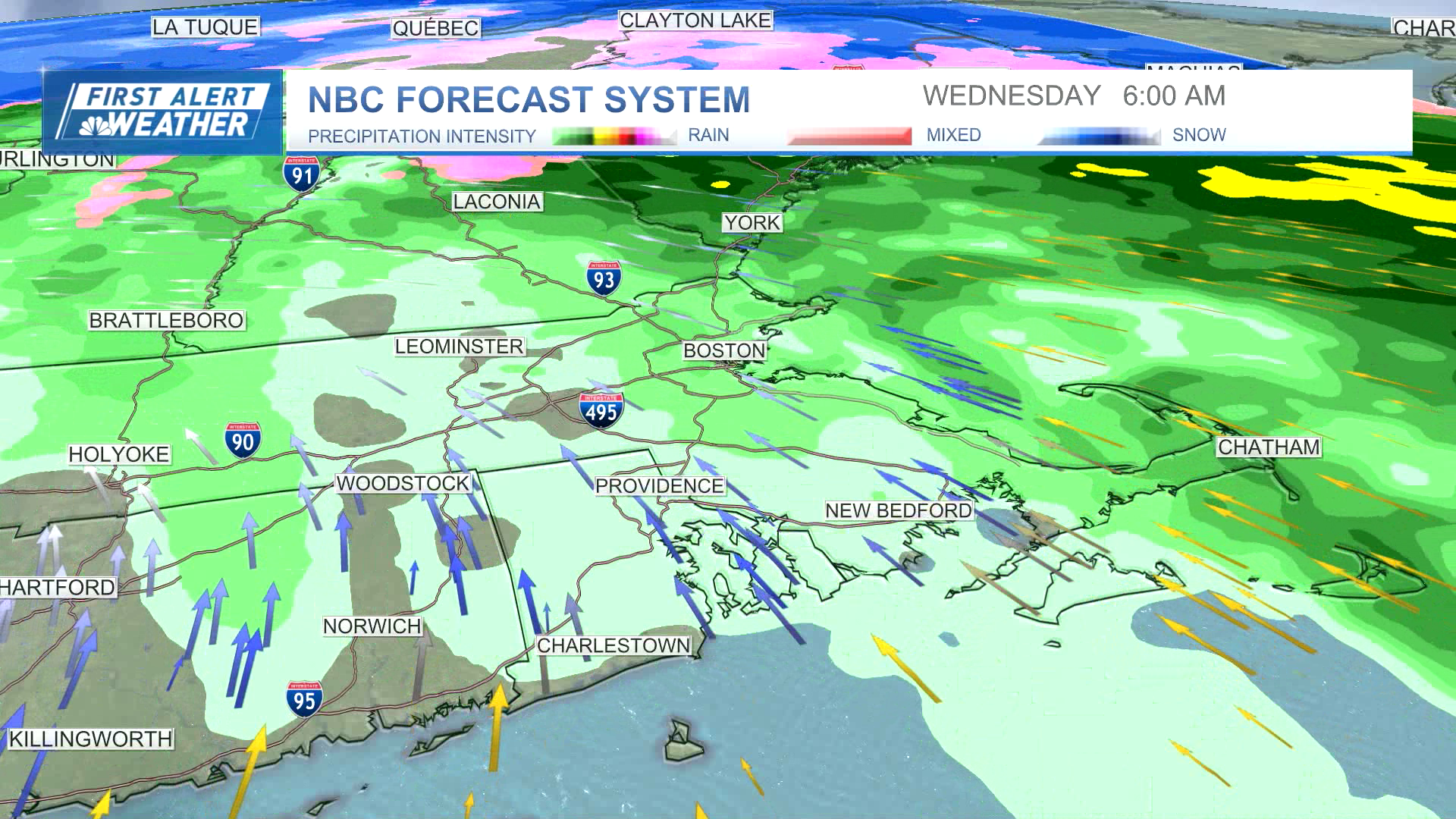
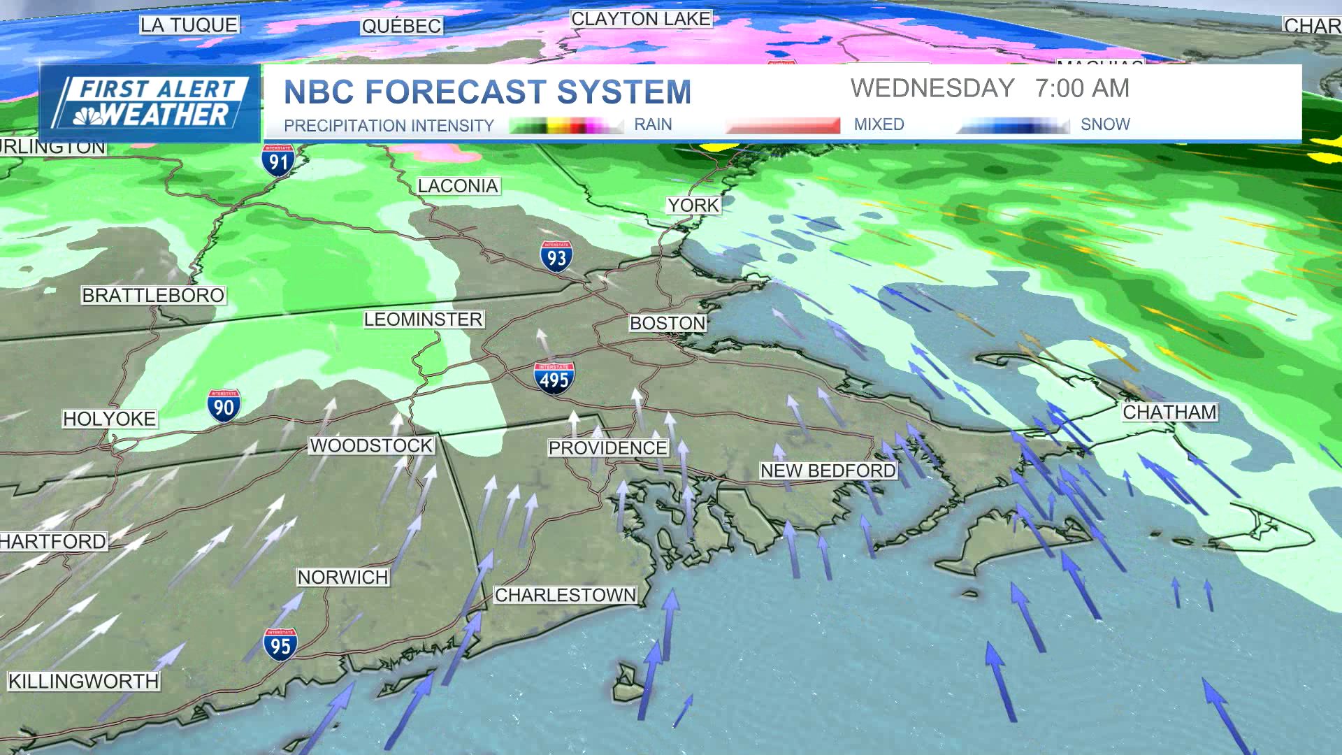
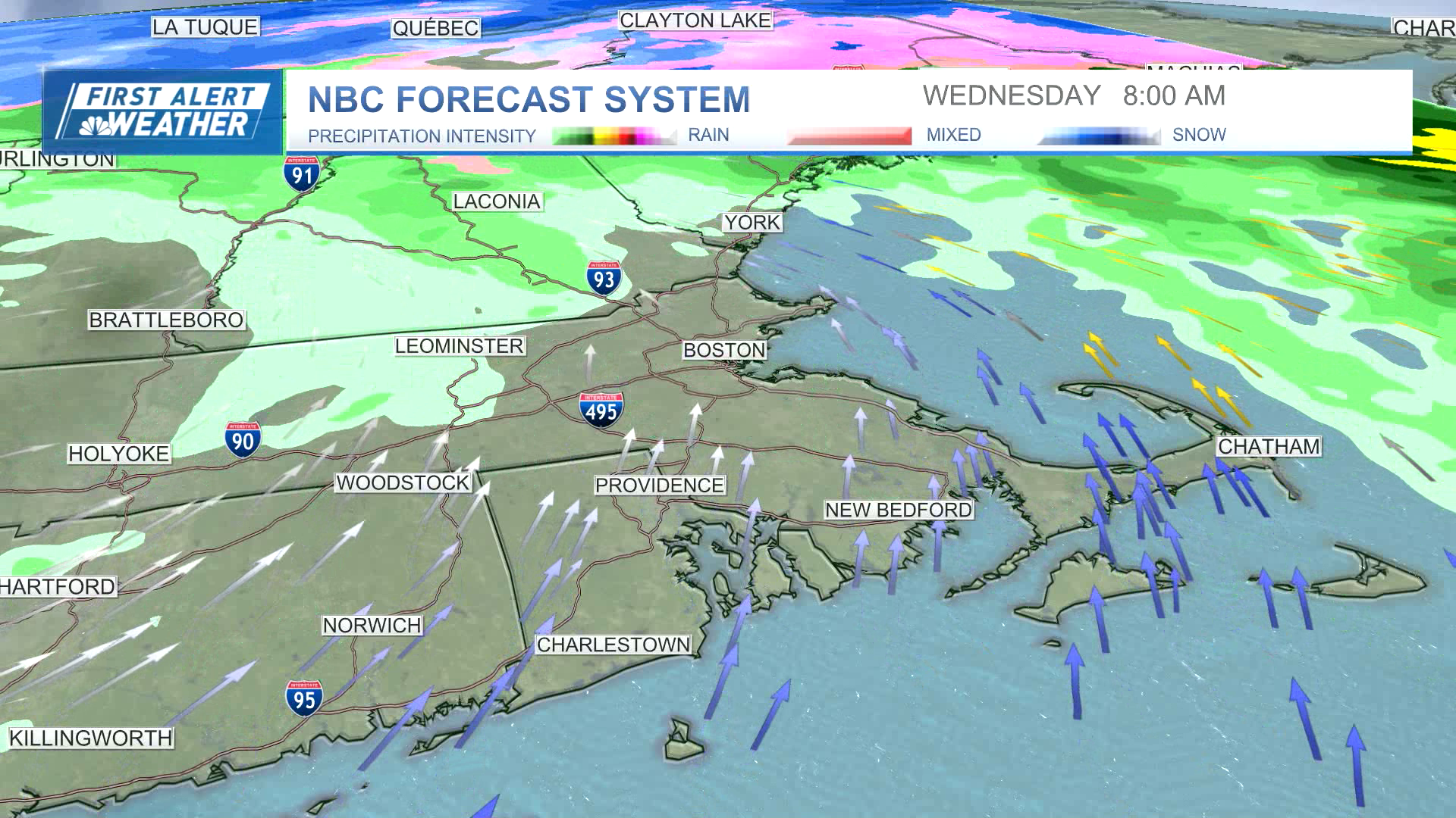
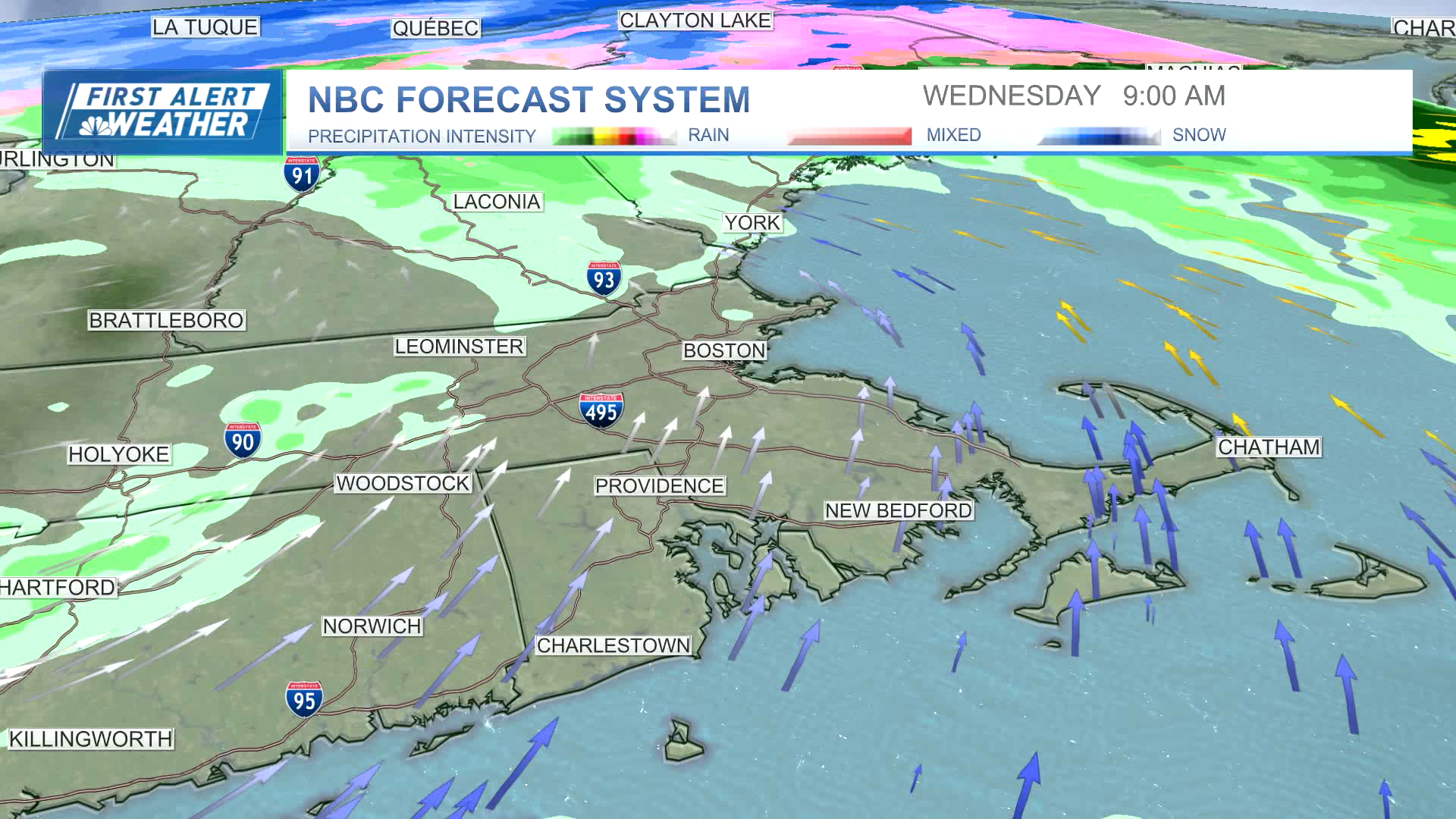
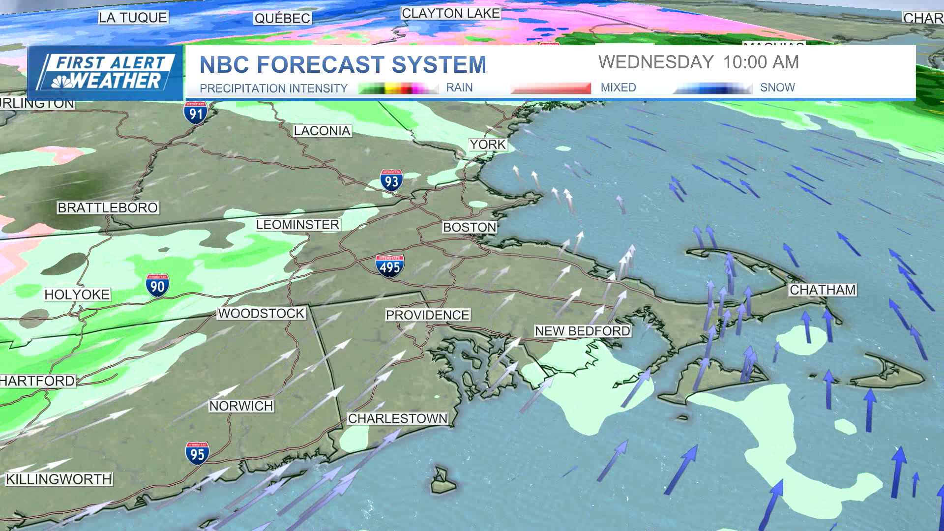
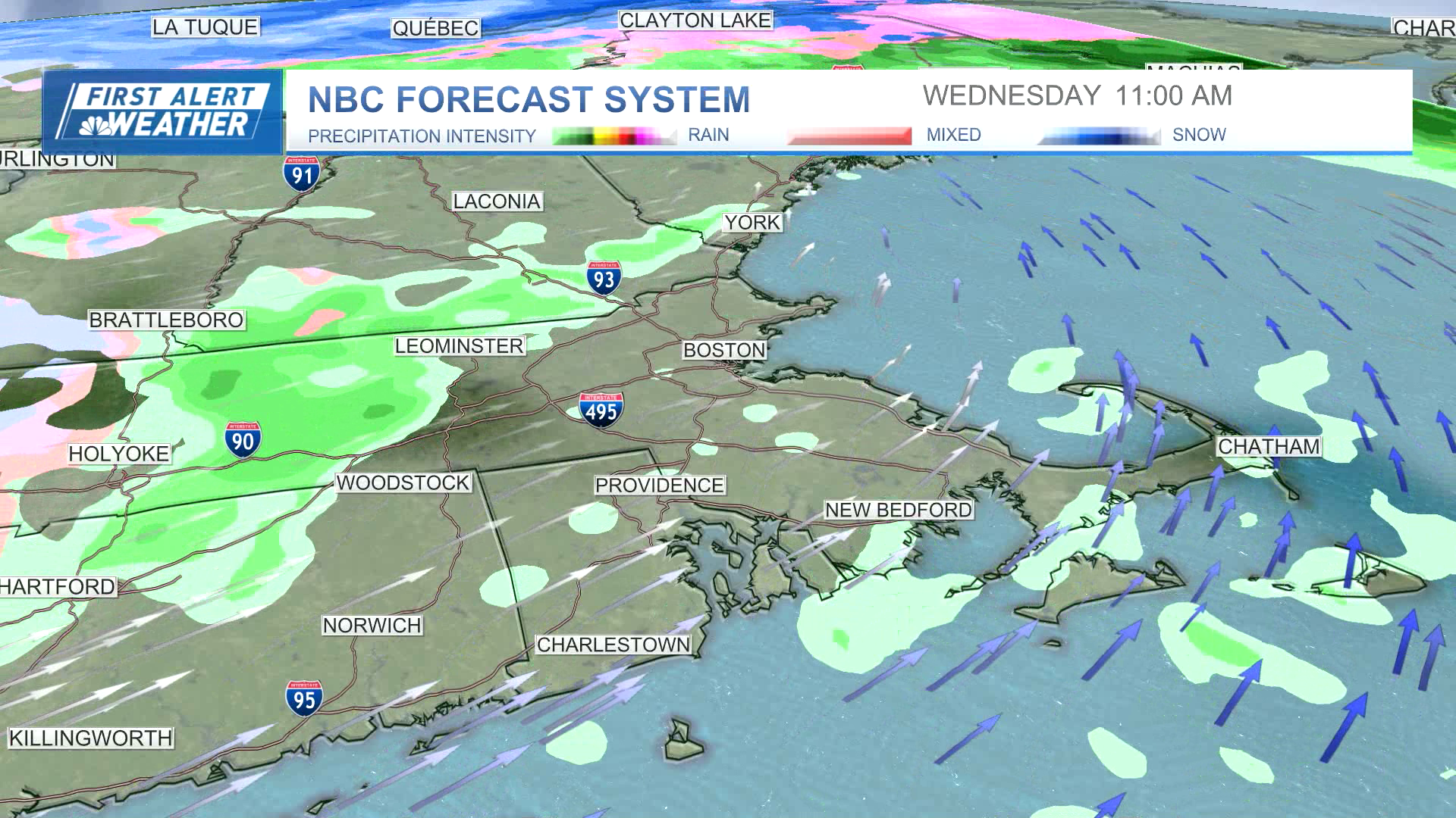
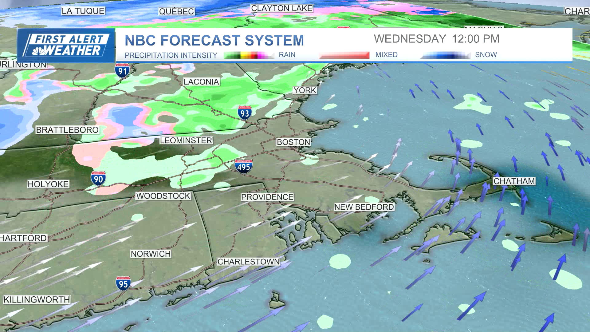
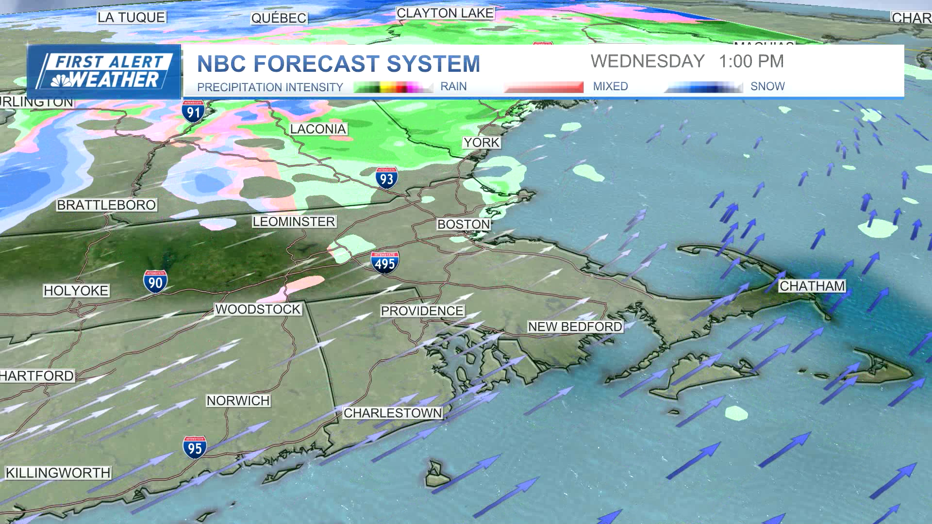
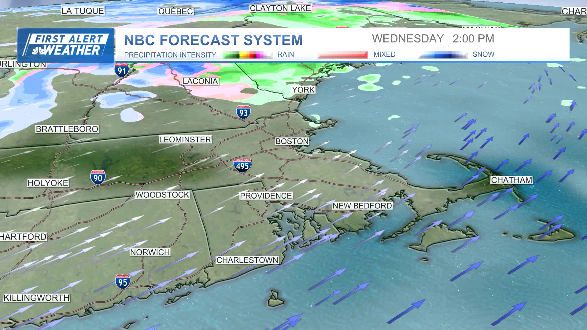
Wednesday: Predawn rain and wind breaks into a few showers with breaks of breezy sun. Temperatures 50s early, 40s later.
Thursday: Fair with highs in the 40s.
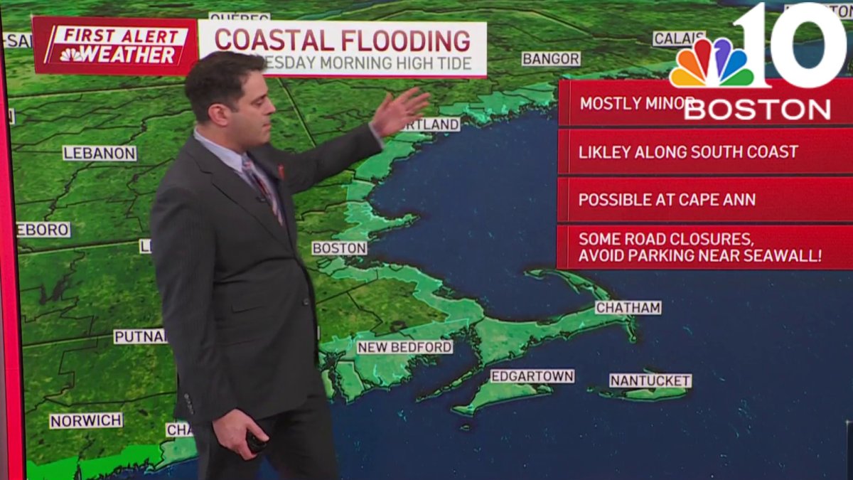
New England's second storm in under a week will arrive Tuesday afternoon, and it's expected to cause flooding and knock out power to thousands.
(See severe weather alerts and advisories in your area here.)
Between the snow already on the ground from the weekend's storm, up to two inches of rain falling by Wednesday and milder temperatures that will melt the snow, there is expected to be flooding across the region. Officials were asking residents to clear out their storm drains and areas around fire hydrants to help prepare for the deluge.
"If they know where the catch basins are in front of their house, it would be an immense help if they can go out and just clear away that catch basin," said Bob Ward, the director of public works in Haverhill, Massachusetts, on Monday.
Get New England news, weather forecasts and entertainment stories to your inbox. Sign up for NECN newsletters.
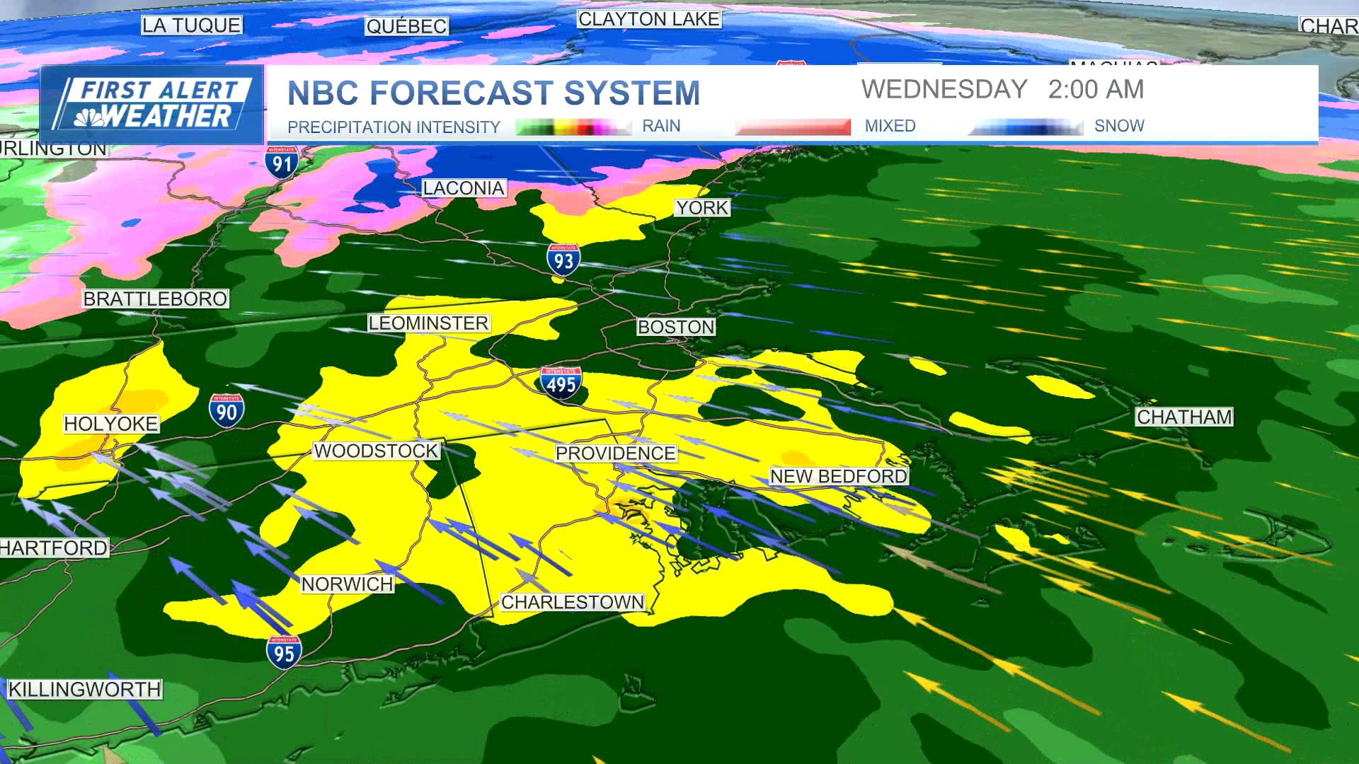
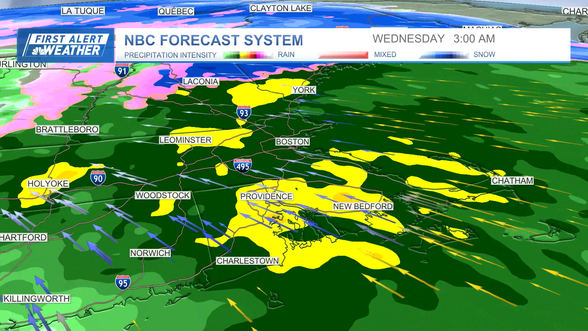
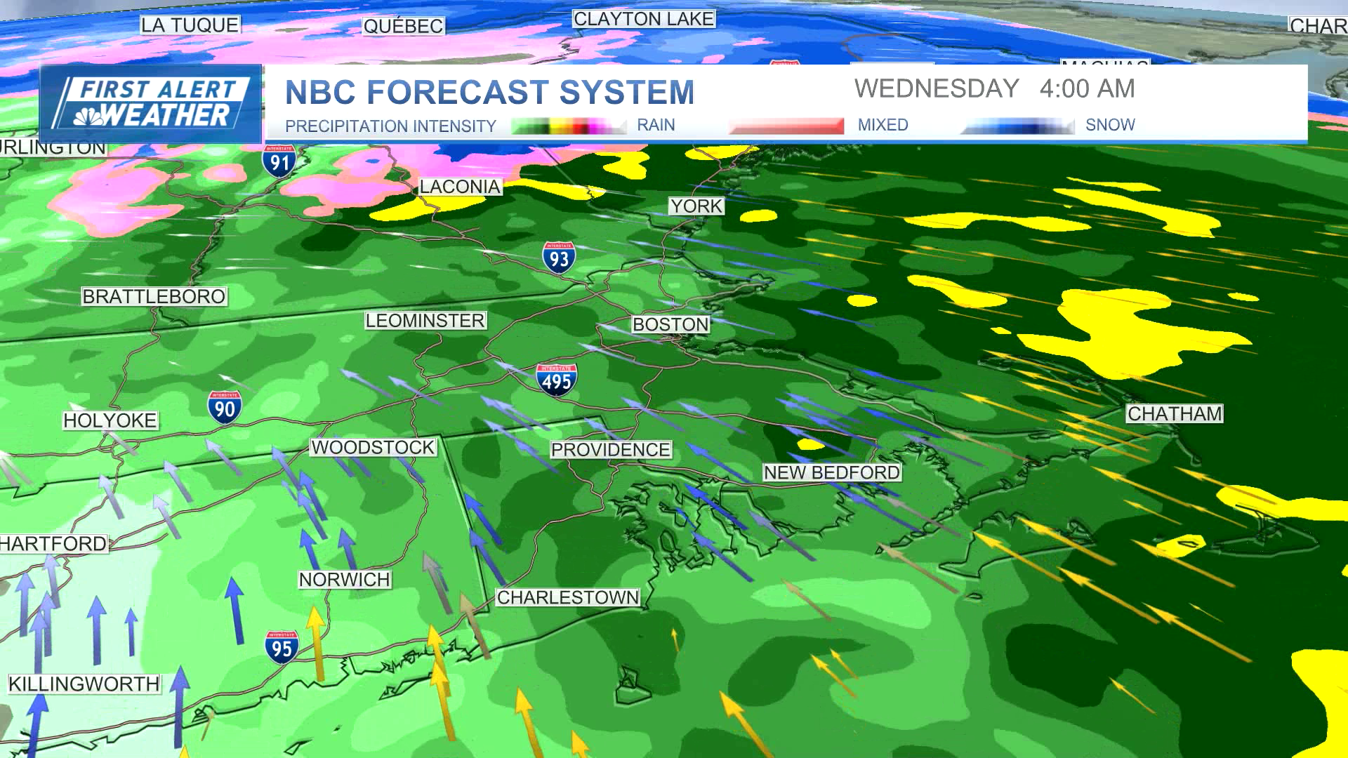
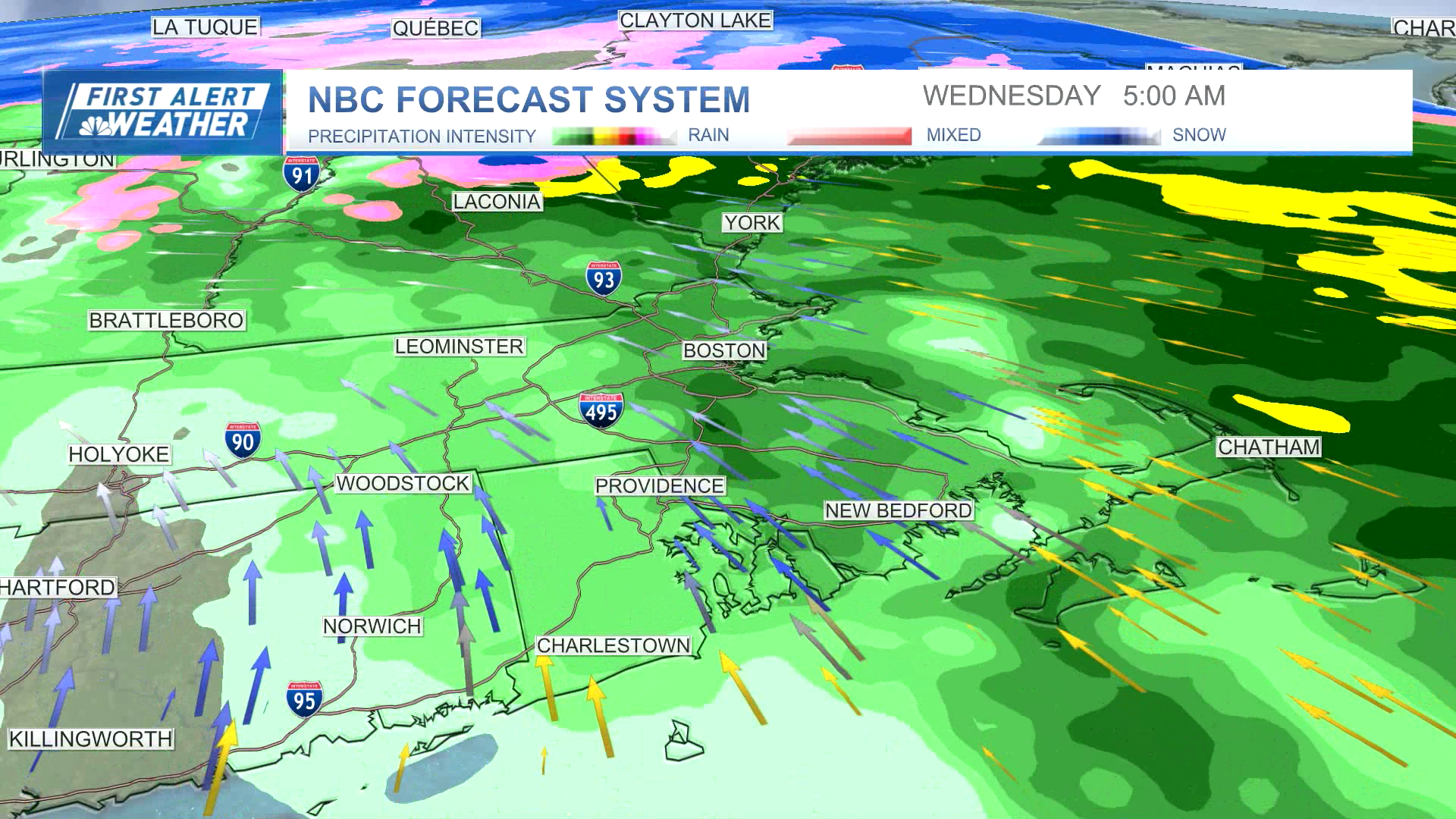
Here are images from our First Alert weather model showing when the snow, rain and wind will move in starting Tuesday afternoon. Use it to see when to expect severe weather in your area.

More on the storm hitting Boston, Massachusetts and New England Tuesday night
The combination of heavy rain, melting snow and strong winds is expected to knock out power for many across the region. Utilities were preparing for the storm already on Monday.


