


We're stepping down in the temperature department in the next few days, only to rocket back later into the weekend. While some drops come with a big cold front, this one is a lot more subtle. Tuesday's highs will only be near 40, while Wednesday and Thursday struggle to crack freezing.


What's more is the coast will see the first flakes of the season as the ocean-effect snow begins to materialize Tuesday night. This comes about with a wind off the water and plenty of unstable air above. Oftentimes, we see one or the other near the coast (cold winds with no clouds or no wind with overcast skies).
The key here is the unstable – or colder air – aloft. It will keep the snow bands going (and growing) into Wednesday evening. The tricky part of the forecast is projecting where they will hang up and how much snow will collect under them.
Get New England news, weather forecasts and entertainment stories to your inbox. Sign up for NECN newsletters.

We've put together a snow map with our latest thinking. Guidance has been focused on the South Shore, targeting the area for the most persistent bands of snow into Wednesday afternoon.

With water temperatures near 50 and air temps in the mid-30s, we think the snow will slowly collect, but in hyper-localized amounts. So, although the map shows a swath of 1-3, not everyone in that shading will see the 1 to 3 inches.
We'll quiet down on Thursday, then see the temps recover both Friday and Saturday. A large, wet, windy storm will approach on Sunday.
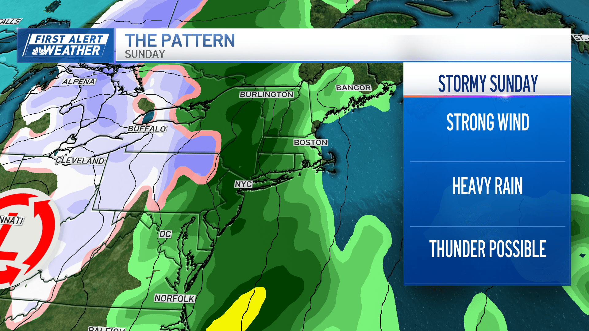
Temps soar into the afternoon, likely hitting 60+ in many spots. This is our next storm-of-concern for the week.


