


Thursday night: Variable clouds. Lows in the 60s. Friday: More clouds than sun, chance afternoon thunder. Highs in the 80s. Saturday: Sun and some lingering clouds along the south coast. Highs around 80.
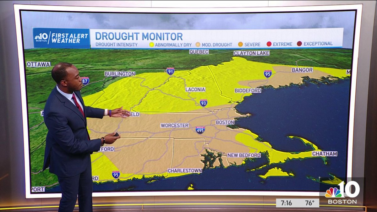
The U.S Drought Monitor provides weekly updates on drought conditions across the Nation every Thursday morning, based on data from Tuesday to Tuesday the week prior. The latest update released today shows drought conditions expanding across parts of New England.
For reference, the map identifies general areas of drought and labels them by intensity. D1 is the least intense level and D4, the most intense. Drought is defined as a moisture deficit bad enough to have social, environmental or economic effects. D0 areas are not in drought, but are experiencing abnormally dry conditions that could turn into drought or are recovering from drought but are not yet back to normal.

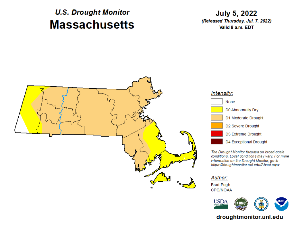
D0 or abnormally dry areas in New England increased from nearly 22% to 24% this week, while D1 (moderate drought) areas almost doubled from 7% last week to 13%. The most notable increase in moderate drought is across central and southern New Hampshire and much of central and southern Maine. Massachusetts saw little change from last week; 76% of the state is experiencing moderate drought conditions.
Get New England news, weather forecasts and entertainment stories to your inbox. Sign up for NECN newsletters.
With minimal precipitation over the past several days, and little forecast between now and next Tuesday, I anticipate next week’s update will feature an expansion of the abnormally dry and moderate dry areas. After that, there is hope we can chip away at the rainfall deficit with an active jetstream pattern and feed of deep moisture for the middle and end of next week.

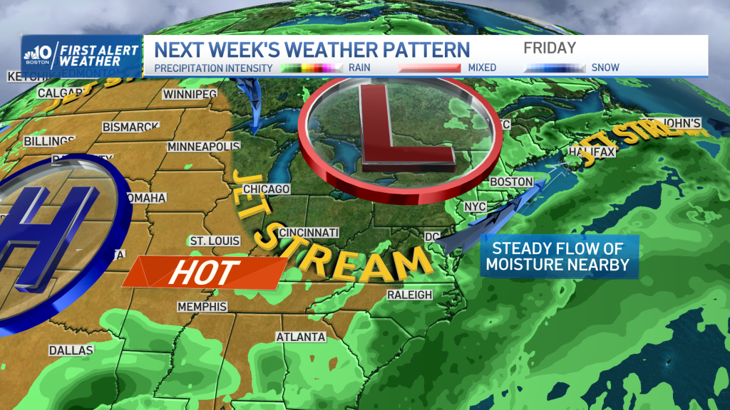
Of course, we also know all it takes is one tropical system to move through to shift our below-average precipitation to a surplus – and this is something our team will be monitoring closely over the weeks to come as we enter the climatological height of hurricane season.


