


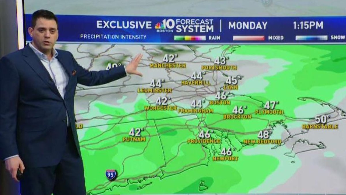
Monday: Rain, snow deep inland with light accumulation. Highs in the 40s, 30s deep inland.
Overnight Monday Night: Partial clearing, South Coast showers. Lows in the 30s, 20s up north.
Tuesday: Light rain, mixed showers early deep inland. Highs in the 40s south, 30s north.
Rain and snow showers will be around this morning. Precipitation amounts look meager through the day on Tuesday. At this point, it appears we’ll see a quarter inch of rain along the coast and 1-3 inches of snow in the mountains.
Temperatures will warm significantly Monday, especially along the coast. Tuesday another batch of precipitation will arrive. Once again, we’re expecting mainly rain along the coast and some snow inland. If you live in New Hampshire and plan on voting in the primary, head to the polls early if you want to avoid the chance for snow.
Wednesday we catch a break in between fast moving storm systems. Temperatures will reach the mid 40s with the sun returning.
Another batch of wet weather will return Thursday. It’s possible that the mountains could see several additional inches of snow, but even there a change to sleet or even rain is possible.
Valentine’s Day will be quiet, but cold. Temperatures will only reach the upper 20s and low 30s both Friday and Saturday. Temperatures will moderate once again by Sunday and into the following week.
Significant mountain snow is possible Monday into Tuesday, but the exact timing is still to be determined. Stay tuned.


