
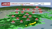
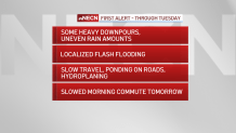
Another day of rain for our Tuesday in New England, though the overall chance of flash flooding and thunderstorms has decreased from Labor Day, owing to less humid and cooler air moving in.
A flash flood warning was issued for parts of southern Connecticut through 2:15 p.m., and a flood warning is in effect until mid-afternoon for parts of Massachusetts, Connecticut and Rhode Island. See all severe weather alerts in your area here.
Satellite imagery shows the tropical feed of moisture that was pluming out of the Gulf of Mexico has been cut off, meaning what’s left for rain is what’s already in the pipeline, streaming overhead Tuesday, but set to cut out substantially Tuesday evening into Wednesday.
Get New England news, weather forecasts and entertainment stories to your inbox. Sign up for NECN newsletters.
While the rain has largely been beneficial for New England, the notable exceptions where too much rain fell too quickly were predominantly in southern and eastern Connecticut into Rhode Island, where amounts of greater than four inches – and in the case of Cranston, Rhode Island, greater than 10 inches – caused dangerous and life-threatening flash flooding Monday.
For most of the rest of central and southern New England, a beneficial one to three inches of rain fell on drought-parched landscape, with a fresh one to two inches with locally higher amounts expected Tuesday. Total rain amounts Tuesday night and Wednesday will be very little, though a few showers, sprinkles and pockets of drizzle will still crop up Tuesday night and a shower or two are expected Wednesday under lots of clouds with a continued onshore flow.
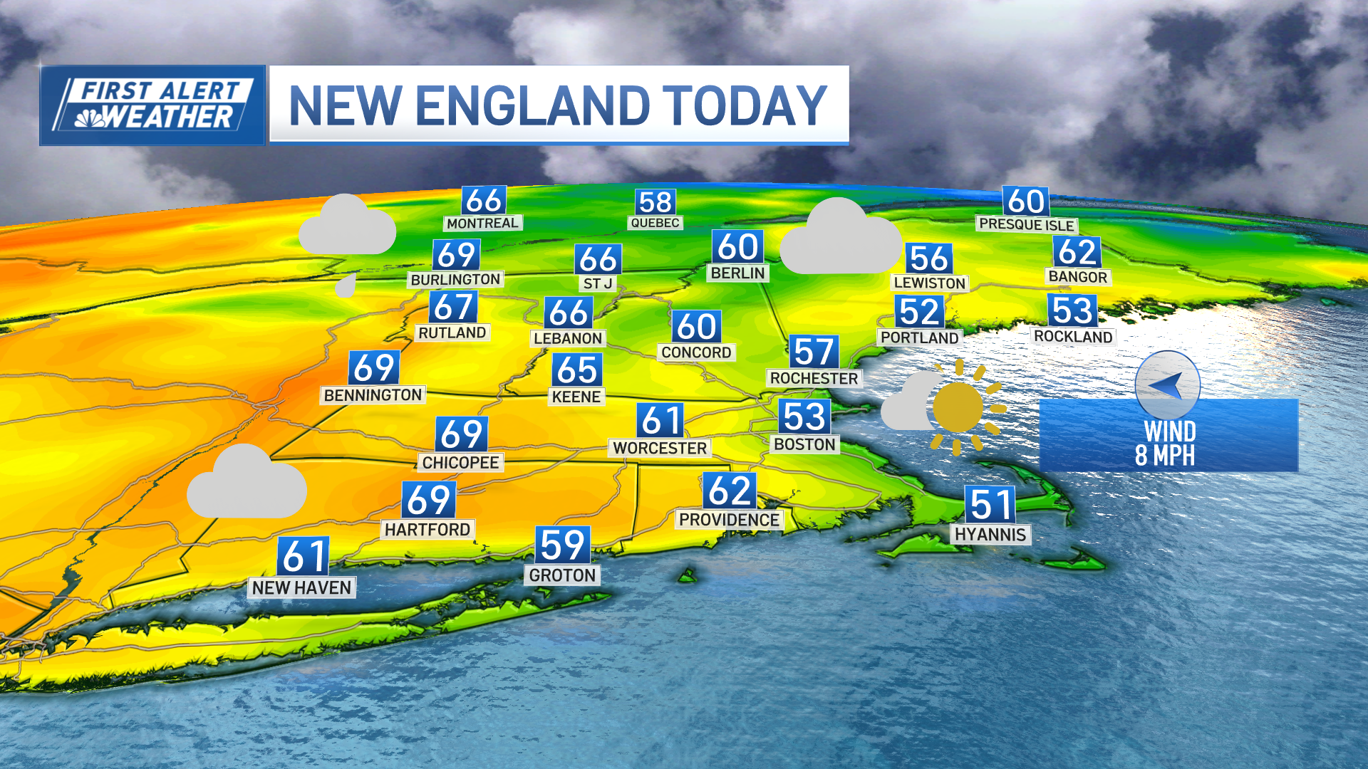
The wind off the ocean will not only ensure a cool Tuesday and Tuesday night with highs in the 60s and overnight lows in the 50s to near 60, but also a relatively cool Wednesday only either side of 70 degrees.
Nonetheless, even with lots of clouds and a shower or two, Wednesday will be vastly improved over Tuesday, and the weather only gets better from there. Ample sun returns Thursday through the weekend with temperatures climbing to near and over 80 degrees for a stretch of spectacular days.
Weather Stories
Clouds are expected to increase Monday ahead of a relatively quick-moving disturbance that raises the chance of showers heading into Tuesday, and while it’s possible for a few linger to Wednesday, our exclusive First Alert 10-day forecast at this point calls for improvement with high temperatures still running above normal at 75 to 80 degrees.
