


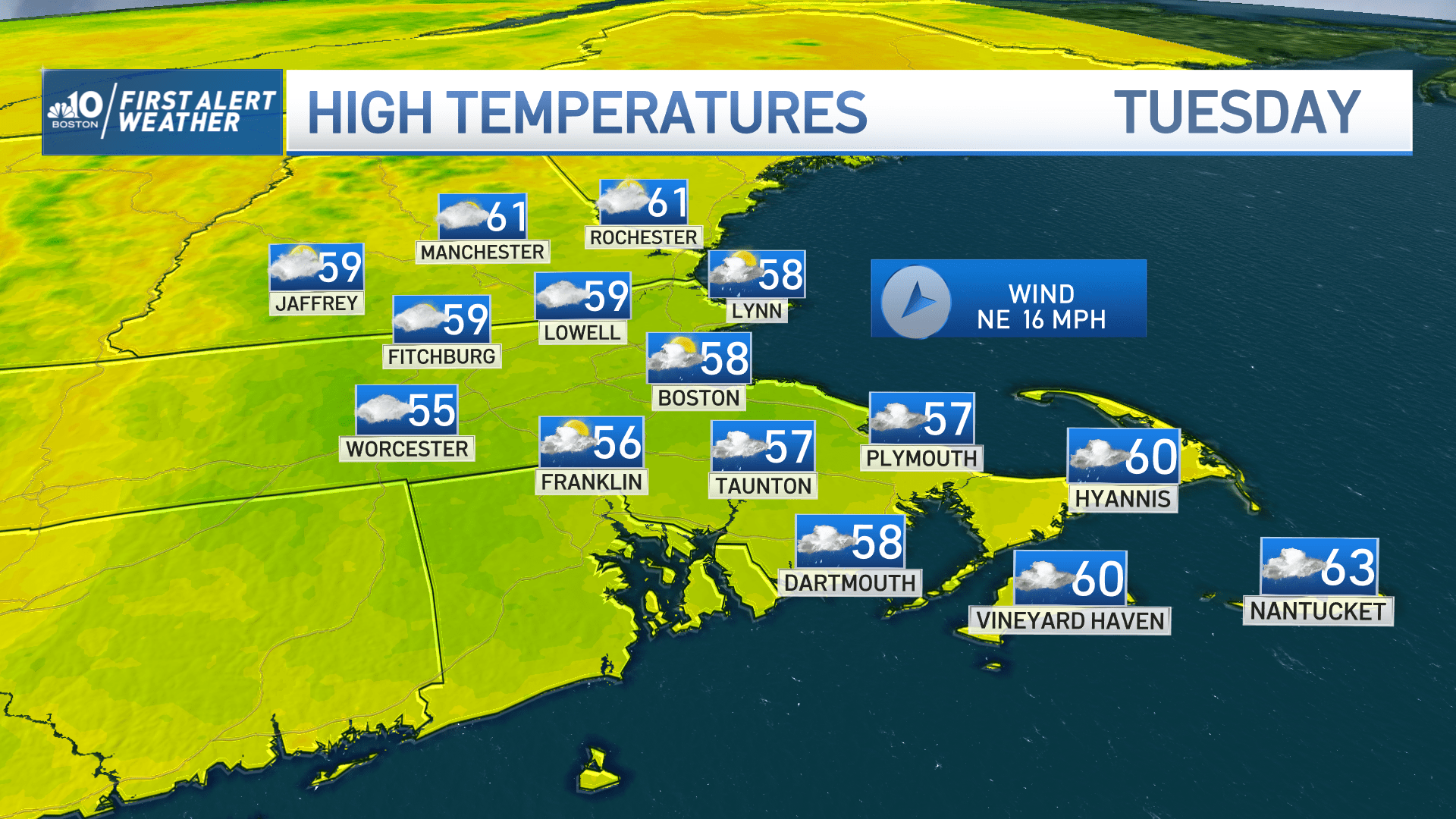
Today: Cloudy and cool with a chilly northeast breeze gusting to 40 mph at the coast. Highs in the 50s. Overnight Monday Night: Cloudy, cool, breezy. Lows in the 40s, 50s southeast. Tuesday: Mostly cloudy and breezy with a few afternoon showers near and south of the MA Pike. Highs near 60.
We closed the chapter on Ian over the weekend, but the spirit of the storm – namely it’s tenacity – is still alive as a slow-moving system to our south. In concert with high pressure to our north, this storm will keep the winds going along the coast. Some gusts may still approach 40 miles per hour on the Capes and Islands, and around 30 in Boston along with both shores. We’ll dodge the showers through the day Monday and a fair portion of Tuesday morning, but we’re delaying the inevitable with the wet weather.

Amounts of rain (yes, we’re still chipping away at the drought) remain on the light side for most, but a few random downpours in Southeastern Massachusetts could push us over an inch of water by the time the storm pulls away on Wednesday night. Elsewhere, plan on a quarter to half inch in spots.

Get New England news, weather forecasts and entertainment stories to your inbox. Sign up for NECN newsletters.
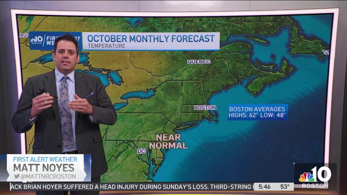
Temperatures for the last three days have not only been below normal, but also failed to make it to 60 in Boston (normal is 67). We’ll see three more days under 60, before we crack back into the warmth on Thursday and Friday. Highs then soar to the 70s under plentiful sun. Another cold front will swing through Friday night to bring us back to the October chill for the weekend.
Enjoy the week!


