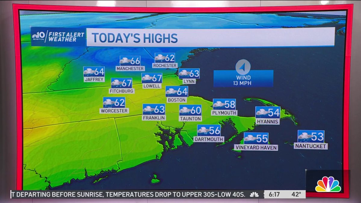
Today: Early rain/downpours through mid pm, foggy, a break in the rain may help develop evening strong-severe thunderstorms inland. Moving W to East. Gusty afternoon @30 mph out of SW. Tonight: Leftover showers overnight departing before sunrise, temperatures drop to upper 30s-low 40s. Sunday: Highs in the mid to upper 40s, bright, strong AM wind gusting near 40 mph slowly reaching 30 mph PM, wind chills in the 30s.
Click here for the latest weather forecast
After showers spread across the region Friday night, the pre-dawn hours of Saturday featured misty conditions and fog. The fog is a sure sign there’s still moisture around, and it will translate to mid-morning thunderstorms, and spotty severe thunderstorms Saturday evening.
We’ll see rain spread across southern New England around 10 a.m. Saturday with an occasional thunderstorm. Those aren’t the strongest we’re likely to see. Breezy conditions settle in, but it will be warmer, with temperatures in the 50s to near 60 degrees.
Get New England news, weather forecasts and entertainment stories to your inbox. Sign up for NECN newsletters.
In the afternoon, spots of sun may break out. This is closer to 3 p.m.
While sunshine this weekend seems like a good thing, it may be enough warmth to spark the atmosphere and bring the region’s first severe storms of the year.
While the tornado threat is low overall, there isn't zero threat. There is a much larger concern for damaging winds near 60 mph and flash flooding.
Generally, rainfall totals will range from half an inch in central Massachusetts and Boston to an inch and a quarter across the outer Cape and Islands.
Where stronger thunderstorms set up, flash flooding will be a concern, especially as the ground has been saturated from Friday night’s rain. We anticipate a thin line-like feature of thunderstorms with embedded areas of gusty winds between 4 p.m. and 10 p.m. Saturday.
After this clears late in the day, sunshine breaks through Sunday morning. The day will be cooler, with highs in the mid-to-upper 40s, which is closer to normal for April 2. Warmer air returns, as we continue through the first week of the month.