
The Latest
-

Rain, slight chance of isolated T-storms, followed by temperature drop
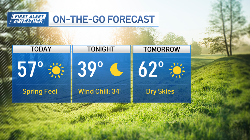
Unlike days prior, Wednesday morning has started with overcast skies instead of sun. Because of the pattern, the clouds won’t be enough to keep temperatures down though. Highs Wednesday will near 60°. The air is a bit more humid, too, as moisture is inbound ahead of a few scattered rain showers for the early afternoon and evening. Most of the…
-
Sunny with mild temperatures Tuesday before more April showers arrive
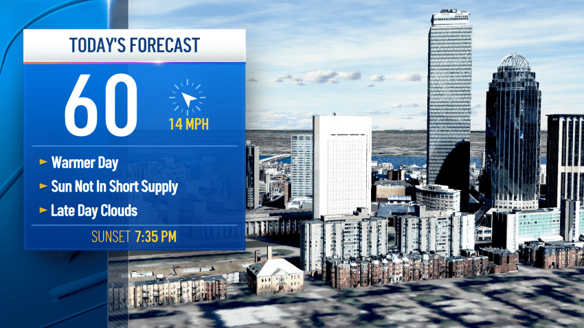
Tuesday has started very similar to Monday, with cooler air for the morning, but that will turn with plenty of sun for the afternoon. High temperatures are in the 50s and 60s regionwide, with warmer air being favored across central Massachusetts. It’s a quintessential spring day in New England. Clouds roll in this evening ahead of a weak storm...
-
Monday starts off chilly, but temps warm up in the afternoon
As clear skies are overhead, there is a chill to the air Monday, but it’s a seasonable spring day. Very fitting as Earth Day is celebrated across the globe. Earth Day pre-dates the Environmental Protection Agency, and first celebrated in 1970. It was first put forth by Wisconsin Sen. Gaylord Nelson, and done to mark the importance of clean air,…
-
Lots of sunshine Tuesday, mild temps stick around this week
Clear skies through Tuesday bring another warm day regionwide. While not as hot as Monday, we’re still under early summer warmth with highs in the upper 60s (near 66° in Boston). There will be a partly cloudy sky with mild air Tuesday night and the overnight hours remain dry. Wednesday turns cooler, as our winds shift from the east,...
-
Next storm to bring heavy rain, isolated lightning and thunder, strong winds
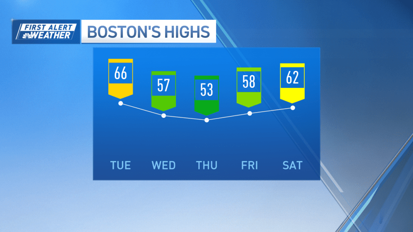
We’re experiencing a little bit of déjà vu as Wednesday morning starts with cool air and clear skies. But Central Massachusetts and MetroWest Boston will see another day of soaring temperatures in the mid to upper 60s. At the coast, an onshore wind will spoil the fun, only keeping us in the upper 50s. Partly cloudy skies trend through...
-
First Alert Friday: Heavy rain, strong winds expected later this week
It’s a chilly start to Tuesday, with temperatures in the 40s. With clear skies, though, we’ll see a warmup through central Massachusetts and MetroWest Boston. The reason temperatures are not the warmest at the coast on Tuesday is due to an onshore wind, so we’re only in the low 50s for highs. But, inland, for a second day, high...
-
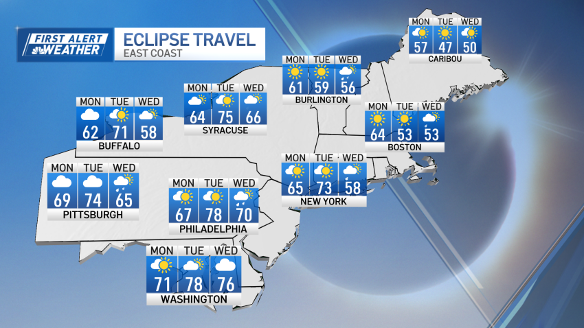
Some clouds Monday but New England will still have a clear view of the solar eclipse
The total solar eclipse is here. We’re in store for an amazing and rare sight as the moon covers the sun for a brief moment of darkness Monday. The skies are mostly cloudy with highs in the low 60s, though there will be clouds approaching at the start of the eclipse. That shouldn’t ruin the view for anyone in...
-
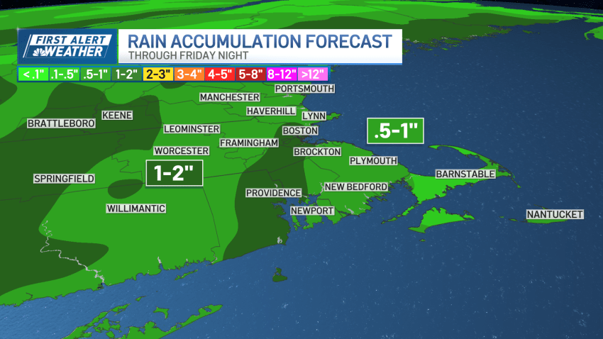
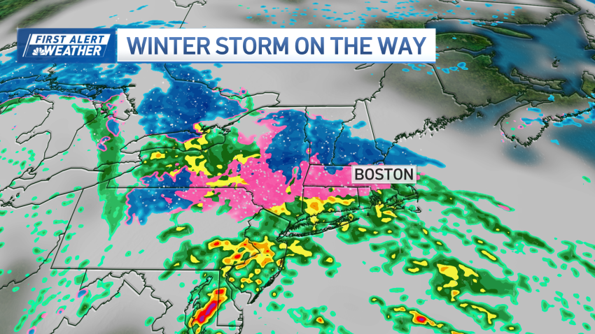
LIVE RADAR: Track the nor'easter hitting New England through Thursday
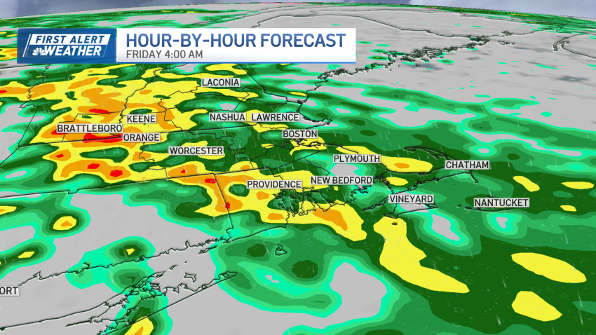
April’s first winter storm is knocking at our door. Here’s how it will play out — and scroll down to explore interactive radar. Light rain began Wednesday morning in scattered pockets across the Greater Boston area, with downpours by the evening. The steadier rain will be reserved for the afternoon and evening drive. This is when rainfall rates will...
-
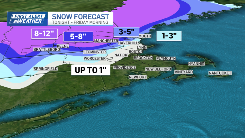
Nor'easter could bring over a foot of snow to parts of New England
We’re in the calmer and cloudy conditions Tuesday – which will also bring cooler air. While there will be a breeze, it’s a far cry from our gusty and windy week ahead. High temperatures are near 45 degrees, with onshore flow across the coast. Further inland, we’ll touch the upper 40s. Light rain and scattered showers pop up for...
-
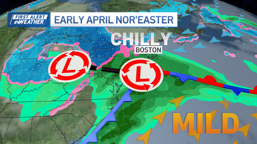
Messy early April nor'easter to bring heavy rain, sleet, snow to New England
We’re staring down one last tranquil weather day before our weather drastically changes. We’re in and out of the clouds Monday, but they should let up around 2 p.m. This will be around the peak heating of the day, so high temperatures approach 60 degrees. Throughout Monday night, a weaker weather system to our south will bring clouds back...
