


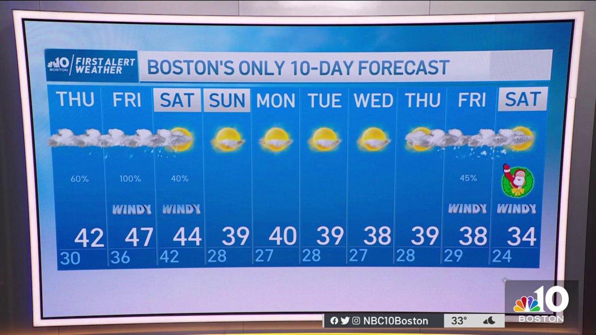
Wednesday night: Partly cloudy, breezy. Lows in the 20s. Thursday: Mostly cloudy, breezy again. Highs in the low 40s. Friday: First Alert. Mild. Upper 40s. Winds between 30 and 40 mph. Heavy rain and downpours.
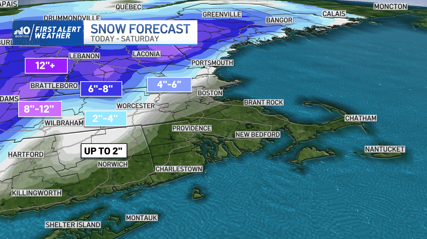
A winter storm with substantial snow and rain are on the way to New England before the weekend is out. This is a very dynamic setup for this storm. It has already brought blizzard conditions across the across the northern high plains, and severe weather across the south; unfortunately claiming the lives of two people in Louisiana.
Winter Storm Warnings and Watches


In advance of the storm, the National Weather Service has issued Winter Storm Warnings and Watches for interior portions of New England.
Get New England news, weather forecasts and entertainment stories to your inbox. Sign up for NECN newsletters.
Much of western Mass., Vermont, New Hampshire & Maine will see accumulating to plowable snow. Forecast totals will range between 6”-10” across Southern Vermont and Western Mass. With terrain, higher totals are likely across mountain peaks which will bring in a great base for resorts.

Will Boston see snow or rain?
Weather Stories

In yesterday’s post, we talked about the potential for snow to trickle in across the Boston metro. That option is not off the table either. In fact, some of the early higher resolution guidance is now coming in line with bringing snow inside of I-495 as colder air settles in prior to the system’s departure on Saturday.
To see all current weather alerts, click here.


