
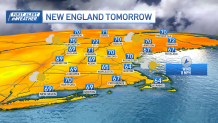
Clouds have been stubborn over parts of New England Tuesday, though gradually, more and more breaks of sun will emerge through the afternoon and evening.
A stiff onshore wind is keeping the coastline coolest, near 60, while far western and northern New England communities are well into the 60s.
Tuesday night will be cool and crisp under variable cloud cover and lows in the 40s (30s in the North Country).
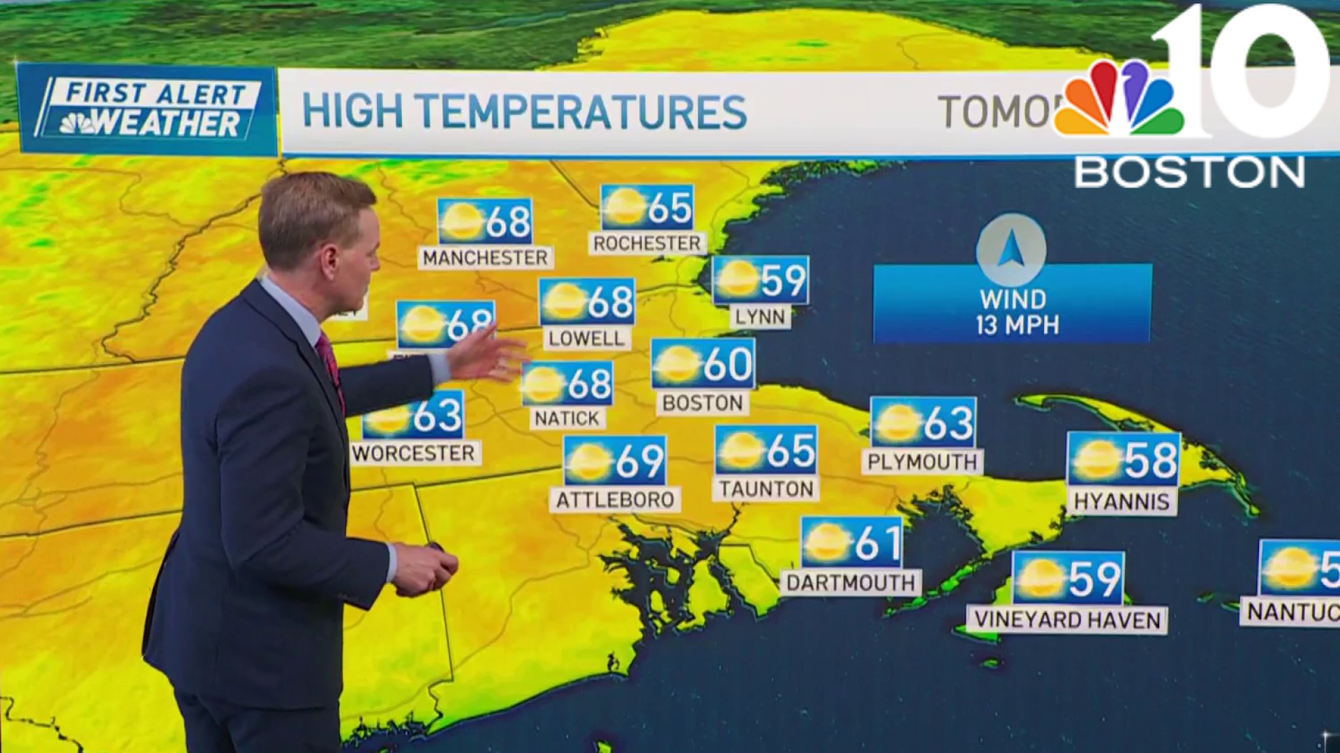
As high pressure continues to nose its way into the Northeast, we’ll enjoy a pair of nice fall days Wednesday and Thursday, with a blend of sun and clouds and highs in the 60s to around 70.
Get New England news, weather forecasts and entertainment stories to your inbox. Sign up for NECN newsletters.
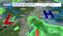
By the end of the week, we turn mostly cloudy again and the risk of showers is increasing, mainly in southern New England, where a low pressure center will flirt with the coast. For reference, our exclusive guidance has a 30-60% chance of rain in the same areas that had a 10-30% chance yesterday. In other words, it bears watching.
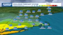
There are some signs that we may see some showers linger into Saturday, though, admittedly, there’s still some uncertainty with the timing and placement of the rain. That said, with such rainy weekends over the region lately, we don’t want to promise too much, too early.
Weather Forecast Video
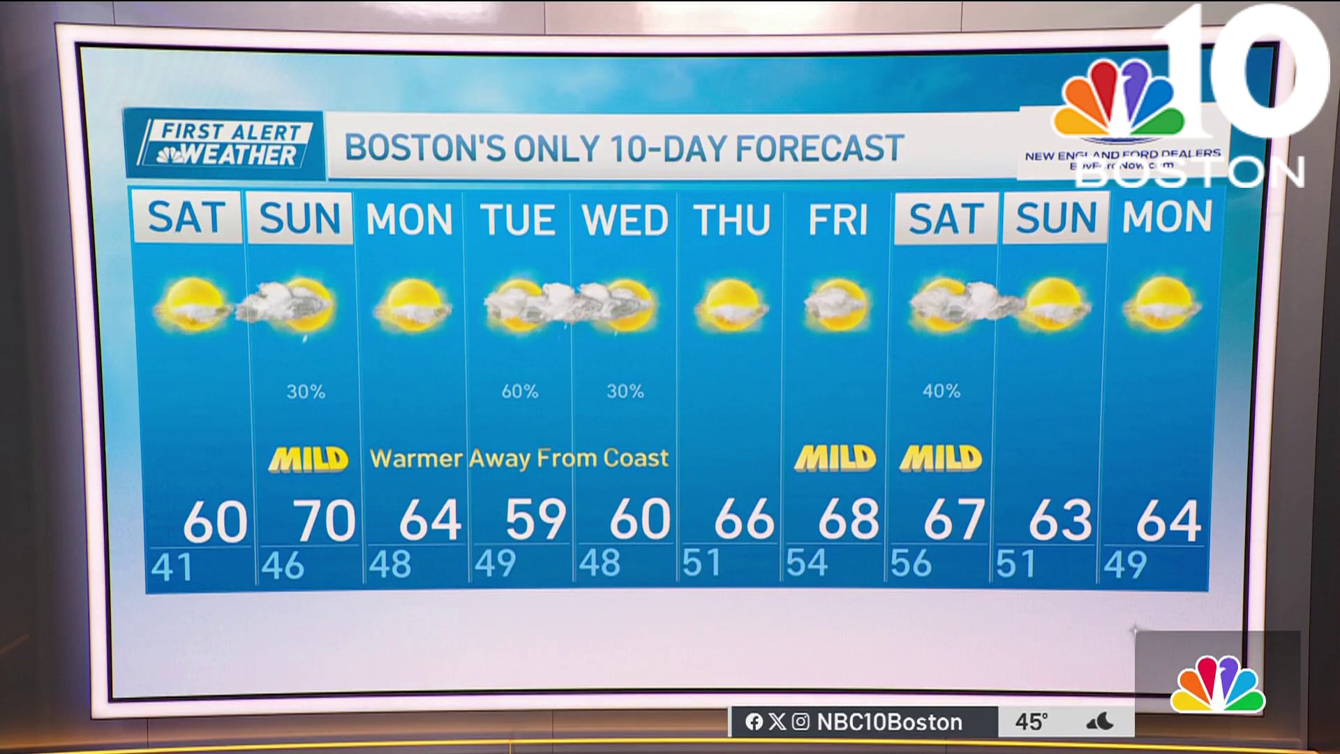
Sunday still looks delightful, with sunshine and mild temperatures expected. The beginning and middle of next week looks great too, with bright skies and mild air in place and a minimal risk of showers.
