


Today (Friday): Filtered sun through clouds. Highs near 50. Overnight Friday Night: Mostly cloudy. Lows around 40. Saturday: Dry and cloudy AM, showers and rain PM. Highs in the 40s, 50s southeast. Sunday: Breaks of sun emerge, sprinkle or shower. Highs in the 50s.
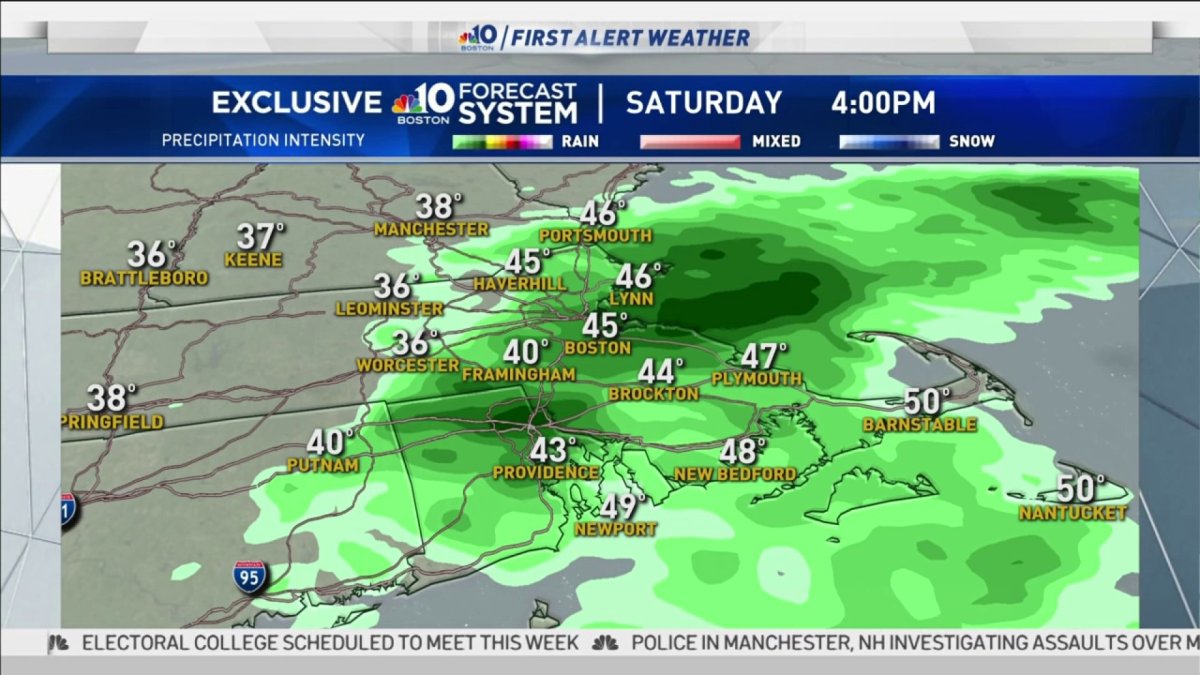
Even though rain is in the forecast for today, don’t cancel your outdoor plans this morning. Most of the morning will be dry, but by the afternoon we will be tracking downpours and even some thunder. Sunday will be the pick of the weekend with sunshine and warm air returning. If you like the warmth, it will only last a day.
We have a busy weather week ahead. First up, some light precipitation will be possible Monday. As cold air returns rain will change to snow by the afternoon. It’s still too early to talk about accumulations, but light amounts are possible.
The next storm on deck is Wednesday going to Thursday. This time around, it looks like cold air will be in place. We still don’t know the exact track of the storm, but snow is looking likely. Strong winds and coastal flooding are also possible. Stay tuned.


