


Today (Monday): Sun to clouds. Cool. Highs in the 30s, wind chill 20s. Overnight Monday Night: Mixed showers of snow and freezing rain late. Lows around 30. Tuesday: Early AM mixed shower to some sun. Highs in the 40s.
While we recover from the holiday, the weather pattern delivers a cold, invigorating shot of winter air this morning. The wind chill map below is the coldest we’ll be today. As the winds ease, the wind chill does too. Thankfully, the air temperature will recover to the seasonable range this afternoon as the coldest part of this airmass starts to move away.
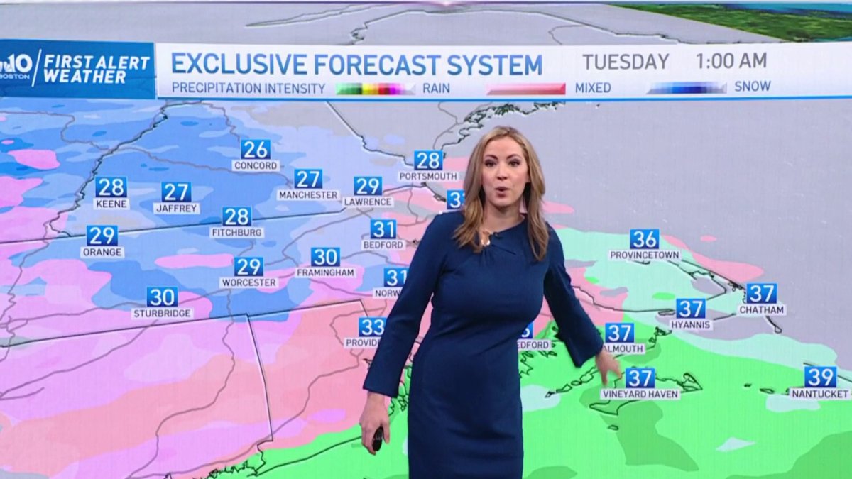
Tomorrow is the start of the warmup. Temperatures recover to the mid-40s, as warm front lifts over the region in the morning. The only fanfare we’ll see from this front is a light batch of light snow or mix overnight. Accumulations will be negligible as the energy is lacking.
The biggest takeaway from this week will be the lack of sun. We’re short on it anyway this time of year, but the clouds just seem to hang for much of the week thanks to decaying weather systems zipping by. We’ll have a chance at a few sprinkles from time to time right through Thursday.
It’s pretty evident that things have been boney in snow department. Boston has only seen .4” thus far, when we should have had nearly 8” by now. Worcester has seen just under 4” when we should have seen over 15”. There isn’t any appreciable snow cooking this week as we undergo a mini-warmup. Later in the new year (i.e. next week), the pattern seems to take a turn for the colder. Whether this is sustainable for the long haul (or merely transitory) remains to be seen. The snow drought may continue in the short term, but there’s plenty of winter to come in the months ahead.
Get New England news, weather forecasts and entertainment stories to your inbox. Sign up for NECN newsletters.


