
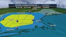
Severe thunderstorm warnings were in effect Tuesday in New England, but they have since expired.
Click here to see the latest severe weather alerts.
Earlier, a flash flood warning was issued in parts of southeastern Massachusetts and Rhode Island as torrential rain moved into the area.
An advancing warm front is triggering showers and thunderstorms and New England. The primary threat with these storms will be torrential downpours and pockets of street flooding. An isolated spin-up-tornado can’t be ruled out through the early afternoon as well.
Get New England news, weather forecasts and entertainment stories to your inbox. Sign up for NECN newsletters.
See the latest weather alerts here.
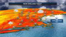
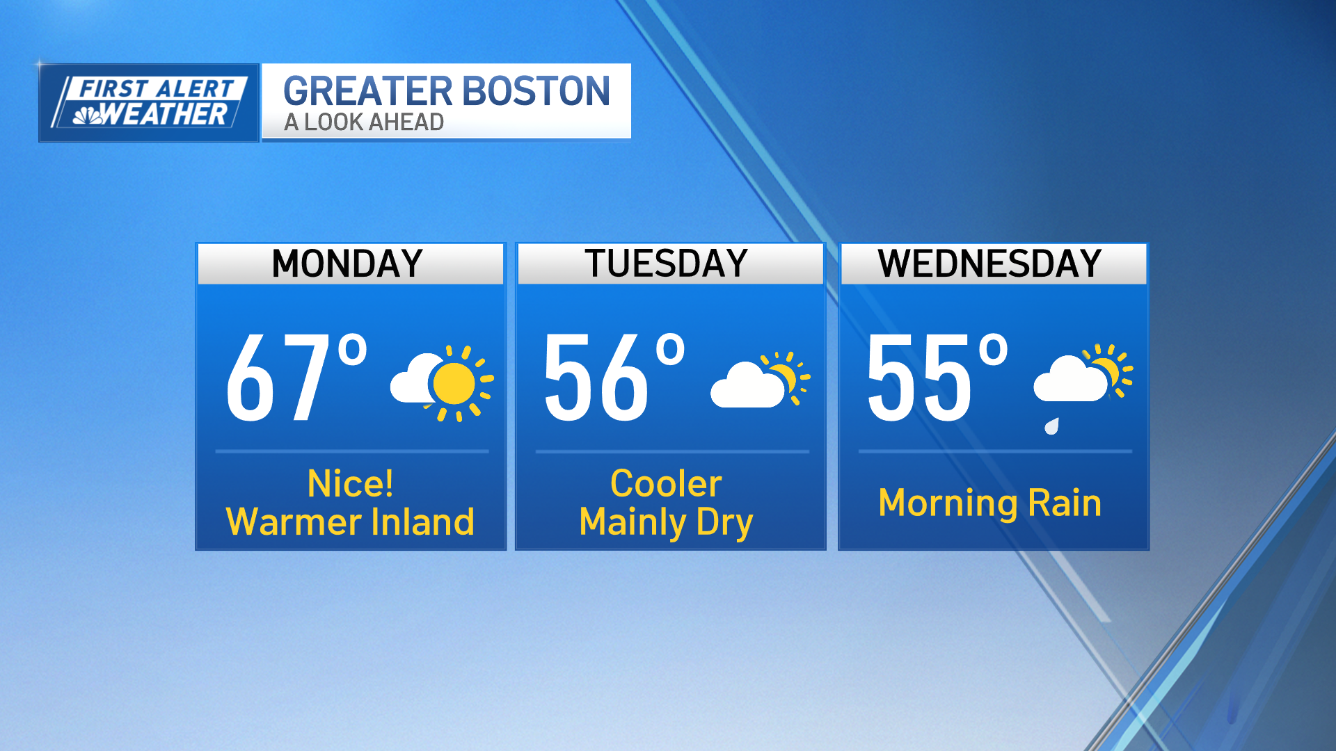
Later Tuesday, a cold front approaching from the west will traverse across New England. This will bring a second round of showers and thunderstorms to mainly western and interior areas. Ample cloud cover and humidity will yield high temperatures in the mid to upper 70s Tuesday.
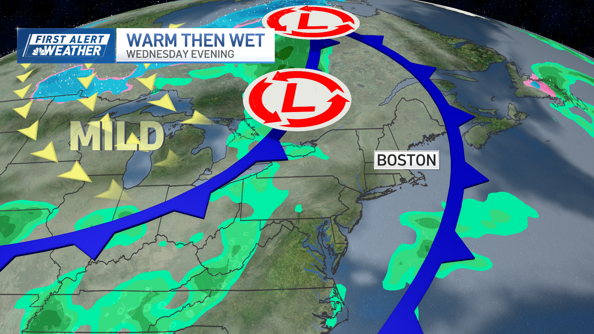
Overnight, clouds will linger across eastern areas while drier and cooler air surges into New England from New York. Lows will drop down into the 50s for most, low 60s across the South Coast, Cape Cod and the Islands. Stunning early-fall weather is on tap Wednesday through Thursday, as a refreshing air mass from northern Canada settles in overhead.
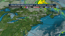
Wednesday features highs in the upper 70s to 80 degrees. Lingering moisture should spawn fair weather cumulus clouds. A reinforcing shot of cool air will arrive for Thursday. High temperatures will only rise into the 60s, except for low 70s across the South Coast.
Weather Stories
We will be wedged between a building area of high pressure across the Great Lakes and a developing area of low pressure over Nova Scotia, resulting in a breezy day. Near carbon-copy weather is on tap for Friday, with early fall-like temperatures in the upper 60s to around 70 degrees and low humidity levels.
Looking ahead to the weekend, our area of high pressure will move offshore, resulting in a return flow developing from the southwest. This will usher closer to normal temperatures back to New England for Saturday and Sunday.
Highs will be in the mid 70s Saturday, moderating into the upper 70s by Sunday. An approaching frontal boundary may trigger some rain chances Sunday night into Monday. Looking ahead to the start of next week, temperatures warm up into the upper 70s to low 80s on the exclusive First Alert Weather 10-Day Forecast on NBC10 Boston and NECN.
