


From the NBC10 Boston First Alert Weather Center… Today (Thursday): Humid, warm, shower from time to time. Highs near 80. Overnight Thursday Night: A few showers, humid. Lows in the 60s. Friday: A round of downpours/thunder from west to east, AM to PM. Highs in the 70s. Cape Cod Radio Forecast: Today (Thursday): Humid, sun and clouds, slight chance of a passing shower. Highs in the middle 70s. Overnight Thursday Night: Humid with the chance of a shower or two. Lows in the upper 60s. Friday: Continued humid, chance of an isolated AM shower, otherwise late day showers, downpours and thunder arrive. Highs in the middle 70s.
Happy Fall!
The first day of the season is here, and no surprise, it feels more like summer still. An area of low pressure is across the Great Lakes and is moving extremely slow. We keep the rain and storm chance in today through Friday, at least.
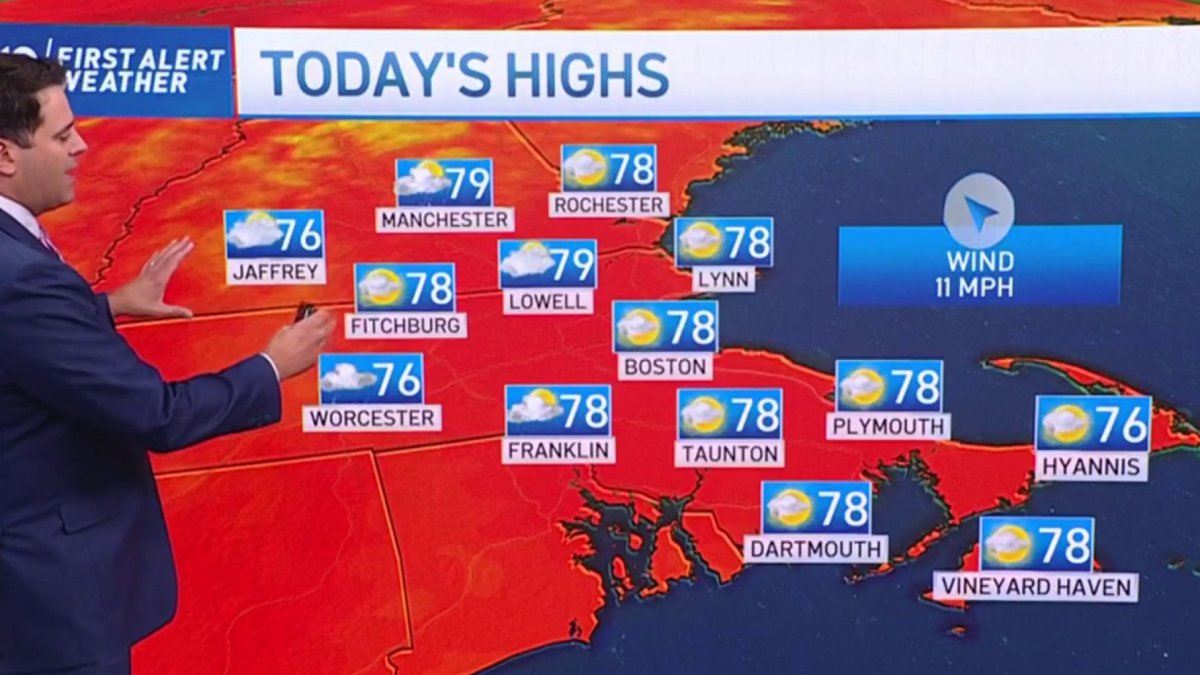
Highs today again reach the 70s to around 80 degrees. With the high humidity it will feel like the low to mid 80s for some places, especially where we see sunshine to crank up temperatures more. Clouds will dominate for most and we squeeze out scattered showers off and on.
Friday is when the cold front approaches western New England. It will likely sit across New York state Friday morning and afternoon and won’t cross through until early Saturday. The instability and storm energy builds and if we can get some sunshine to peak through Friday afternoon, the storms could become strong to severe. The main threat is damaging wind, but a tornado is also possible since there is some spin in the atmosphere, too. Heavy downpours and lightning are likely as the line of storms heads through Friday afternoon and evening.
Get New England news, weather forecasts and entertainment stories to your inbox. Sign up for NECN newsletters.
The rain and isolated storms linger in the forecast across eastern New England Friday night into Saturday morning. Saturday afternoon we see gradual improvement as drier air returns and highs reach the mid 70s. Our weather stays amazing for Sunday with highs in the mid 70s again and sunshine. Next week we have more of a fall feel and a period of dry weather until about Tuesday into Wednesday.


