
We're in a fast weather flow now. Systems will be zipping by like it's winter — not the first day of spring.
And it may feel like it by Thursday morning. We're seeing breezes Tuesday, and cooler temperatures overall. Upper 40s should take the cake, with a small wind chill factor. Good thing the sun feels warm this time of year.
Speaking of, the clouds should swarm in during the afternoon as our next system moves in. This one won't produce much in the way of precipitation, but it's the kind of precip that we're watching. Cold air is rushing in as quickly as the showers are moving through.
Get New England news, weather forecasts and entertainment stories to your inbox. Sign up for NECN newsletters.
Best chance will be in the evening as the temperatures fall and therein lies the issue. The air may be too dry to allow for many showers, and synching may be off for snow. Best chance seems to be in the Worcester Hills Wednesday evening.
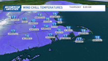
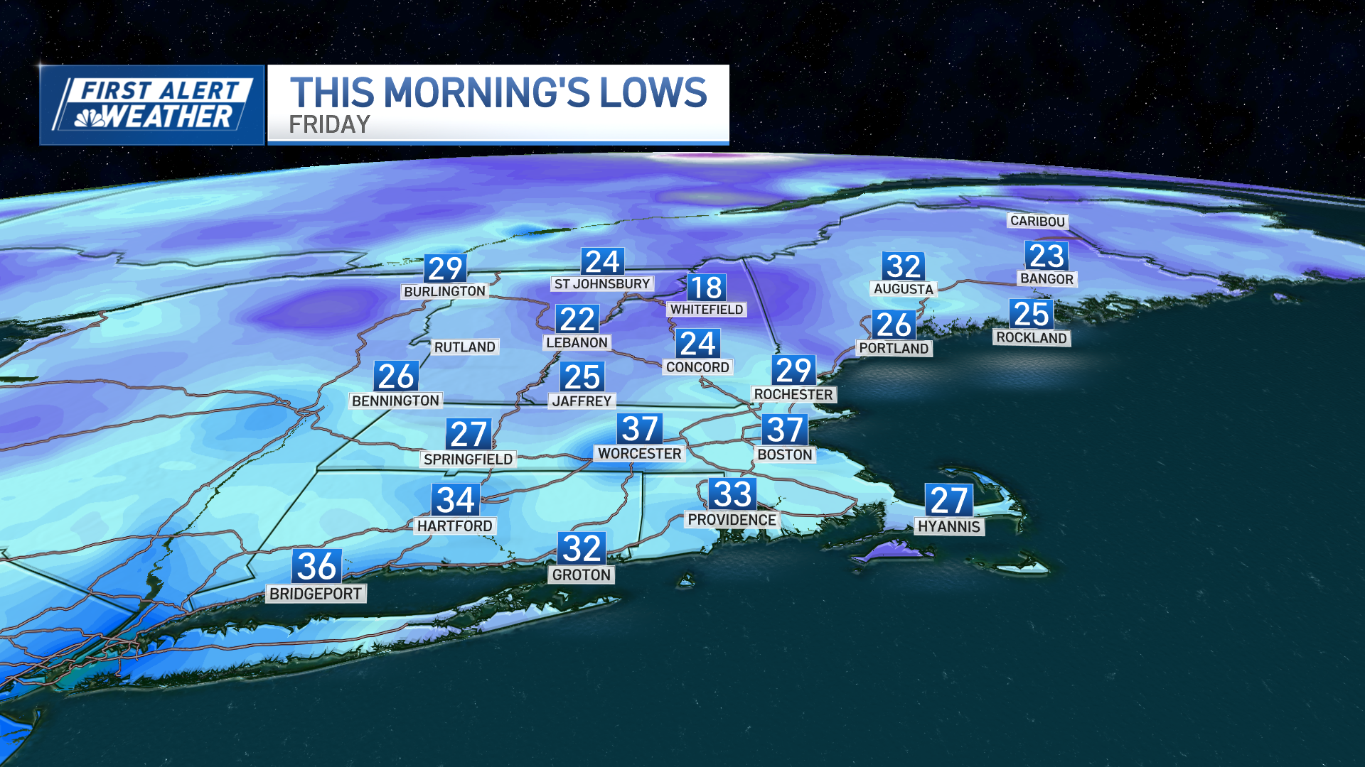
Gusty winds will be with us overnight Wednesday and into Thursday. That will drive the wind chills down in the low 10s for most, with single digits possible in Greater Worcester. Winds finally ease Thursday night for a very cold night in the upper 10s to low/mid-20s.
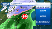
The recovery isn't spectacular into the weekend, either. We'll be below normal into Saturday as we watch a strong storm take shape to the south. When it arrives on Saturday, we could see some snow in parts of southern New England depending on the path the storm takes.
Weather Stories

Guidance is all over the place right now, so we'll sit tight and let it play out.
