
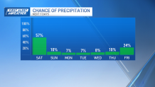
Heavy rain slammed parts of Western and Central Mass yesterday. Towns around Springfield and west of Worcester saw between 2-4 inches of water in the downpours.
This was a sneaky setup where a narrowly focused plume of water vapor focused the rain from New York City north to Massachusetts. Thankfully, that plume has dissolved, as a storm system has formed south of Long Island this morning.
That’s not necessarily great news, unless you live in Northern Mass and Southern NH, out of reach for the storm and its swirl of rain. As the day wears on, and the storm spins away, drier air will work down from that area and push the rain to the Cape/Islands.
Get New England news, weather forecasts and entertainment stories to your inbox. Sign up for NECN newsletters.
Unfortunately there, it arrives too late to salvage any part of the day. Instead, we’ll wait for clearing overnight and the sunshine tomorrow.
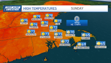
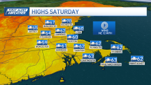
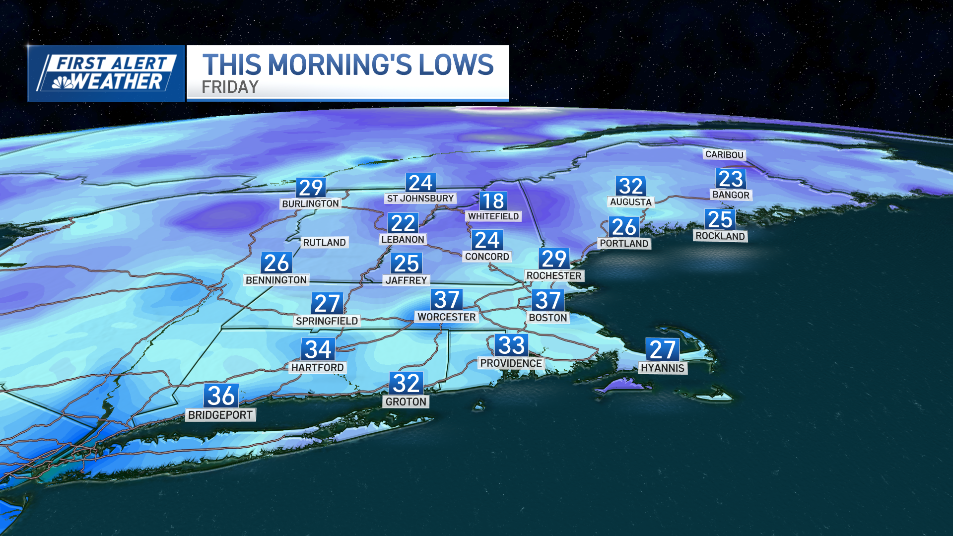
Temps recover from our highs today in the upper 50s straight into the 70s tomorrow. The warmer air has been sitting across the border in Quebec for days, warming a bit each afternoon (yes, it’s strange that the warmer air is to our north this time of year).
We’ll continue this warming process into the early and mid-part of next week, pushing the numbers to summery levels for some. Highs from Tuesday-Thursday could touch 80+ in spots!
Late week features a sharp cold front with a more October-like airmass in route for the second half of next weekend.
Weather Stories

Enjoy the weekend!
