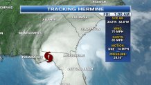
When Hurricane Hermine made landfall at 1:30 a.m. Friday along the Florida panhandle, it was the first hurricane to make landfall since Hurricane Wilma in 2005!
At the time of landfall as a Category 1 hurricane, with sustained 80 mph winds, Hermine has since been weakened to a Tropical Storm as she continues her way farther inland into southeastern Georgia.
Hermine is still a very destructive system, continuing to soak the northern half of Florida under plumes of heavy downpours and with sustained winds continuing to pick up to maintain its tropical storm status (between 39 to 73 mph), downed trees and power lines will still be a concern as the soil continues to weaken under so much rainfall.
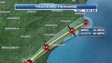
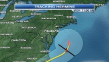
The track for Hermine continues to keep its grip along the eastern seaboard, inching its way closer and closer to New England and the Cape just in time for Labor Day Monday.
A Tropical Storm Watch has been expanded to include most of the Atlantic seaboard through Connecticut in preparation for rough surf, high winds, and coastal flooding on Saturday and Sunday. The watch currently ends at Watch Hill, Rhode Island.
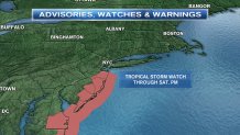
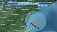
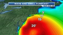
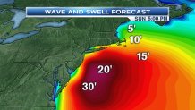
By the time Hermine tries to swipe New England's southern coast with the outer bands of rain possibly late Sunday into Monday, the biggest threat will be the high waves for the weekend as early as Saturday with wave heights increasing to 10-15 feet at times through the weekend.
With many families flocking to the coast for their Labor Day Weekend plans, please exercise caution and keep an eye on small children if you're trying to get some beach time on Saturday and Sunday.
We certainly need the rain as we continue to see the extreme drought in the Boston-area. As Hermine approaches New England, she'll likely be a post-tropical storm, Monday and Tuesday.
This does not mean that we will not see cloud cover and the outer rain bands associated with this storm into Connecticut, Rhode Island, and along the Cape, but it is certainly something we are keeping our eye on in the necn Early Warning Weather Center. Stay tuned for continued updates.


