With all eyes on the tropics and particularly Hurricane Idalia barreling toward Florida, it’s easy to lose sight of the weather here at home – but our First Alert Team has issued a First Alert for Wednesday, and we’re ready for dangerous rip currents at some New England beaches in the days ahead.
Hurricane Franklin churns in the Atlantic
The first impactful weather player is Hurricane Franklin: not as glamorous as Idalia, given the lack of direct strike on any land, but this Category 4 beast is tracking between Bermuda and the U.S. East Coast and will miss New England by hundreds of miles to the southeast Wednesday; instead it will continue throwing swell across the western Atlantic.
Get New England news, weather forecasts and entertainment stories to your inbox. Sign up for NECN newsletters.
Waves increase to four feet by Tuesday’s end at the South Coast, with a period of 13 to 14 seconds, and the waves will continue to increase to six to 10 feet by Wednesday, with these powerful waves creating both high surf and dangerous rip currents.
Although eastern beaches will see lesser magnitude, the rip current danger exists there, as well. That said, the beach weather isn’t the type that will draw many folks out in the next couple of days anyway.
Strong storms possible in New England on Wednesday
As moisture feeds northward toward New England, more clouds than sun dominate the sky Tuesday, with occasional showers on the Cape and Islands and at least isolated showers will expand north into southern New England late Tuesday afternoon into the evening.
Overnight Tuesday night, showers will increase in coverage and humidity will continue to steadily rise, leading to a peak in both humidity and showers on Wednesday. In fact, the latest indications are that we may have just enough energy in the atmosphere – and just enough wind – to create a few locally strong to damaging storms Wednesday around midday to early afternoon, so our weather team has hoisted a First Alert to keep one and all aware of the risk of lightning, locally heavy rain and isolated damaging wind.
By Wednesday evening, storms will not only have waned in intensity, but mostly will be few and far between as drier air begins an arrival on a northwest wind and by Thursday, dew point temperatures – the measure of the amount of moisture in the air – will have made a 24 hour drop of about 20 degrees, from the upper 60s to the upper 40s! This is exceptionally dry, fresh and comfortable air to end the week and will come complete with sunshine, though it will lead to cool overnights Thursday night, in particular, with a few North Country deep valleys possibly dipping into the upper 30s!
Great Labor Day on deck
Temperatures will steadily rebound over the holiday weekend, returning to daytime highs in the 80s by Sunday and Labor Day, all of it under sunshine and all of it with comfortable humidity levels.
Even the chance of an isolated storm on Labor Day has dwindled to the point we’ve removed it from the 10-day forecast, leaving a dry stretch all the way until the end of next week, great for so many outdoor projects that have been delayed due to the rainy weather this summer – from painting to haying to outdoor recreation.

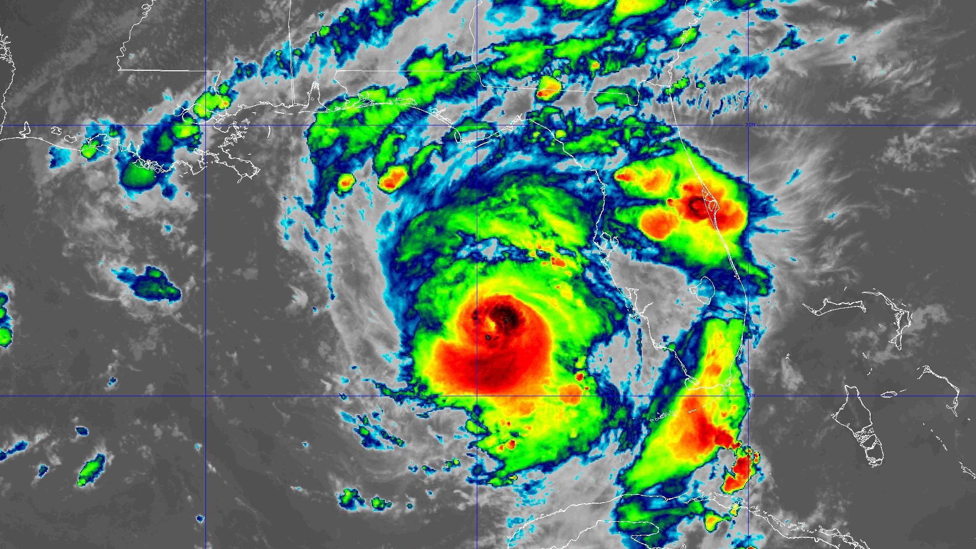
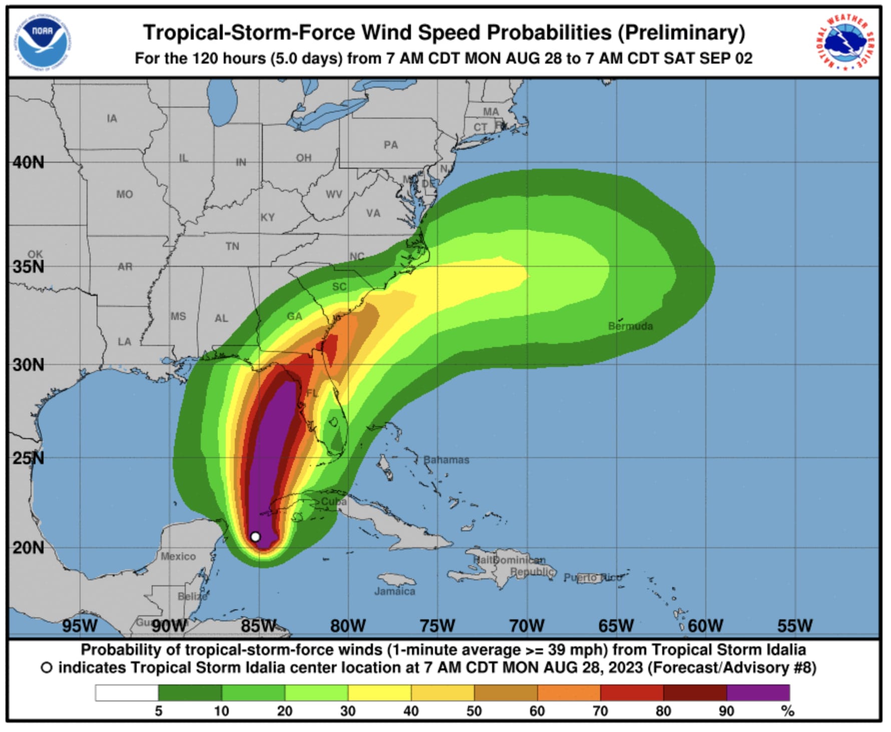
Hurricane Idalia targets southeastern U.S.
Of course, Idalia continues to be a major story for Florida and the southeast U.S., with landfall Wednesday morning as a major, Category 3 hurricane expected in the Big Bend area of the northwest Florida coast, posing a significant hazard from wind and storm surge, while six to ten inches of rain is forecast to fall across a large swath of the southeastern U.S.