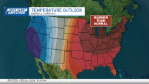
After clouds built in for the morning, sun returns for Monday afternoon. That will warm temperatures into the 50s by the evening.
This is the beginning of our warm-up. Tuesday will be the best afternoon to be outdoors, with warm air and dry skies. Highs are near 55 degrees. Tuesday evening, more clouds build in ahead of stormy skies on Wednesday.
Warmer air progressively builds in for Wednesday, but some of that will help support showers and even isolated pockets of thunderstorms.
Get New England news, weather forecasts and entertainment stories to your inbox. Sign up for NECN newsletters.
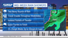
There are two rounds of rain that we’re watching: Morning showers, then evening downpours and gusty winds approach ahead of a cold front. The midday will have a brief clearing.
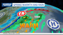
The quiet and lull during the day is something to watch, as thunderstorms could develop in it its wake. Any storms that develop should be rather limited in duration and size.
Weather Stories

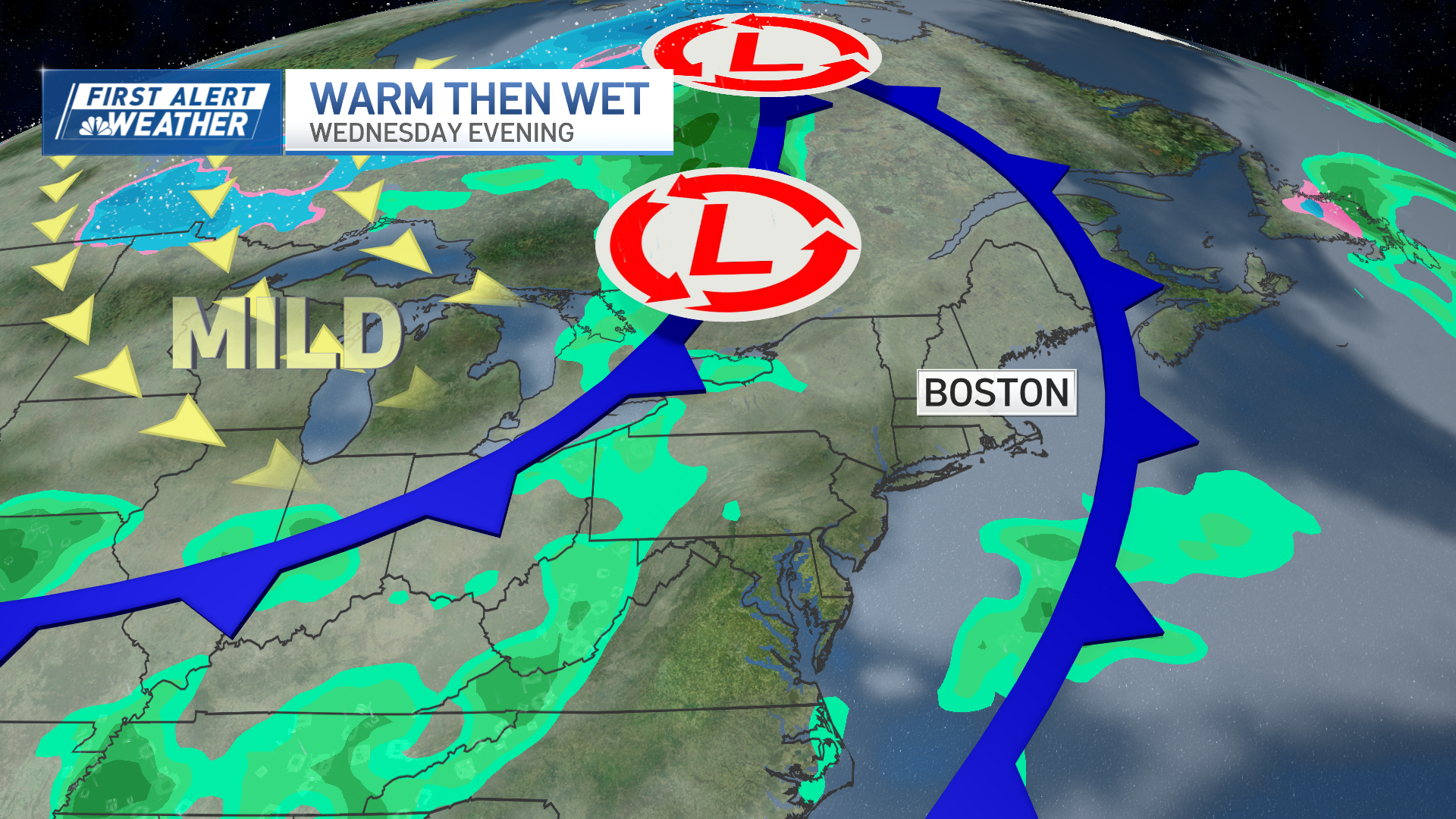
Not only will the day be wet, but Wednesday will be windy. Wind gusts at near 45 mph along the coast are possible, and only a little slower, at 40 mph, for interior New England.
After on-and-off showers through the day, a cold front will guide the last batch of rain overhead Wednesday into Thursday. Rain totals near and below 1 inch.
Higher elevations could see some snow/a rain-snow mix before sunrise Thursday.
Thursday remains windy with drying skies. Temperatures will drop through the day Thursday, by Friday morning it will be brisk. The cold air won't linger long, by Saturday we're back to the mid-50s.