
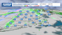
An upper level system will rotate through the region this afternoon bringing lots of clouds and a few showers to go with them. Overall, the day doesn’t look to be lost with plenty of dry time, but with afternoon clouds ‘building,’ showers will start to crop up putting a brief halt to any outdoor plans, some showers may be briefly heavy with very isolated small hail.
Across the higher elevations of Vermont and New Hampshire, in particular the Green & White Mountains, temperatures will be just cold enough to support snow showers which may produce several inches across the highest peaks. Highs today top out the 40s and 50s south, 40s north along with a southwest wind gusting over 25mph.
Clearing out overnight tonight with a diminishing wind. Stays on the chilly side with temps mostly in the low 40s south, 30s far north.
Get New England news, weather forecasts and entertainment stories to your inbox. Sign up for NECN newsletters.
A sunny start Sunday with increasing clouds in the afternoon, another round of rain showers develops from west to east during the afternoon as a quick moving system dives through New England. Highs reach the upper 50s to low 60s south, 50s north with gusty west wind.
Looking fantastic for Marathon Monday with a good deal of sunshine, lighter winds, and comfortable temperatures in the 60s. Stays on the warm side Tuesday with highs well into the 60s, more rain showers move in by the mid-week.
Local


Have a great Saturday!
