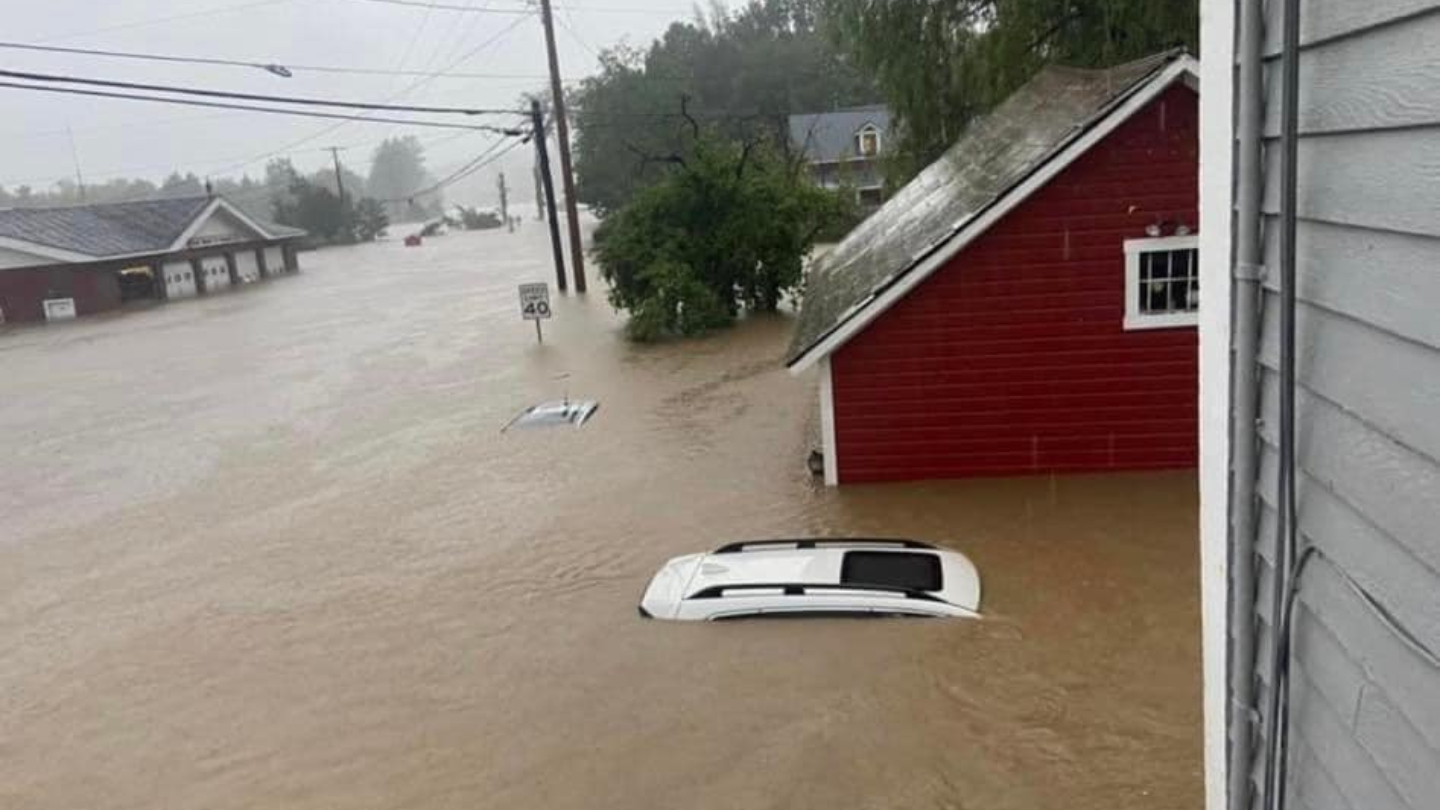
Life-threatening flash flooding, mudslides and landslides continued Monday afternoon across Vermont, while the strong weather system prompted severe thunderstorm and flash flood warnings in places across New England Monday.
In Vermont, flash flood warnings will be in place until 2:15 a.m. in Caledonia County, Orleans County, Chittenden County, Franklin County and Lamoille County. Flash flood warnings will also affect Addison County, Essex County and Rutland County until 3 a.m.
See a list of all severe weather alerts in your area here.
Get New England news, weather forecasts and entertainment stories to your inbox. Sign up for NECN newsletters.
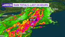
Sunday brought widespread rain and flooding from northern New England to New Jersey. Between four and eight inches of rain fell through eastern Pennsylvania and New Jersey.
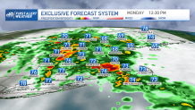
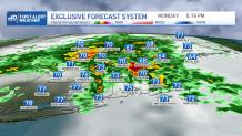
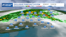
Due to the overall forward motion and orientation of the storm complex, southern New England was majorly spared on Sunday. Heavy rain continues to push through and now pivots towards eastern New England.
The upper level low is moving through now, which will likely induce more widespread heavy rain, leading to a high risk of flooding throughout northern Vermont and the Champlain Valley. While the threat will modify and potentially lessen throughout Monday night, it isn’t completely diminished until just before sunrise on Tuesday morning.

In Massachusetts, stronger thunderstorms will spark between Franklin, Norwood, Framingham and Northbridge around 2 p.m. Boston should see moderate downpours continue Monday, with most activity diminishing after 9 p.m. Coastal communities across the Cape and Islands aren’t removed from rain, but should be spared of the worst of the storm threat.
Because of the nature of saturation of the rain, downed trees and powerlines become a concern; specifically where strong winds correspond to downpours. Though we’re not expecting widespread severe winds, rain will loosen soils, weakening roots of older and rotting trees, thus adding to the threat of trees coming down. So watch for downed powerlines. If you come across a downed wire, treat it as live... it could still carry a current and cause electrocution.
Airport delays likely
Airport delays and cancellations will likely mount today too. Nearly 2,000 flights were cancelled within, into, or out of the U.S., according to FlightAware.com. Specifically from major Northeast hubs like Newark, JFK and LaGuardia. Airlines are playing catch up from Sunday, and the same storm system will be in our hair on Monday, making it all the more difficult for flights to depart and land on time.
What will influence and limit Monday’s storm threat are cooler temperatures. With little sun and ample cloud coverage, the environment will start off much cooler than Sunday. The rain from Sunday has also helped that cooling too. That said, areas that do see exposed sun, especially as the front nears, should be on guard for a slightly stronger storm threat in the mid-afternoon to evening.
How much more will it rain?
Rain totals are expected to near an inch for MetroWest and tail off toward the east. West of that, with terrain, we expect totals to peak near 2 inches for central Massachusetts, and 3 inches for the Berkshires. Isolated spots of 3-5 inches of rain will occur through the Green Mountains and Northeast Kingdom of Vermont.
Construction zones where the natural flow and drain of water has been tampered with will see water began to pool. Areas of topography will also induce heavier rain and downpours. Areas in hilly terrain where low water crossings exist will be dangerous to cross and potentially deadly in heavy rain situations.
Roadways and intersections with standing or flowing water should be avoided at all costs — especially Monday, with heavy tropical downpours overhead.