
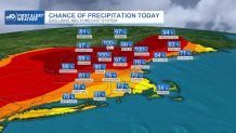
Our First Alert continues for Friday, as we expect a number of showers, downpours and thunderstorms to develop over the course of the day, particularly during the afternoon to evening.
Flash flood warnings and severe thunderstorm warnings were in effect in parts of northern New England, but have since expired.
See active severe weather alerts here.
What’s unusual is the amount of uncertainty lingering, even on this day of the event, as to exactly where and when storms will hit – so our best forecast is to continue expecting scattered showers and downpours to crop up until they expand during the afternoon, converge into pockets of downpours and thunder, raising the potential for localized flash flooding where downpours linger, and a few spots of damaging wind gusts where storms grow strongest.
Get New England news, weather forecasts and entertainment stories to your inbox. Sign up for NECN newsletters.
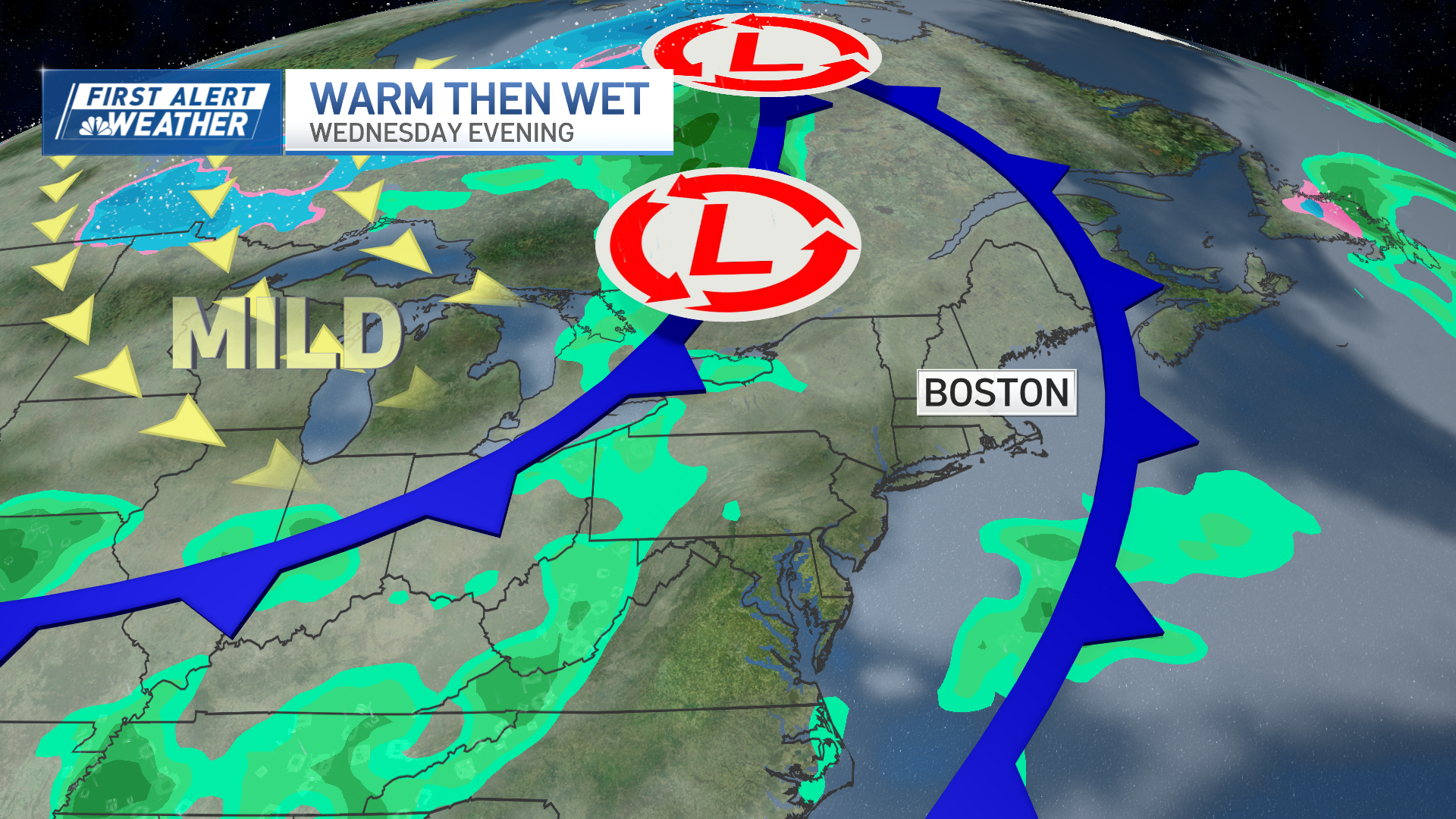
The culprit – both regarding storm development and uncertainty in the details surrounding it – is the convergence of warmth and humidity arriving on a breezy southwest wind and the destabilization of the atmosphere ahead of a cold front pressing southeast out of Ontario and Quebec.
The cold front won’t press through southern New England until predawn Saturday, which is why even after the worst of the storms weaken heading into Friday night, at least some showers will continue to float through, still falling on Nantucket at sunrise Saturday, clearing out quickly thereafter.
At the beaches, Friday doesn’t bring much sun and beachgoers will not only have to occasionally duck inside when showers and thunder move through (though very few, if any, showers are expected Friday on Cape Cod, with more breaks of sun), but rip currents will be a possibility through the day.
Weather Stories
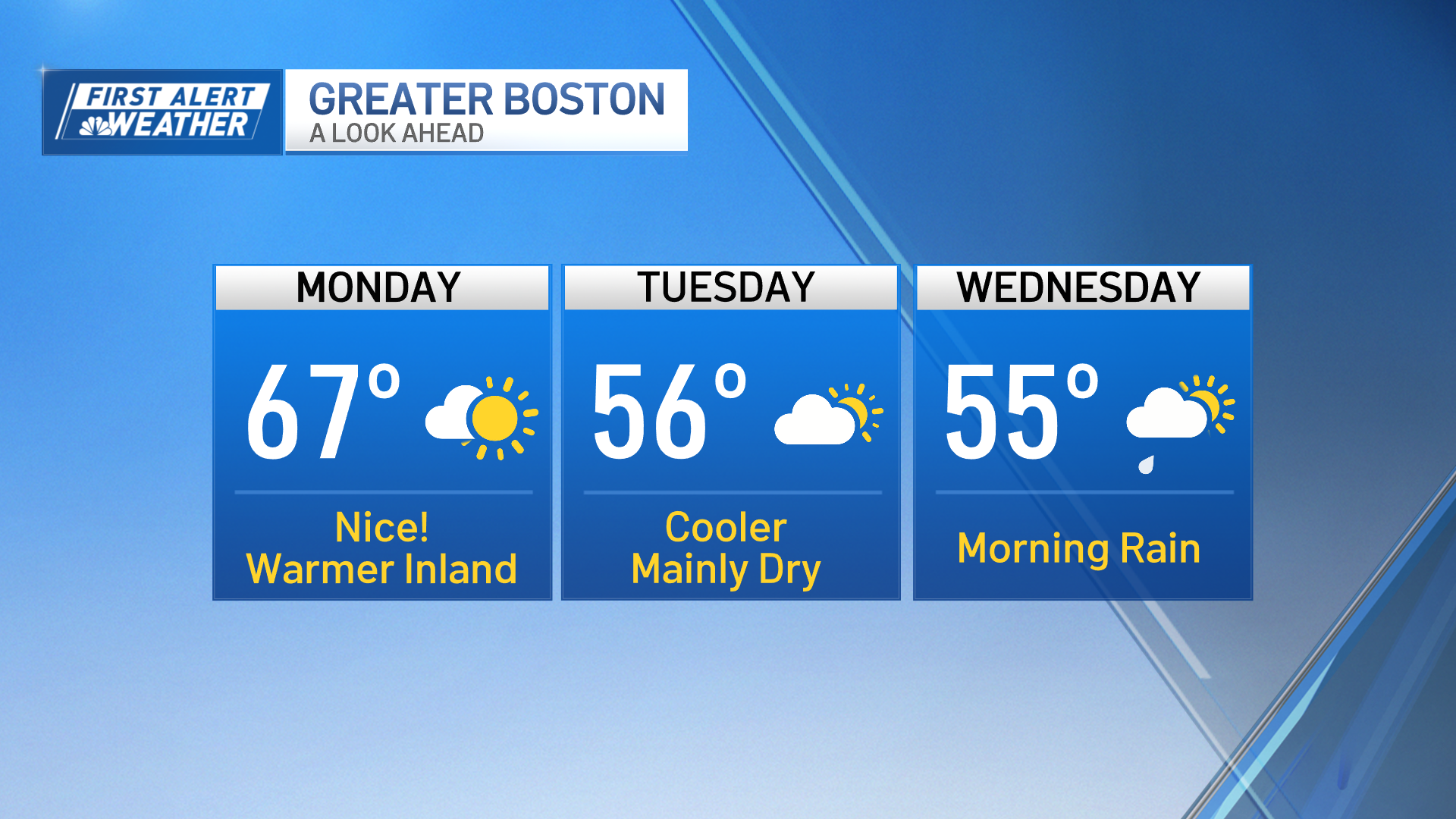
Although Friday night will still be a bit humid, Saturday may start with a twinge of humidity but that will be swept away for comfortable air and a fair sky for the day, though building puffy, cumulus clouds may yield an isolated shower in the afternoon, particularly in southeast Massachusetts. Sunday most assuredly will stay dry, regionwide, with comfortable air, though high-altitude clouds will mute the sun through most of the day. At this point, it looks like all of next week into next weekend will reach the 80s for high temperatures, daily. The best chance of scattered showers and thunder is Monday night and especially Tuesday, then perhaps again late in the week around Friday in our exclusive, First Alert 10-day forecast.
