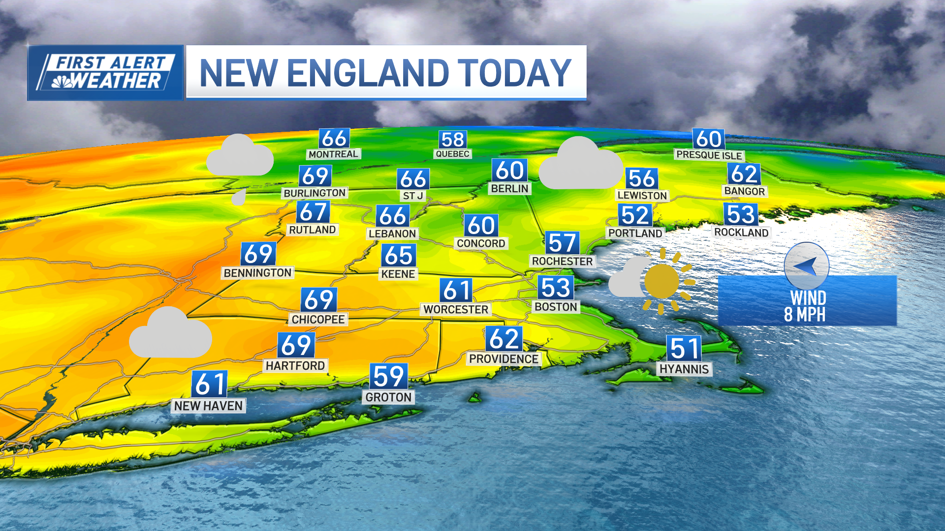
Hot and humid conditions take over from now through Friday and severe thunderstorms rolled through parts of New England Wednesday afternoon.
Heat indices range from the low to the mid-90s. Mid-level ridge builds into New England allowing ample sunshine with a significant rise in temperatures.
This same heat and lingering humidity may allow for some cloud formation and some instability which may allow a few showers or perhaps an isolated t-storm to develop along the interior this afternoon. Severe thunderstorm warnings were issued for parts of Maine Wednesday afternoon, but have since expired. For a full list of weather alerts, click here.
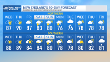
Otherwise, it’s a mainly dry and beautiful day for us with a very similar forecast into tomorrow through Friday.
Get New England news, weather forecasts and entertainment stories to your inbox. Sign up for NECN newsletters.
By Friday though, our ridge will start to shift east of New England which may allow for the south flow to return and settle in more humidity.
A low pressure system will be anchoring itself into the Midwest which will begin a new period of wet/unsettled weather for us into the weekend.
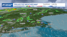
Friday night will see the chance for the first round of showers along the northwest with the passage of the frontal boundary, a few showers may take over southern New England Saturday.
Weather Stories
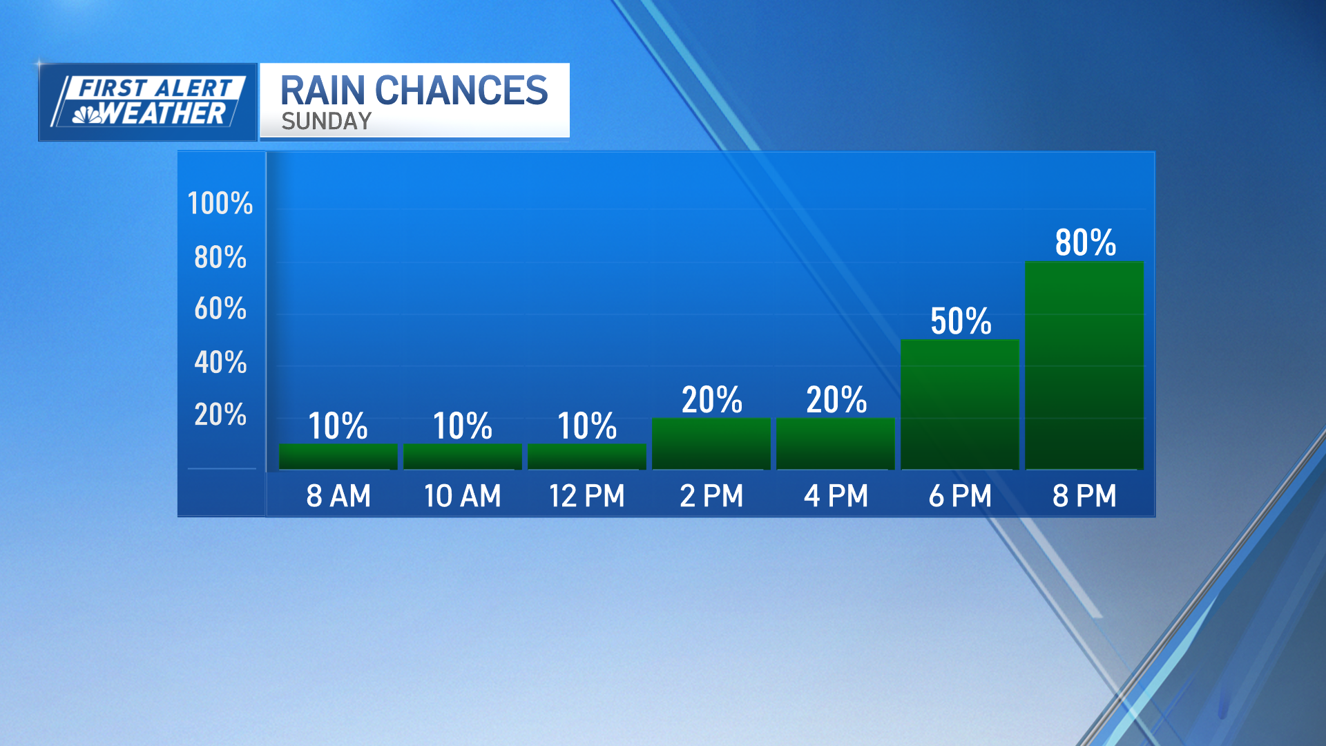
The unsettled weather remains through early next week as we see a coastal low pushing in closer to our south coast merging with the boundary’s energy to our west.
Temperatures will remain mild to seasonable through Saturday but will begin to dip slightly into early net week.