
Another clipper system is heading our way for overnight tonight.
Snow and slick spots possible overnight
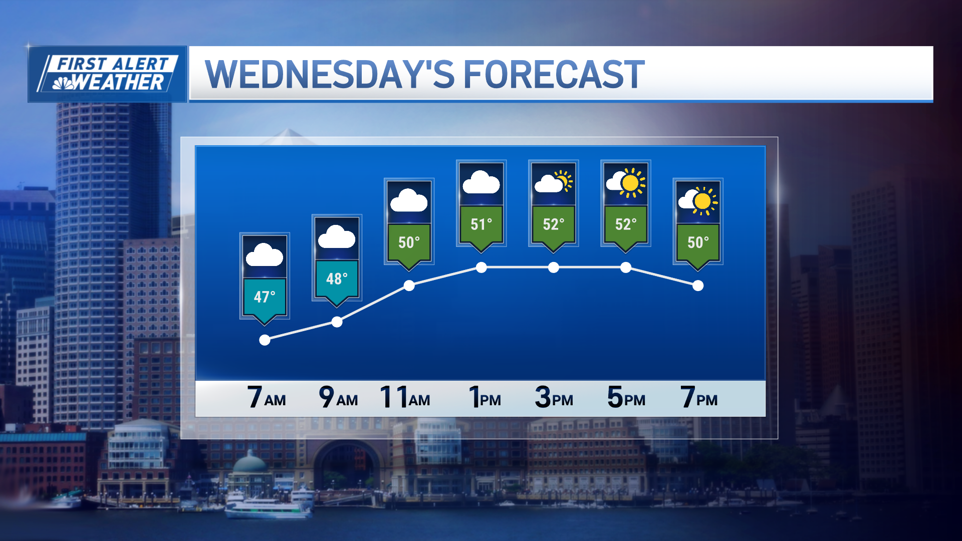
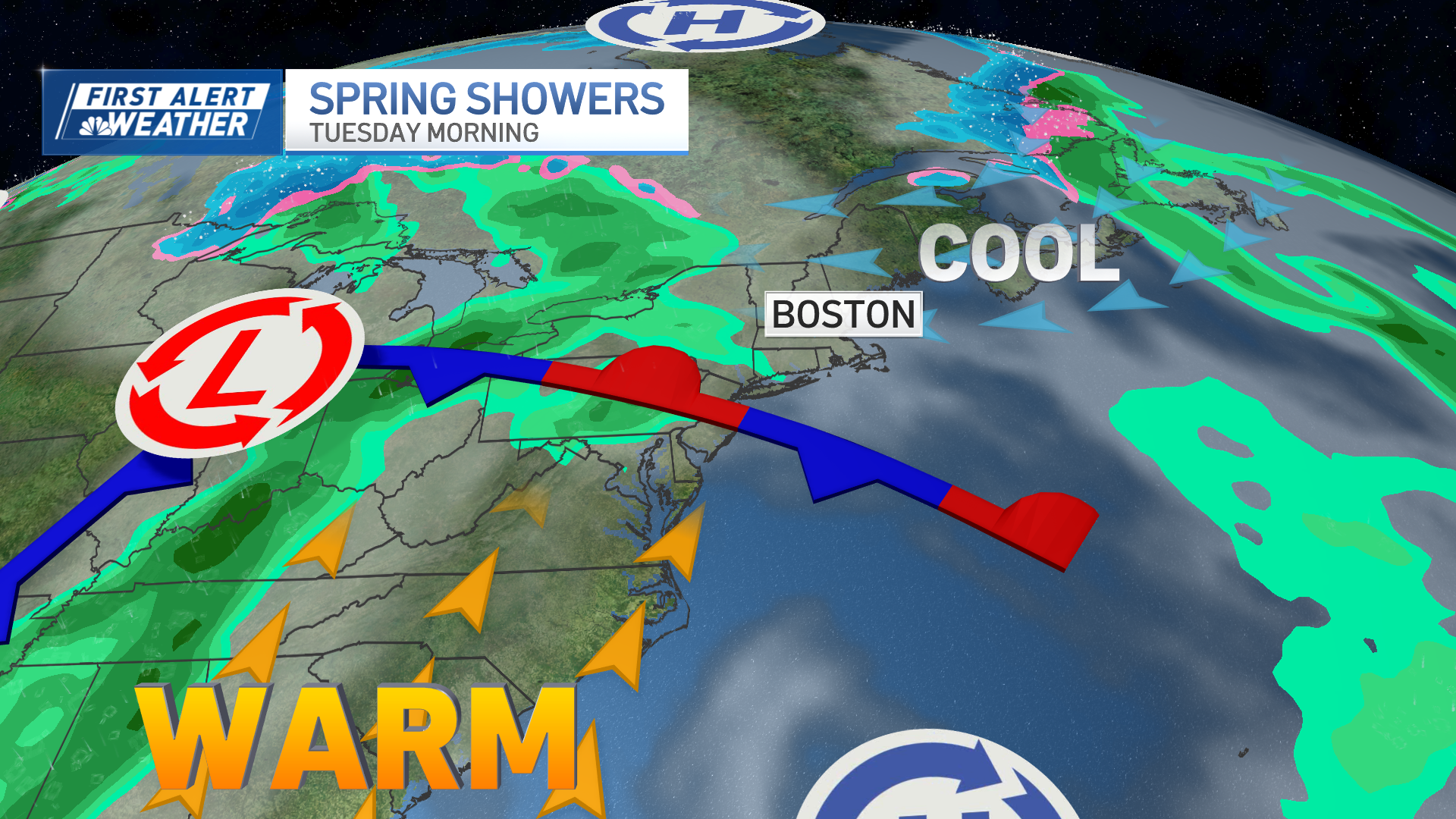
Milder air does stick around overnight, with temps barely dropping to around freezing so many areas south will not see much wintry accumulation. However, watch for sneaky icy and snowy spots on untreated surfaces, especially from the Pike and north. It doesn’t take much to make roads slick. Snow showers will be light in northern New England, with a wintry mix to light rain between midnight and 5 a.m. south. This system drops scattered coatings to 1” of a snow mix across higher terrain of Massachusetts and northern Connecticut, to coatings to 1-2” around Vermont, New Hampshire and Maine.
Get New England news, weather forecasts and entertainment stories to your inbox. Sign up for NECN newsletters.
Wintry cold returns
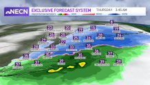
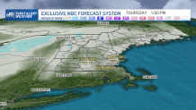
We dry off for the morning drive on Thursday, but turn blustery and colder. Temps won’t fall too much until really Friday. The wind and temps in the 30s on Thursday will make it feel very wintry even with the sun around. Lows Friday morning fall to the single digits, with highs barely near freezing.
Weather Stories
Warmer temperatures by the weekend
This weekend looks more promising for dry weather during both days even with a system moving through. Saturday’s highs reach the low 40s with an approaching system by nightfall. Overnight Saturday into Sunday morning a warm front lifts northeast and brings in snow to sleet, then swapping to a rain snow mix in northern New England.
Dry air heads in for southern New England Sunday afternoon. The wind picks up and we see really warm temps again-highs approaching 60 degrees. Sunday into Monday the cold front sweeps through, bringing in slightly cooler temps and some showers as we kick off the next week.
