Showers have already started in southern New England, with localized heavy downpours south of the Mass Pike. The rain is expected to increase in coverage this afternoon, with the possibility of thunderstorms, although the main concern is heavy downpours & lightning.
A flash flooding is in effect for parts of Massachusetts and Rhode Island, and the Sagamore Bridge to Cape Cod was closed due to flooding. Heavy flooding was reported in Rhode Island as well, leading to cars getting stuck in Cranston and the cancellation of the PVDFest on Sunday.
Get New England news, weather forecasts and entertainment stories to your inbox. Sign up for NECN newsletters.
To see all the weather alerts click here.
Some areas have already seen significant rainfall since Friday and may be less able to handle more rain. Outdoor plans should be monitored, and if a thunderstorm approaches, seek shelter. The forecast doesn't anticipate much sunshine, resulting in cooler temperatures.
While instability may be slightly less due to limited sunshine, we’ll keep the showers and thunderstorms, potentially leading stronger localized storms.
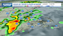
Though the risk of severe weather is low, there is a potential for heavy rain and localized street flooding, especially in urban areas. Some parts of the region are at a slight risk for excessive rain.
Weather Stories
For tonight, shower and thunderstorm activity decreases after midnight as a low-pressure system moves away from southern New England. Temperatures drop into the mid-60s, with patchy fog possible before daybreak.
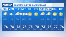
Meanwhile, the weather remains muggy with overcast skies and limited sunshine, resulting in temperatures mostly keeping the upper 70s.
Another round of showers and thunderstorms is expected tomorrow, with a lower risk of strong storms compared to previous days. Some thunder and heavy downpours may take place but won’t be as extensive in coverage.
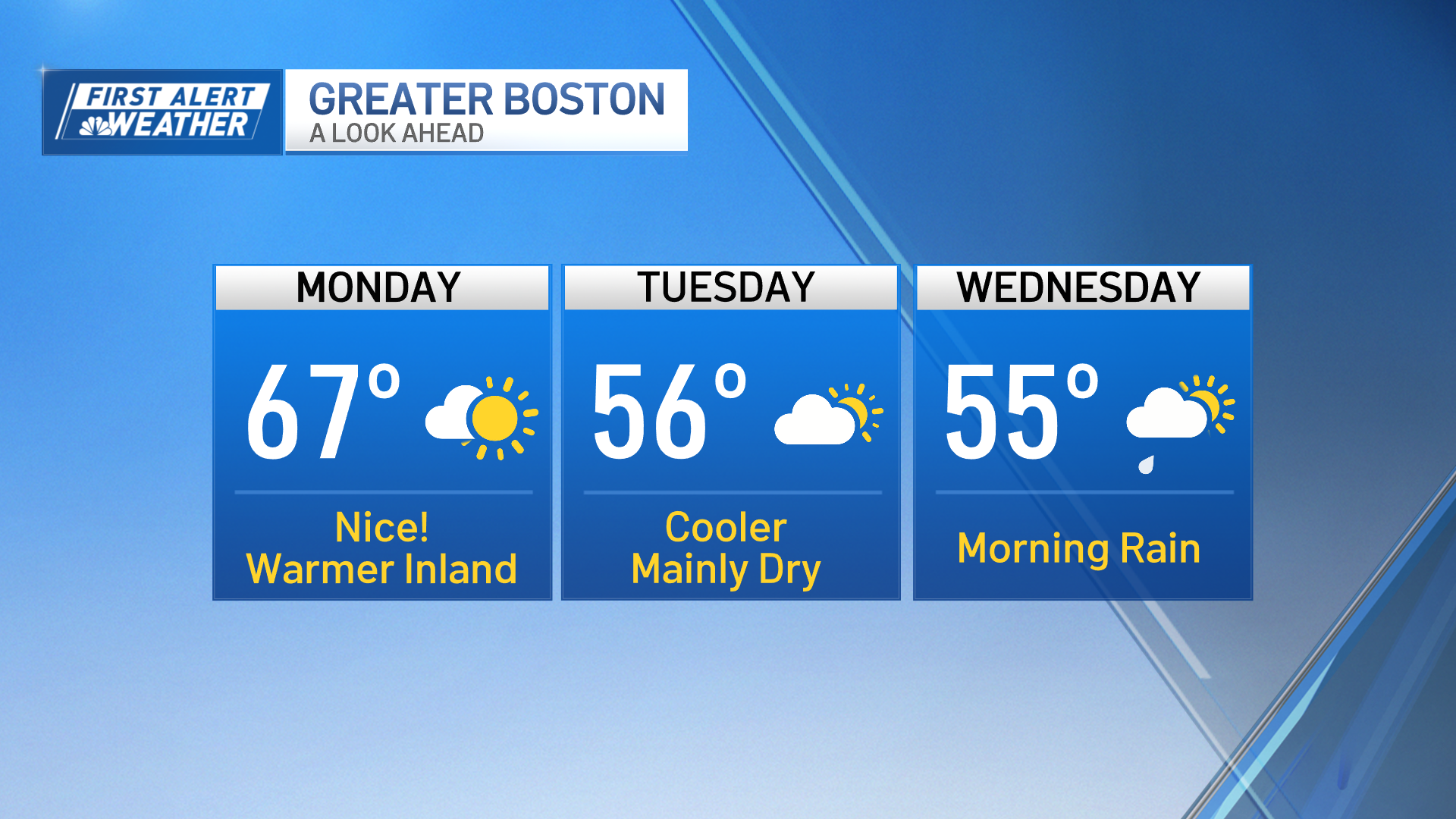
In the long term, conditions trend drier on Monday night, but there may be lingering fog and stratus into Tuesday along mostly cloudy skies Tuesday morning.

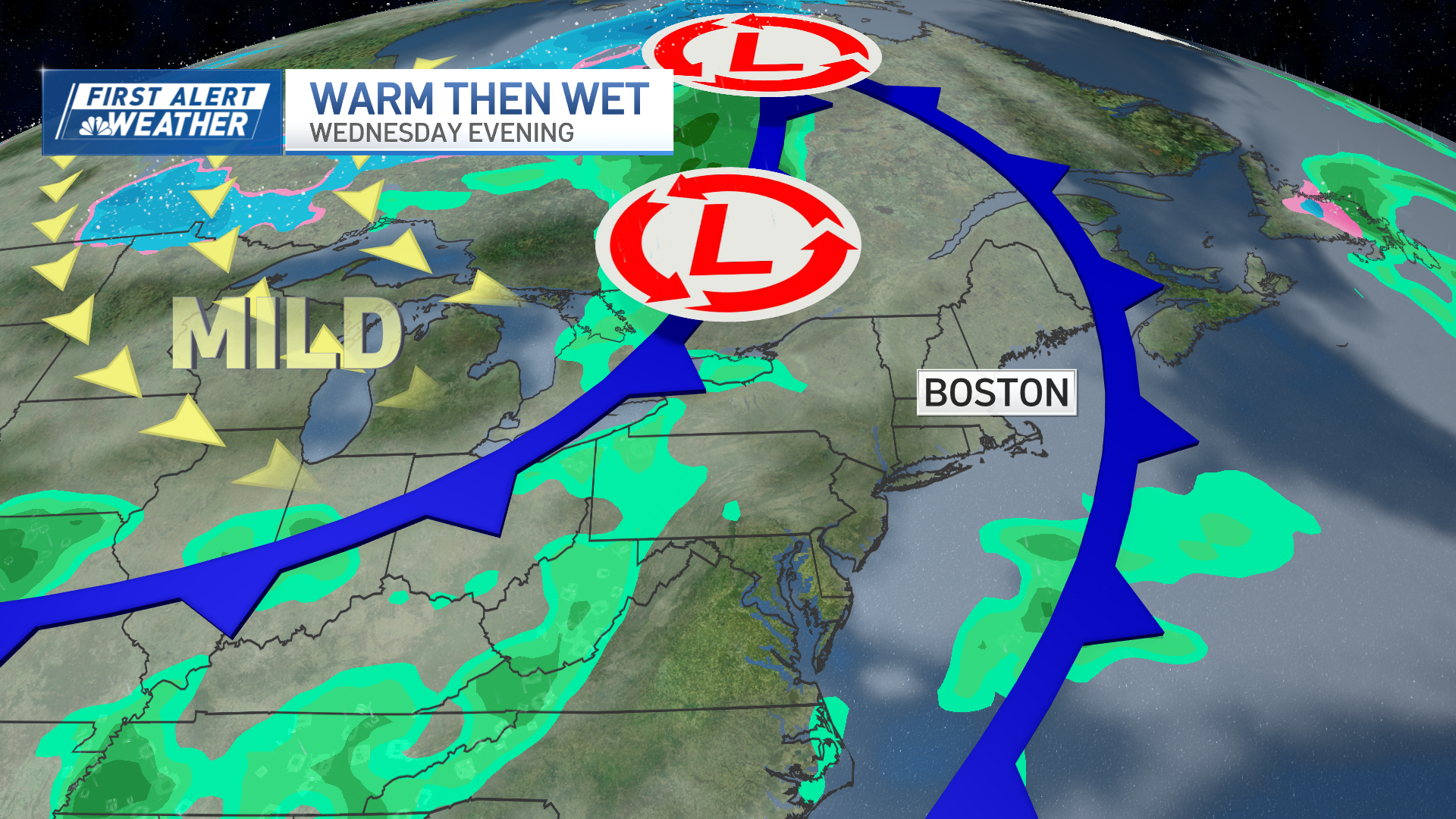
Wet weather returns on Wednesday with showers and thunderstorms potentially bringing soaking rain to some parts of southern New England. The rest of the week is expected to be seasonable and dry, although there is uncertainty regarding the potential impact of Hurricane Lee in the region.
Rip currents and high surf are expected on south-facing beaches starting Tuesday night into the weekend due to Hurricane Lee's proximity.