Despite all that rain-soaked topsoil associated with Henri, we did manage to break 90 in many spots yesterday, including Logan Airport in Boston that got to 91°.
That was a bit of a surprise, as a weak sea breeze reversed and the high temperature was at 4 o’clock in the afternoon. Today, we have high pressure settling right over New England and to our south, so it’s another hot one with plenty of sunshine and temperatures again near 90°.
A bit of smoke has returned to the sky, making for a hazy, hot and humid Wednesday afternoon. Also there is very little pressure gradient, so that means a local sea breeze may keep us somewhat cooler, including perhaps the thermometer at Logan Airport. But downtown Boston is 90° or better.
Many places are experiencing the second day of 90°-plus, and tomorrow is almost a lock for a third, which should make this the fourth heat wave of the season for many. But the good news is a front that’s going to bring in cooler air looks like it may come in without much action tomorrow.
Get New England news, weather forecasts and entertainment stories to your inbox. Sign up for NECN newsletters.
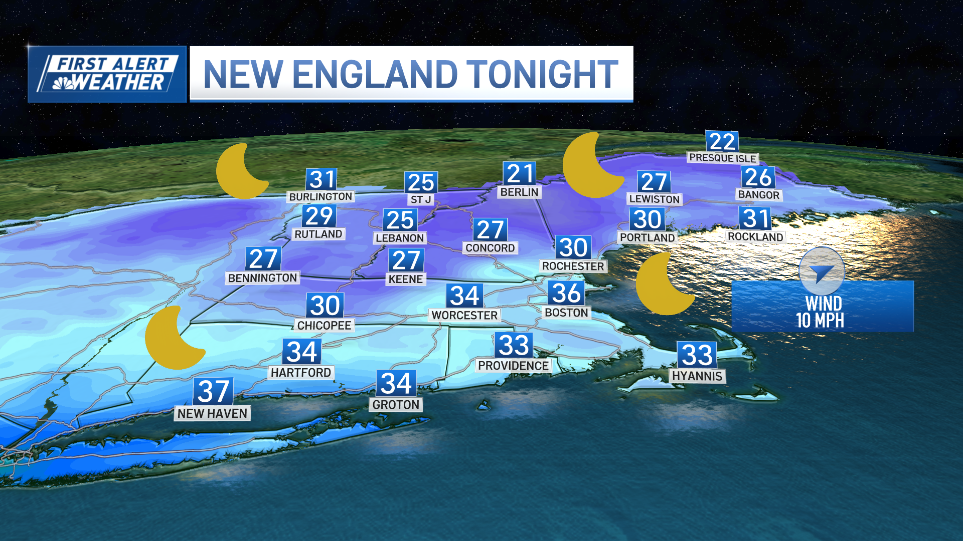
Overnight tonight expect some patchy fog, mild and muggy, with low temperatures late at night near 70°.
The next front eases out of Canada into northern New England tomorrow, with some scattered thunderstorms in western and northern New England. For most of us, though, it’s going to be a partly to mostly sunny day with temperatures in the low 90s.
The front continues south tomorrow night into Friday, with a couple of more spot showers or thunderstorms possible, but we are not expecting a widespread severe weather event like many of the previous fronts this summer. Friday gradually becomes less humid with the return to sunshine, but the front may hang up at the South Coast with clouds and a chance of a few showers or thunderstorms. High temperatures again in the 80s to near 90° before cooling, so some of us may have a fourth day of this heat wave.
Weather Stories
High pressure builds to our north Friday night and Saturday with the wind coming in from the north and the east.
The weekend forecast has become muddled, though. It looks like the return of warmer air from the southwest wants to happen a little quicker than earlier thinking, so we may have only limited sunshine Saturday as clouds increase with a chance of showers in the afternoon. The warm front may stall out over central and southern New England Saturday night into Sunday, which could mean showers to go along with much cooler air.
There is still a pretty high degree of uncertainty for the weekend, with the only sure thing is that it does look cooler, and may end up damp. We'll also be watching the Gulf of Mexico this weekend for another potential tropical storm developing that may turn into a hurricane, threatening the Gulf Coast states late in the weekend or early next week.
Stay tuned to our First Alert 10-day forecast for the latest updates.


