
Temperatures more typical of middle April are unfolding across New England over the next couple of days, and this means highs in the 55 to 60 degree range for many, which will push records for warm daytime highs and nighttime lows, particularly in central and northern New England.
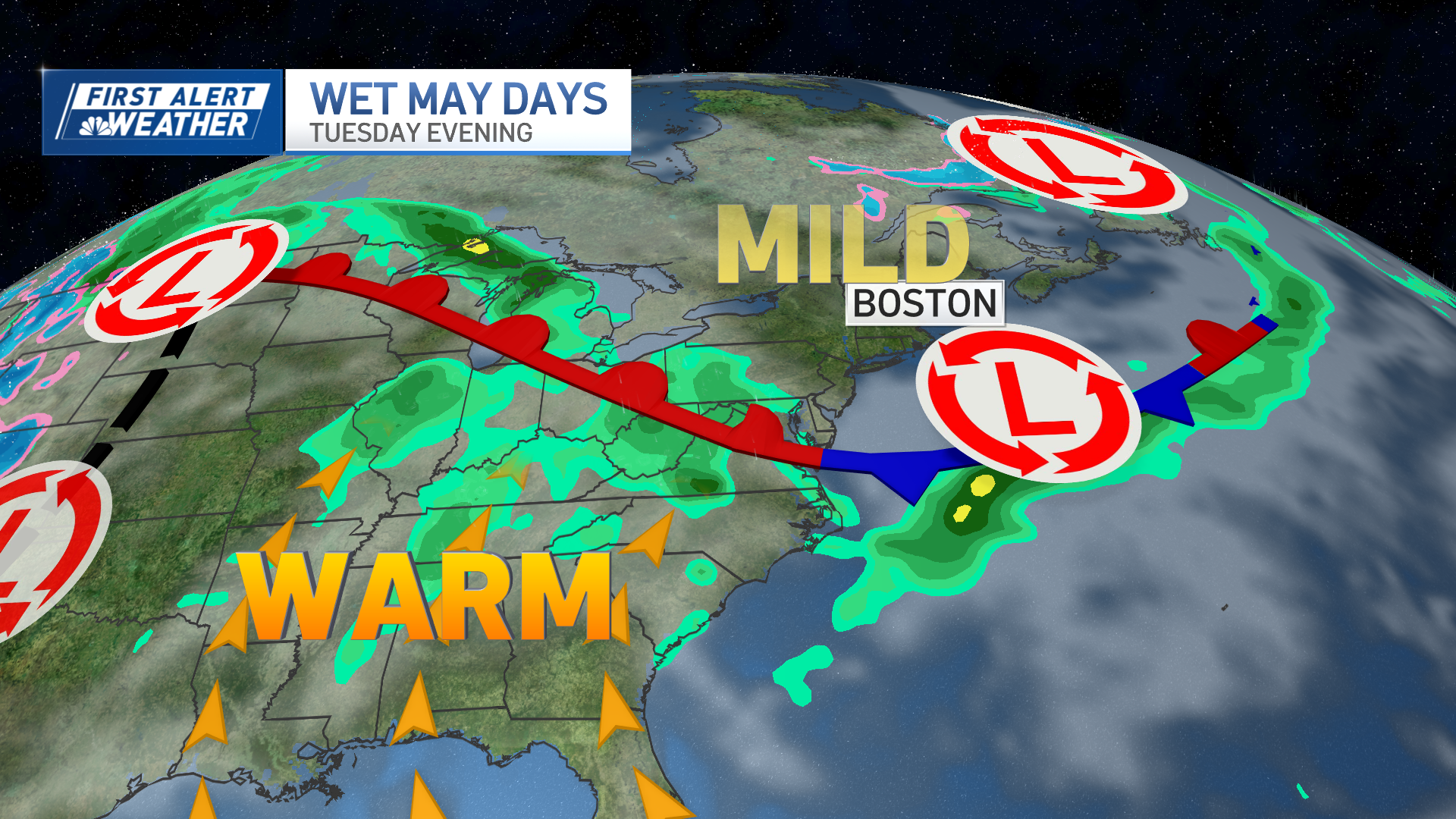
This warmth comes ahead of a storm center in the nation’s midsection, which will strengthen further as it pulls northeast into southern Canada, with the counter-clockwise flow of air around its center increasing a southerly wind across the Eastern Seaboard.
The wind will increase noticeably in New England Tuesday afternoon to evening and gust over 40 mph on Cape Cod Tuesday night, while rain arrives during the late evening and continues periodically through Wednesday into Wednesday night.
Total rain amounts in New England will be either side of an inch, though some of Connecticut, Rhode Island and southeast Massachusetts likely will come closer to two inches.
Get New England news, weather forecasts and entertainment stories to your inbox. Sign up for NECN newsletters.
With both commutes impacted Wednesday – morning and evening – our weather team continues a First Alert all day Wednesday and those on the roads should leave extra time for travel. Meanwhile, the south-southwest wind increasing Tuesday night will continue to ramp up gradually Wednesday, with gusts in excess of 40 mph for many, then a peak Wednesday evening to night of gusts exceeding 50 mph for some, meaning isolated power outages Tuesday night and Wednesday may become more widely scattered Wednesday evening.
A powerful cold front Wednesday night changes the last raindrops to snow showers with a coating to two inches in the northern mountains and little accumulation elsewhere, but delivers a pronounced drop in temperature by some 20 degrees or more Wednesday night, which should result in icy spots developing as leftover moisture freezes.
Weather Stories
Blustery conditions Thursday are anticipated with a new, west-northwest wind gusting to 45 mph and high temperatures in the 30s feeling like the 20s when considering the wind chill as flurries fall from time to time.
Cool and bright weather is expected Friday, before an extended stretch of mild but unsettled weather with rain showers along the way, again, somewhat similar to an April pattern.
